
Northern Interiori Plateau (Kentucky, Indiana, Ohio, Illinois)
LETTERS FROM ALABAMA.
LETTER III.
Lexington, Kentucky 8th Dec., 1817.
“Dear Matt,
I INTEND to spend a few days in this town, or city, whatever it be called. I have seen but little of it yet. Should I describe it to you, it would be too much like repeating “a thrice told tale.” The country around it is well situated-beautiful in the extreme, and in a state of high cultivation. The first three days of my journey, after entering Kentucky, presented no Variety, the soil and face of the country being nearly the same from Big Sandy River to Mount Sterling, about ninety miles. The surface is very uneven, covered with heavy timber, and thinly inhabited; but on approaching Mount Sterling, you are suddenly transported, as it were, into another world. The face of the country assumes a new appearance, the soil and its productions differing entirely from the preceding. It is not in the power of imagination to paint the contrast, which you behold on emerging from the gloomy, lonesome woods into open day. The light, which was hitherto excluded by the lofty timber, rushes upon you in an instant; and you find yourself in a soil, rich indeed, but the growth of timber, which principally consists of locust, cherry-tree [Prunus serotina], and black-walnut [Juglans nigra], is low and small, and the trees universally terminate abruptly from a large base to a diminutive top, although they have wide-spreading branches. The fruit trees on the Kenhawa equal them in height: they are thinly scattered over the ground. Such is the face of the country from Mount Sterling to this place, and it is said to extend to Danville in this state.
..You have often heard it stated, that a solid rock of limestone runs beneath the surface of the earth here. This is not generally the fact; it only exists in what is called old Kentucky meaning that part of the state, which extends from Mount Sterling to Danville, and which, I presume, was the first settled. This rock is said to be at unequal distances from the surface^ from two and a half to four feet. To this circumstance may be ascribed the diminutive growth of the timber. As I rode through the country from Mount Sterling to this place, I observed that the sugar trees [Acer saccharum] were dead. Upon inquiry into tlie cause of this novel appearance, I was informed that they were killed by a worm, which attacks the leaves and boughs with such avidity, and in such numbers, that they succeed in destroying the tree; and having despatched the sugar trees, it had begun the same process on all others, except the walnut [Juglans], which it has never yet been known to touch.”
From Letters from Alabama by Anne Royall (1817), pp. 9-10
LETTER VL
Bowling Green, Kentucky, 15th Dec, 181 7.
“Dear Matt,
We arrived here without meeting with any accident. This place is situate in the barrens of Kentucky, and is a handsome village. These barrens are almost destitute of timber. The soil, however, is very rich, and produces crops equal to any in the state: it is of a black color, tinged with red. Black Jack [Quercus marilandica] abounds on these barrens, and serves the inhabitants for fire wood; but it is not sufficient to defend them against the beams ef the sun in summer, nor shield them from the cold blasts of winter — neither can it furnish rails for fencing, and the inhabitants are obliged to procure timber for this purpose, and also for building elsewhere at considerable expense. These barrens are but poorly watered, being destitute of springs; and the inhabitants have to supply the deficiency by digging wells. I am informed that the scenery, in Summer, is beautiful, being varigated with flowers of the richest hue, and clothed with a coat of most luxuriant grass.”
From Letters from Alabama by Anne Royall (1817), pp. 13-14
“During the summer of this year [1775] the arrangements were made by several families to start for the Cumberland. One party of emigrants was to take the land route, which was a difficult and circuitous one, and with stations or localities known as Cumberland Gap, Kentucky Trace to Whitley’s Station on Dick’s river, thence to Carpenter’s Station on Green river, thence to Robertson’s Fork on the north side of that stream, down the river to Pittman’s Station, crossing and descending that river to Little Barren river, crossing Barren at the Elk Lick, passing the Blue Spring and Dripping Spring to Big Barren River, thence up Drake’s Creek to a bituminous spring, (yet known,) thence to the Maple Swamp, thence to Red River at Kilgore’s Station, thence to Mansker’s Lick, and thence to the French Lick or Bluffs. With the exception of the first and last two of these places, they are all in Kentucky. Some parties, in reaching the Cumberland from East Tennessee, travelled as far out of the way as to a station where Lexington now is, thence by Harrod’s Station, now Harrodsburg, and so ” around and around about.”
From A History of Middle Tennessee by Professor A. W. Putnam (1859) pp. 65-66
“The 12th passed through a Country covered with grass and Oaks which no longer exist as forests, having been burned every year. These lands are called Barren lands although not really sterile. The grasses predominate: Salix pumila [willow species], Quercus nigra [water oak] and Quercus alba [white oak] called Mountain White Oak. Gnaphalium dioicum [possibly Antennaria howellii ssp. neodioica] also grows there in abundance. It is called by the Americans White Plantain.”
From the Journal of Andre Michaux, 1793-1796 (1795) p. 92
“The 13th of February traveled 37 Miles without seeing a house through the lands called Barren lands. The Salix pumila [a willow species] that grows there in abundance is the same as that which is very common in the Illinois prairies as one leaves Vincennes Post to go to Kaskaskia. Slept beyond the Big Barren river.”
“The 29th [February 1796] in the evening crossed the Creeks and slept in the wood near the road at a place where reeds or canes [Arundinaria gigantea] were growing in abundance. This species of grass which grows abundantly in many places which have not been settled, is destroyed when completely eaten by cattle; swine also destroy it by rooting in the earth and breaking the roots. The stalk is sometimes as thick as a goose quill, but in the rich lands bordering on the rivers and between the mountains, some stalks are as much as 2 and even 4 inches in diameter; the height is sometimes from 25-30 feet. The grass is ramose but it seldom bears fruit in the territory of Kentucky, in that of Teneseee or in that of the Carolinas. This grass begins in the southern and maritime portion of Virginia. Further South as in the Carolinas, in the Floridas and in Lower Louisiana, this grass is found in abundance.”
From the Journal of Andre Michaux, 1793-1796 (1795) pp. 94-95
“Daniel Boone and others had been employed by Colonel Richard Henderson and his associates to examine the same country; they had passed beyond the mountains, and discovered the rich lands upon the Cumberland and Kentucky rivers, and the extensive barrens, or open lands, in Kentucky. Their report of the beauties and richness of the country, and of its attractive features, came indeed like “good news from a far country.”
The accounts given of the quantity of wild game – “herds of deer and droves of buffaloes, thousands and thousands – seemed incredible; yet they were true. The fact needed no coloring, no exaggeration.”
From A History of Middle Tennessee by Professor A. W. Putnam (1859) p. 20
Sunday 26th of July herborized.
Plants in the neighborhood of Louisville: Quercus cerroides [likely Quercus montana] [mountain chestnut oak], Quercus rubra [northern red oak], Quercus alba [white oak], Quercus prinus [likely Quercus michauxii] [swamp chestnut oak], Liriodendron [tulip poplar], Fagus castanea [likely Castanea dentata] [American chestnut], Fagus sylvatica [Fagus grandifolia] [American beech], Rhus foliis alatis divique [possibly Rhus coppalinum] [winged sumac], Hibisicus joliis hastatis calyce exterior lacinis subulatis flore pallide rosea [probably Hibiscus moscheutos] [rose mallow].”
From the Journal of Andre Michaux, 1793-1796 (1795) p. 65
“Trees, shrubs and Plants of Louisville territory:
Liriodendron tulipifera [tulip poplar], Platanus occidentalis [sycamore], Acer rubrum foliis inferne argenteis [presumably Acer rubrum] [red maple], Fagus sylvatica americana [Fagus grandifolia] [American beech], Quercus rubra [northern red oak], Quercus alba [white oak], Quercus praemorsa [possibly Q. macrocarpa] [bur oak?], Quercus prinus [possibly Q. michauxii], Quercus cerroides [possibly Q. montana] [mountain chestnut oak], Tilia americana [basswood], Juglans nigra [black walnut], Juglans alba [Carya tomentosa] [mockernut hickory], Juglans hickory [some kind of Carya], (Juglans pacane rare) [Carya illinoinensis] [pecan], Gleditsia triacanthos [honey locust], Guilandina dioica [Gymnocladus dioicus] [Kentucky coffee tree].”
“In swampy places in the vicinity of Longlake [near Standeford and Shepardston in the vicinity of Louisville]: Nyssa [gum or tupelo], Laurus benzoin [Lindera benzoin] [spicebush], Sassafras [albidum] [sassafras], Mitchella repens [partridge berry], Fagus sylvatica americana [Fagus grandifolia] [American beech].
On the hills: Pinus foliis geminis conis oblongis minoribus squamis aculeis retrocurvis [likely Pinus echinata] [shortleaf pine]. Saw planks of this tree at the house of an inhabitant. The wood seemed to me almost as heavy as heavy as that of the three leaved Pine of Carolina. Tar is also made of it in Kentucky.”
From the Journal of Andre Michaux, 1793-1796 (1795) p. 90
“In the neighborhood there is Liriodendron [tulip poplar] with yellow wood [Cladrastis kentuckea] and in some parts Liriodendron with white wood. The inhabitants prefer the yellow variety.
Wednesday 10th of February 1795, I had supped the previous evening on Tea made from the shrub called spice-wood [Lindera benzoin] [spicebush]. A handful of young twigs or branches is set to boil and after it has boiled at least a quarter of an hour, sugar is added and it is drunk like real tea. There was no milk at the time, and I was told that milk makes it much more agreeable to the taste. This beverage restores strength and it had that effect for I was very tired when I arrived. This shrub is the Laurus benzoin linn [Lindera benzoin]. The Illinois French call it Poivrier and the hunters season their meat with some pieces of its wood.”
From the Journal of Andre Michaux, 1793-1796 (1795) p. 91
Middle Tennessee & the Nashville Basin
“The country in which most of the scenes transpired to which we shall invite attention is chiefly embraced in the present counties of Davidson, Sumner, Robertson, and Montgomery: a country of rich lands, and then of unbroken forests.”
From A History of Middle Tennessee by Professor A. W. Putnam (1859) p. 2
“When the people arrived upon the Cumberland they saw no [Native Americans], and they knew of no tribe that was settled between its waters and those of the Tennessee, nor of any [Native] towns north of them and south of the Ohio. Here seemed to be a vast extent of woodland, barrens, and prairies, inviting human settlement and the improvements of civilization. The Delawares, who had appeared on the head-waters of Mill Creek and professed to have come only to hunt, had travelled a long distance. The Creeks and Cherokees claimed no lands within the limits of these new settlements, therefore, it is not surprising that some of the people were reluctant to give much of their time and labor to the erection of forts and stations, when all wanted homes; and some had made haste to select the choicest places, thus creating discontent with others.
..
It was agreed that the fort at the Bluffs, or Nashborough, should be the principal one, and the headquarters. Others were commenced about the same time, at the spring of North Nashville, as we have mentioned, and was called Freelands; one on the east side of the river, upon the first highland at the “river bank, called Eaton’s;” others at or near the sulphur spring, ten miles north, called Gasper’s, where is now the town of Goodlettsville..”
From A History of Middle Tennessee by Professor A. W. Putnam (1859) pp. 85-86
“At Shawnee town they had their principal settlement east of the Ohio, whence parties annually recrosscd the river to hunt in the great park between the Ohio and Cumberland, and Tennessee.
..They [the Shawnees or “Sewanees” and Delawares] had been in the habit of crossing the rivers Mississippi and Ohio to hunt in the vast prairies, or barrens and forests, between the Ohio and Cumberland and Tennessee.”
From A History of Middle Tennessee by Professor A. W. Putnam (1859) pp. 365-366
“Shortly after this incident [in 1781], Maj. Buchanan went out hunting on Richland creek, several miles west of Nashville. Having the luck to kill a young doe, after skinning and selecting the choice pieces to take home with him, he converted the hide into a knapsack in which he placed his venison. Throwing this knapsack over his neck and shoulders, he commenced to retrace his steps toward home. The country was covered with a heavy growth of cane and peavine, through which the buffalo had beaten a track from Richland creek to French lick, now called the Sulphur Spring. Maj. Buchanan was returning by this path, and at a point some distance out, he came to where a tree had fallen across the path and the buffalo had made a path around the top as well as the root of this tree. As he approached the spot, he turned to the left, and just at that moment he heard the voices of [Native Americans] coming around by the right. To his astonishment, there were seven [Native American] warriors within 20 feet of him, who had that day stolen two boys from the fort, and had these boys with them. Before the Indians discovered him, Maj. Buchanan shot the leader dead, which so frightened the others that they took to their heels in a wild scamper through the brush, cane and peavines, the two boys running with their [Native] captors, fearing that they would be killed if they attempted to escape.”
From Old Times in Tennessee by John C. Guild p. 303
“The distance from Nashville to Natchez was estimated to be five hundred and fifty miles. The road was a mere trace of bridle-way through the woods and canebrakes.”
From Old Times in Tennessee by John C. Guild p. 93
“There were women and children who could not have endured such a journey and exposure [between Nashville and Muscle Shoals, AL]. The distance is about one hundred and twenty miles in a direct line ; by the present public highways it is at least one hundred and forty miles; and by the meandering course which would then have been pursued, in all probability, would not have been less than two hundred miles. Three fourths of that distance [150 miles] would have been through dense cane-brakes, and all of it through an unbroken forest, never traversed by a white man.”
From A History of Middle Tennessee by Professor A. W. Putnam (1859) p. 78
“The account they gave of the appearance of the bluffs and Salt Lick, when the companies arrived in the winter and spring of 1780 is, that although there was ‘open ground,’ there was no evidence that it had ever been in cultivation. The open space around and near the Sulphur or Salt Spring, instead of being an ‘old field,’ as had been supposed by Mr. Mansker at his visit here in 1769, was thus freed from trees and underbrush by the innumerable herds of buffalo and deer and elk that – came to these waters. The place was the resort of these wild animals, among which also came bears, panthers, wolves, and foxes. Trails, or buffalo-paths, were deeply worn in the earth from this to other springs. Much of the country was covered with a thick growth of cane, from ten to twenty feet high. (Upon the banks of our rivers and creeks and on many plantations in Middle Tennessee, the cane has not yet been entirely destroyed..And so, too, the native, the original grasses, and the nutritious cane-brakes, which in all past time served for pasturage to countless herds of wild animals, have been or will be compelled to give way and disappear, to be succeeded by a Heaven-ordered, higher state in food, in men, and in animals.”
From A History of Middle Tennessee by Professor A. W. Putnam (1859) p. 81-82
“By the spring, the waters of which run through the Horticultural Garden, in what is now known as McGavock’s Addition to Nashville, there was a fort or station erected [in 1779], under the management of George Freeland, and called ‘Freeland’s Station.’ The beautiful ground between that station and the Sulphur Spring was then covered by an almost impenetrable cane-brake, with a few buffalo-paths through it.”
From A History of Middle Tennessee by Professor A. W. Putnam (1859) p. 83
“The fort at Nashville was erected upon the bluff between the southeast corner of the Square and Springs Streets, so as to include a fine spring, which then issued from that point, the waters of which dashed down the precipice giving great charm and interest to the location. The structure was a log building two stories high, with port-holes and a lookout-station. Other log houses were near it, and the whole was inclosed [sic] with palisades or pickets firmly set in the ground, having the upper ends sharpened. There was one large entrance or gateway, with a lookout-station for a guard or sentinel above it. The top of the fort afforded an elevated view of the country around, though at that time much obstructed to the west and southwest by a thick forest of cedar trees, beneath which, towards Broad Street and Wilson’s Spring, there was a dense growth of privet [Forestiera ligustrina] bushes. Upon lands with deeper soil and less rock there were forest trees of large growth and thick cane-brakes. The rich bottom-lands were covered with cane measuring from ten to twenty feet in height. The ancient forest-trees upon the lands in this region were of a majestic growth, some of which have been spared the woodman’s axe, which destroyed by thousands these monarchs of the forest, to make room for civilizaed homes and cultivated fields. There are a few, and but a few, of such native woods and magnificent trees remaining in the vicinity of the capital of Tennessee; but from the depth of our heart we cry,
‘Woodmen, spare those trees!’
If once cut down, you nor our posterity will ever ” see the like again.”
From History of Davidson County, Tennessee by Professor W. W. Clayton (1880) p. 24 &
From A History of Middle Tennessee by Professor A. W. Putnam (1859) pp. 87
“This force was distributed [circa 1792] to nine separate stations, ‘from Taylor’s Spring, near Bledsoe’s, down the east side of the Cumberland, down to the Cave Spring’ near the junction of Red River and Cumberland.
Such was the extent of country, on the east side of the river, to be patrolled and defended. The extreme stations were at least seventy miles apart, with a wide interval of hills and dense forest, from Eaton’s to Maulding’s, and to Clarksville.”
From A History of Middle Tennessee by Professor A. W. Putnam (1859) pp. 392
“In the mean time [circa 1781] another large body of the enemy, which had taken post before dayling in the cedar [Juniperus virginiana] and privet [Forestiera ligustrina] bushes which thickly covered the present site of Cherry Street embraced between Church and Borad, ran from their concealment after the horsemen had passed and extended their line rapidly in the direction of the fort and the river.”
From History of Davidson County, Tennessee by Professor W. W. Clayton (1880) p. 81
“In this Cumberland region [Nashville], what progress has been made in the way of improvements of farms in the country, or houses in the towns, or commerce on the river, or roads through the woods? Much had been done to burn off the cane and undergrowth; forest trees were “girdled and deadened,” over hundreds of acres in all directions, and to distances varying from four to six miles around or near to the original stations the beginnings of plantations and farms, which in time have become ‘cleared,’ fully opened, properly enclosed, and highly improved.”
From A History of Middle Tennessee by Professor A. W. Putnam (1859) pp. 398-399
“Shortly after this incident [in 1781], Maj. Buchanan went out hunting on Richland creek, several miles west of Nashville. Having the luck to kill a young doe, after skinning and selecting the choice pieces to take home with him, he converted the hide into a knapsack in which he placed his venison. Throwing this knapsack over his neck and shoulders, he commenced to retrace his steps toward home. The country was covered with a heavy growth of cane and peavine, through which the buffalo had beaten a track from Richland creek to French lick, now called the Sulphur Spring. Maj. Buchanan was returning by this path, and at a point some distance out, he came to where a tree had fallen across the path and the buffalo had made a path around the top as well as the root of this tree. As he approached the spot, he turned to the left, and just at that moment he heard the voices of [Native Americans] coming around by the right. To his astonishment, there were seven [Native American] warriors within 20 feet of him, who had that day stolen two boys from the fort, and had these boys with them. Before the Indians discovered him, Maj. Buchanan shot the leader dead, which so frightened the others that they took to their heels in a wild scamper through the brush, cane and peavines, the two boys running with their [Native] captors, fearing that they would be killed if they attempted to escape.”
From Old Times in Tennessee by John C. Guild p. 303
“The distance from Nashville to Natchez was estimated to be five hundred and fifty miles. The road was a mere trace of bridle-way through the woods and canebrakes.”
From Old Times in Tennessee by John C. Guild p. 93
“There were women and children who could not have endured such a journey and exposure [between Nashville and Muscle Shoals, AL]. The distance is about one hundred and twenty miles in a direct line ; by the present public highways it is at least one hundred and forty miles; and by the meandering course which would then have been pursued, in all probability, would not have been less than two hundred miles. Three fourths of that distance [150 miles] would have been through dense cane-brakes, and all of it through an unbroken forest, never traversed by a white man.”
From A History of Middle Tennessee by Professor A. W. Putnam (1859) p. 78
“In 1802 there were but four brick buildings in Nashville – viz, the market-house on the public square, twenty by forty feet; Hynes corner, a one-story, where Hugh Douglass now owns; a one story corner of square, where the Burns Block now is, and occupied by William Witherall; and a one-story on Market Street, occupied by Joseph McKain, and afterwards by John and Alexander Craighead. A large proportion of the private houses and stores were built of cedar logs and weatherboarded.”
From History of Davidson County, Tennessee by Professor W. W. Clayton (1880) p. 197
“Judge Robert Whyte owned the property from Bass’ to Broad Street, bounded by Summer and Broad, a block of four acres in a cedar grove, where he lived about the year 1802 or 1803.”
From History of Davidson County, Tennessee by Professor W. W. Clayton (1880) p. 202
“Between Cherry and Summer, on Cedar, were several houses pretty thickly populated. On the corner of Cherry and Cedar Dr. John Shelby lived. North on Summer Street towards the Sluphur Spring, near the railroad, were a good many cedar-log houses, some of which were still standing a few years ago.”
From History of Davidson County, Tennessee by Professor W. W. Clayton (1880) p. 201
“It was a compact little city of some five or six thousand souls, confined pretty much to a single hill or bluff on the left bank of the Cumberland. But it [Nashville] was beautiful even then, set like a gem in the green casket of the surrounding hill country. It stood just at the outer apex of a long curve in the river, where, after sweeping westward through a rich valley, and striking the elevated bluffs of stratified limestone rocks underlying the
city, it flows gracefully and slowly away in a long stretch to the north, as if the waters lingered to look upon a spot of so much beautry. It was precisely such a spot as the old classic Greeks and Romans would have chosen to build a city. It was a site of gently rising and continuous hills, almost as numerous and quite as elevated as the seven hills of Rome; and each of their summits at that time wore the green crown of a dense cedar-grove, while from the midst of the city, out of its very house-tops, rose on central and higher hill, like Alp on Alp, overlooking all the scene, and not unworthy of the Athenian Acropolis. In that central cedar-crowned hill the old Greeks would have imagined the genii loci to dwell.”
From History of Davidson County, Tennessee by Professor W. W. Clayton (1880) p. 209
“Prewitt, Spurr & Co. – the wooden ware and lumber manfactory of Prewitt, Spurr & Co., nearly opposite the steamboat-landing, surrounded by huge rafts of logs on one side and grassy fields and suburban residences of Edgefield on the other, is one of the most prominent industries of the city. ..Their productions are red-cedar buckets, churns, and cans, oak well-buckets, ash-ware, packing-buckets of white wood, and all kinds of lumber.”
From History of Davidson County, Tennessee by Professor W. W. Clayton (1880) p. 222
“[of the Church of the Holy Trinity in Nashville] The edifice is after a design of Wills & Dudley, of New York, an illustration of which appears in this work. It is of pure Gothic order, built of blue limestone, and with its open roof of varnished cedar and its deep recessed chancel it is, indeed a pure and beautiful piece of architecture. Its altar is of cedar, and a crown of thorns adorns the centre frontal. The nave is seventy by thirty-five feet, and has a seating capacity of two hundred and fifty people.”
From History of Davidson County, Tennessee by Professor W. W. Clayton (1880) p. 337
“[of the City Cemetery in Nashville] The twenty-seven acres inclosed are regularly laid out in streets, named like those in a city of the living. The soft sunlight here falls through the delicate foliage of Southern evergreen and deciduous trees upon grand monuments, picturesque shrubbery, grassy mounds and bright green carpets of trailing myrtle [*Vinca minor]. A lasting palisade of cedar excludes the outside world, whose only approach is through the massive iron gates by which its sleeping tenants centered.”
From History of Davidson County, Tennessee by Professor W. W. Clayton (1880) p. 345
“Taking the section east of Mill Creek and south of the Cumberland, we find the best soils for cotton, wheat, and clover in the county. The color of the soil, except in the alluvial bottoms, is mulatto, and the timber consists of poplar [Liriodendron tulipifera] and white-oak [Quercus alba], with a very small intermixture of maple and walnut. This section is drained by Mill Creek and Stone’s River, with the exception of the fourth district, which is drained by Stoner’s Creek mainly and Stone’s River, and a considerable of it known as Jones Bend is drained by the Cumberland.
With a radius of nine miles, if the segment of a circle were described from the Cumberland River opposite Bell’s Bend to Mill Creek, it would inclose a body of as fertile land as can be found in the State. With a slightly rolling surface, just sufficient for drainage, it grows in large quantities all the crops cultivated in the Central Basin. This
area is drained by Richland Creek, Little Harpeth, Brown’s Creek, and Mill Creek. It embraces the seventh, eighth, ninth, and eleventh districts and parts of the tenth, twelfth, and fourteenth districts. The native growth is poplar [Liriodendron tulipifera], walnut [Juglans nigra], maple [Acer], and several varieties of oak [Quercus].”
From History of Davidson County, Tennessee by Professor W. W. Clayton (1880) p. 47
LETTER VIIL
Nashville, 18th December, 1817.
“The soil of West Tennessee, north of Cumberland river, is very rich and equally as productive as any in Kentucky or on the Kenhawa — it is an open plain of uninterrupted good land..
Nashville is principally built of bricks, and is very handsome, and does much business. In size it is nearly as large as Lexington. It commands a handsome view, both of the river and of a beautiful cedar grove, which is rendered more beautiful by art, being trimmed and cut into cones and pyramids. The citizens of Nashville in their dress and manners exhibit mucb taste and opulence.”
From Letters from Alabama by Anne Royall (1817), pp. 19-21
“The youngest son of the Parris family in Tennessee was David Winston. He was about my age, and we were schoolmates. Our path to the Academy led through his mother’s orchard, where the mellow Father Abraham apples lay, in profusion, on beds of Nimble Will grass. It then wound along through the shadiest places of the beech and poplar grove, and along side of Mr. McKey’s orchard; and we had to do some skillful engineering to make it hit both orchards.”
From Early Settlers of Alabama by Col. James Edmonds Saunders, p. 307
“Another indigeneous perennial grass is known as nimble will [Muhlenbergia schreberi]. On limestone lands where the forest has been thinned out, it grows up to the height of about fifteen inches and forms a dense mat, affording good pasturage for five or sis months in the year.”
From a History of Tennessee by Westin A. Goodspeed (1886) by p. 244
“In the year 1808, he removed from Virginia and settled upon a tract of land six miles southwest of Franklin in Williamson county, Tennessee. The country was then covered with cane; but strange to say, society was refined and intelligent. … Everything really necessary was made at home, and the luxury of sugar was furnished from the
maple tree.”
From Early Settlers of Alabama by Col. James Edmonds Saunders, p. 326
JOURNAL OF ANDRE MICHAUX
“Trees of Nashville Territory:
Quercus prinus [now Quercus montana: chestnut oak], Quercus phellos latifolia [willow oak], Quercus pinnatifida [Quercus alba: white oak], Quercus joliis lyratis sublus tombentosis calycibus maximis margine laciniatis glandibus includentibus Vulgo, overcup white oak [Quercus lyrata], Quercus rubra [northern red oak], Quercus tomentosa [possibly Quercus velutina or black oak], Acer saccharum [sugar maple], Acer negundo [boxelder maple], Acer rubrum [red maple], Juglans nigra [black walnut], oblonga, hickory, Platanus occidentalis [Sycamore], Liquidamber styraciflua [sweetgum], Ulmus viscosa jungosa (Ulmus julva) [Ulmus rubra: slippery elm], Carpinus Ostrya americana [American hornbeam], Rhamnus alaternus latifolius, Rhamnus frangula frutex prunifer [likely Frangula caroliniana: Carolina buckthorn], Juniperus virginiana [eastern redcedar]. Banks of Cumberland river: Philadelphus inodorus [mock orange], Aristolochia siphtomentosa [likely Aristolochia tomentosa: Virginia snakeroot], Mimosa erecta-herbacea [possibly Mimosa microphylla: Eastern sensitive briar], Mirabilis clandestine seu umbellate seu parviflora [likely Mirabilis albida: wild four-o’clock], Hypericum Kalmianum grandiflorum [likely Hypericum frondosum: cedar glade St. John’s-wort].
Soil of Nashville clayey, rocky, limestone rocks somewhat similar to the Kentucky formation, position of the rocks horizontal, occasionally quartz veins in the rocks, abounding in marine petrifactions.
Sunday 21 st of June 1795, killed and skinned some birds.
Birds: Robin, cardinal, Tetrao (grouse), Lanius tyrannus (rare) [Eastern kingbird], quantities of the genus Muscicapa, few species of the genus Picus [woodbeckers]: Wild Turkeys. Quadrupeds: Musk-rat, Beaver, Elk, dwarf Deer, Bears, Buffalos, Wolves, small grey squirrels.”
From the Journal of Andre Michaux, 1793-1795
The boundaries of Tennessee are embraced within the great Atlantic forest region. The whole of this territory was in its virgin state, an immense expanse of varied woodlands, being in the lowlands of dense and massive growth, filled with pathless jungles of cane and shrub, or, away from the water courses, on the uplands, reduced to open and airy groves (with great diversity of timbers), the barrens. Here a dense sward covers the ground and herbaceous growth prevails. Mountain forests are always of greater uniformity in distribution of timbers.
Nearly one-third of the entire area is now reduced to fields or occupied by buildings or roads. Canebrakes have well-nigh disappeared, and the forest is in all accessible regions depleted of valuable timber.
From The Flora of Tennessee and a Philosophy of Botany by Augustin Gattinger, p. 11
“In the great western division, there is not a single eminence or ridge, that claims the name of a mountain. This country, nevertheless, is sufficiently diversified by rising ground, and bears no resemblance to the continued plain, which is found near the coast, in the middle and southern states. The rich lands near Cumberland river are considerably broken by knobs or short hills; but those hills have lime-stone for their basis, and are fertile and fit for cultivation to the very top. Streams that run in opposite directions are uniformly divided by rising ground, and some of the ridges are considerably elevated; but they are generally covered with good soil, and are seldom too steep for the plough. There are two remarkable ridges, or broken tracts; in that country of considerable dimensions, which are not included in the above description; for they are stony or barren in many places! The first of those ridges divides the waters of Cumberland river from those of the Tenasee; it is broad as it approaches the foot of Cumberland mountain, or rather diversified if that part by alternate hills and plains; but the plains, being chiefly without timber, are called barrens. The second remarkable tract of broken or barren land, begins near the mouth of Tenasee, dividing the waters of that river from those of the Mississippi, and extending southerly towards the Chickasaw towns. The small rivers that run into the Mississippi have their heads in this ridge. It is, in some parts, above 20 miles broad, rising at the very margin of the Tenase. It is covered with long grass, having little or no timber, except a small growth on the watercourses, which are numerous.
The territory west of Cumberland mountain has been stated at fifteen millions of acres; but this calculation leaves eight millions for the Holston settlement, which is certainly too much. The amount that may remain for sale on that side of the mountain, has, in round numbers, been stated at six millions; but the quantity, in all probability, will be considerably greater, without including the great tract of vacant land south of the Frenchbroad, nor the considerable tracts of arable land that are found in Cumberland mountain, nor those in the Cumberland barrens, so called, where the land, though without timber, is frequently very good; the [Natives] formerly, in burning the long grass, must have destroyed the trees.”
From A Topographical Description of the Western Territory of North America (1797) by Gilbert Imlay pp. 522-523
“West of this central ridge [Cumberland Plateau and its outlying mountains] is the barrens. This land was formally supposed to be barren. There are many fine farms in this section now. But in the pioneer days there was no timber in this section of the County. This land is comparatively level and when the white settlers first came it was covered with a tall grass and not a tree could be seen. Some parts of it were covered with canebrakes. The [Native Americans] burned these canebrakes and grass lands to run game for their winters’ kill. Great herds of buffalo and wild horses roamed over these lands. When the [Native Americans] were drive out, and these fires ended, the timber grew and this section of the County is well timbered now. The coves and valleys in the early days were also burned over every year by the [Natives] so that there was no timber there. There was timber in the hills and on the sides of the mountains and in secluded coves and valleys where the fires were not apt to rage.”
From History of White County, Tennessee by Monroe Seals (1867), pp. 53-54
“My first approach to these mountains [Cumberland Plateau] was along a plain almost void of trees, and covered entirely with grass; and at the termination I saw the base of the mountains ranged in majestic order before me, bidding defiance to my approach, and indicating the difficulties I should have to encounter in the accomplishment.”
From Journal of a Tour in Unsettled Parts of North America in 1796 & 1797 by Francis Baily p. 427
“The limestone soils of the basin are succeeded in DeKalb county by the siliceous loams of the so-called “barrens,” and then by stronger calcareo-siliceous soils which characterize the entire Highland Rim, for a breadth varying from five to fifteen miles, along the western base of the Cumberland tableland extending from the Kentucky line to Huntsville, Ala. The early extension of this road to crown the tablelands, and so reach the great coal deposits of the Cumberland plateau, in Putnam and Fentress counties, is now highly probable…
The road runs in a southeasterly direction, passing from Davidson County through Rutherford and Bedford, up the valley of Norman’s creek to the Highland Rim or “barrens,” the first bench of the Cumberland Mountains.”
From the Chattanooga Daily Times, September 16th, 1876
“A few days ago, a gentleman was riding through the barrens in the eastern part of Cannon county, when he overtook a sandy-haired, freckled-faced, slab sided native, and the following conversation took place..”
From the Chattanooga Daily Times, February 22nd, 1895
“That country [Lawrence County, Tennessee] is in the barrens, deer are found there, and wildcats. It is as wild as any that ever Charles Egbert Craddock described.”
From the Chattanooga Commercial, February 22nd, 1886
“The siliceous or flinty soils are found in greatest abundance over the counties of Lawrence, Wayne, Lewis, Stewart, Montgomery, DeKalb. Cannon, Coffee, Moore, Hickman, Humphreys, Dickson and Franklin, and are thin and poor. They have a bluish, or pale yellow subsoil so porous that manures are lost after a few years. The natural vegetation of all kinds is scrubby and coarse, though a rank grass which grows in open woods supplies large herds of stock. Fruit trees do well. These are the “barrens,” which are destitute of calcareous matter and have a porous subsoil and a leachy surface soil. Similar lands containing lime and iron and having a tenacious red subsoil are much better.”
From a History of Tennessee by Westin A. Goodspeed (1886) by p. 26
MIDDLE TENNESSEE
“The next division embraces the valley of East Tennessee and the entire area of Middle Tennessee. Contour of surface and geological structure result in East Tennessee from the combined processes of folding and erosion, whereby heterogeneous strata are ‘placed in juxtaposition, the whole valley being an often-repeated series of synclinals and antichinals of calcareous and siliceous rocks, -while in Middle Tennessee erosion alone had been at play.
A great fault connected with the upheaval of the Pine and Crab Orchard Mountains, and in a line south of it, an eroded anticlinal, the Sequatchie Valley, designate in the Cumberland Mountain region the western terminus of those convulsions which in-volve the problem of the stratography of the Alleghanies in so great difficulties. West of this line spread out the horizontal strata of ‘the Cumberland table-land, which terminates with an abrupt descent of about 1,000 feet upon the highlands of Middle Tennessee. These in turn overreach and encircle the floor of the basin of Middle ‘Tennessee by from 500 to 600 feet, either in a bluff or through a gradual descent.
The succession of strata is normal throughout: Uppermost subcarboniferous limestone and chert, followed by the Devonian shale; lastly, the lower Silurian.
Irregular basins, crossed and intersected by ridges of from 400 to 600 feet elevation, and this lower terrace again girded by a plateau, is the outline of Middle Tennessee. This shape of surface is the effect of unequal erosion through differently constituted strata. This agency has been in bygone epochs, probably during the Champlain, much more energetically at work than at the present day. Some superficial gravel beds and the iron ores in the western part of Middle Tennessee have probably been deposited at this period. The floor of this denudation lies either in the Nashville (Hudson) or Trenton limestone, while the hilltops are Devonian or subcarboniferous shales or chert, sometimes sandstones. The limestones produce the strongly calcareous, very productive soil of the lower grounds. The disintegration of the Devonian shales resulted into strata of heavy, impermeable beds of clay or loams, and the concomitant swampy lands and the cherty and ‘siliceous beds have yielded the angular gravels of the poor hilltops. The difference of elevation is so slight that it cannot essentially affect vegetation, and the greater or less adaptation only of plants to certain soils causes their appearance or disappearance at the limits of particular geological areas. The phosphatic rocks belong to this group.
Alluvium is restricted to river and creek bottoms. The heavy and fertile clay soils of the uplands are the insoluble residuum of the fossiliferous, argillaceous limestones, with more or less complete lixiviation of the lime by atmospheric precipitations.. In the midst of these is a third class of soil, of black color, full of bog iron ore in the shape of rounded grains. Sulphurated ferrugineous springs, decomposition of pyritical limestones, accompanied by perennial growth of cane, have, as it seems, generated it.
Increase in annual range of temperature and greater dryness of air, as compared with the former regions, cause the mountain flora to disappear and to yield to other designs in nature’s garb. A close botanical inquiry into the array of species soon discloses the fact that different assemblies of species congregate in the limestone and argillaceo-siliceous region. The former includes the glades ; the latter, the barrens, of Middle Tennessee.
Glades are thinly-wooded, unarable lands, with shallow soils, fit only for pastures. They ought to remain in their natural state, undisturbed by cultivation. To clear them is to convert them into deserts. In some parts they are exclusively occupied by the cedar, with a small percentage of deciduous trees intermingled.
Trees distinguishing this ground and region are the overcup oak (Quercus lyrata), bur oak (Quercus macrocarpa), in moist soils; the water Spanish oak (Quercus texana) [probably Quercus palustris or pin oak], in wet lands. The former two are the largest of our oaks. The yellow chestnut oak (Quercus muhlenbergii) grows in wet and dry soil. The shingle oak (Quercus imbricaria), with undivided lanceolate leaves, like the willow, makes a large, well-shaped, and very ornamental tree. White oaks, post oaks, black oaks, and red oaks are equally disseminated. Elms, very large and numerous, add four species. Two varieties of shellbark hickory belong to rich bottoms, and mocker-nut [Carya tomentosa] and pignut hickory [Carya glabra] to the hills. The pecan nut (Carya oliveformis) [Carya illinoinensis] occurs here and there in single old trees, probably planted by early settlers. Black walnut (Juglans nigra) has formerly been copious; white walnut [Juglans cinerea] is scattered along the river and creek banks and swamps. The Ohio buckeye [Aesculus glabra] abounds on the north side of Cumberland River. In Hadley’s Bend, near Edgefield Junction, are groves of holly with 20-inch diameter of trunk. Catalpas [Catalpa speciosa] are rare, but the yellow wood (Virgilia lutea) [Cladrastis kentuckea] and the coffee tree (Gymnocladus canadensis) [Gymnocladus dioicus] are very numerous on the rich hillsides south of Nashville. Altogether, we have about one hundred different kinds of timber in the immediate vicinity of Nashville.
The climbing form of growth is an eminently Southern type, loving rich soils and moisture, addicted to the forest which it is destined to embellish. Multiform ligneous and herbaceous climbers, stragglers, and creepers tangle and barricade the woodlands. Five different grapevines fill the air in May with the sweet fragrance of their flowers—the summer grape (Vitis aestivalis) on dry or rocky ground; the winter grape (Vitis cordifolia) [Vitis vulpina] on rich and moist lands, especially river banks. A variety of this with lobed leaves (Vitis riparia) grows copiously on Mill Creek. The rock [sand] grape (Vitis rupestris), on rocky bluffs, is a Western species, not discovered before east of the Mississippi. All these bear edible fruit, and are serviceable for root grafting with imported varieties, such vines being more resistant to the aggression of the root phylloxera. Two species with inedible fruit (Vitis indivisa and Vitis bipinnata) may also be mentioned. The woolly-leaved Dutchman’s pipe (Aristolochia tomentosa), the [American] wisteria [Wisteria frutescens], the bignonia [crossvine] [Bignonia capreolata], and the trumpet flower [Campsis radicans] bear beautiful or curiously-shaped flowers, but the unsightly smilax threatens with his thorns the vexed explorer.
Several plants held for exclusively Western have lately been observed around Nashville. The Solanum rostratum—from the tribe of the Irish potato—with golden flowers, foliage like the watermelon, elegant looking, but unapproachable from the prickles and thorns with which it is beset all over, is such an intruder, and a very undesirable one, being an inexterminable, all-spreading weed; Oenothera triloba [stemless evening primrose], a dwarfish evening primrose, not more than a: span high, with large yellow flower, a common plant on the plains; and some other less conspicuous weeds. Where the soil thins out, leaving here and there the rock exposed, or where from the collapse of subterranean cavities the strata are tumbled about in confusion and earth and humus irregularly distributed, there the heavier timber growth gives out, and the cedar is the predominant growth. Its far-searching roots descend into the crevices and cavities of the age-worn rock. The somber tint of the cedar delineates a cedar barren from its surroundings at a distance, and serves within its environs to bring out with dazzling vividness the beautiful green of the glade grass, aglow with rose-colored petalestemons [Dalea], sky-blue lobelias, golden Leavenworthias, Schoenoliriums [Schoenolirion] and shrubby hypericums. The pink stonecrop, Sedum pulchellum, covers acres of surface, yielding again to equal profusion of the delicate white Arenaria (Arenaria patula) [Sabulina patula], or a low, purple-flowered skullcap: (Scutellaria nervosa). The Talinum teretifolium [Phemeranthus teretifolius] [Appalachian rock pink], span high, with fleshy leaves like a portulaca, the flower resembling the bloom of a phlox, but of the purest carmine, finds room for its tuberous rootlets in the smallest fissures. It will bear transplanting even while flowering, and grows well in the garden. Cream-colored and blue astragals (Astragalus plattensis [A. tennesseensis?] [possibly Tennessee ground plum] and Astragalus caryocarpus [likely A. bibullatus] [Pyne’s ground plum]), and a purple, large-flowered, and prostrate psoralea (Psoralea subacaulis) [Pediomelum subacaule] [Nashville breadroot], phacelias, the blue false indigo (Baptisia australis), bluets, and the Carolina anemone (Houstonia patens, Anemone caroliniana), verbenas [Glandularia or Verbena], violets (especially the pansylike Viola pedata var, bicolor), the dwarf heliotrope (Heliotropium tenellum) [Euploca tenella], the pale purple Phlox stellaria [Phlox bifida] [starry phlox] (which deserves a bed in every garden), and many, many more assemble—a natural conservatory that could fearlessly challenge any flower garden in the combined effect of gayety and luxuriance. For truth, my honored Tennessee friends, go and see, and learn to appreciate and to preserve such great ornaments of your native land. I cannot dwell longer on this point; suffice it to say that the above are only a few of the most obvious spring flowers, and that every succeeding season has its own peculiar growth. The hop tree (Ptelea trifoliata), fragrant sumac (Rhus aromatica), Carolina buckthorn (Frangula caroliniana), Forestiera ligustrina [glade privet], delightfully fragrant when flowering in July, the Callicarpa [americana] [beautyberry], with clusters of rosy flowers and violet berries, and several kinds of hawthorn, are the characteristic shrubs of these barrens. Hackberry [Celtis occidentalis], honey locust [Gleditsia triacanthos], winged elm [Ulmus alata], post oak [Quercus stellata] and shingle oak [Quercus imbricaria] intermingle in limited numbers with the cedar.
The siliceous and argillaceous soils which surround the Silurian formation correspond to the cherty strata of the subcarboniferous and the blue or black shales of the Devonian formation. The former is commonly called “ gravelly hills,’ and supports a meager and monotonous vegetation. Black-jack oak [Quercus marilandica], Spanish oak [Quercus falcata], red oak [Quercus rubra], and black oak [Quercus velutina] are prevailing, especially the former two. Post oak [Quercus stellata] and white oak [Quercus alba] attain only medium size. Chestnut [Castanea dentata], sourwood [Oxydendrum arboreum], mockernut [Carya tomentosa] and pignut hickory [Carya glabra] are the principal trees. The shrubbery is represented by the farkleberry (Vaccinium arboreum), deerberry (Vaccinium stamineum), black huckleberry (Gaylussacia resinosa), Kalmias, purple azalea, chinquapin chestnut (Castanea pumila), New Jersey tea (Ceanothus Americanus) and an immense amount of dwarf sumac (Rhus copallina), Lespedezas and Desmodiums, and later in the season several species of Coreopsis and Solidago. The common brake [tropical bracken] (Pteris aquilina) [Pteridium caudatum] and the beech fern (Phegopteris hexagonoptera) grow aboundantly. The sandy, loamy, or argillaceous soils of the shale contain some valuable farming lands, but a good deal of it is either too light or too wet. The underlying slate seems to form impermeable strata, and in winter and spring large tracts of land are covered with shallow ponds, which disappear only from evaporation in the summer and autumn. These strata underlie the Oak Barrens (Tullahoma). The vegetation is diversified and very interesting. The forest contains a good selection of hardwoods, and the trees attain a very good size. Water oak [Quercus nigra], willow oak [Quercus phellos], and white oak [Quercus alba] grow very large; sweet gum [Liquidambar styraciflua] and black gum [Nyssa sylvatica], in abundance; poplars [Liriodendron tulipifera] and beeches [Fagus grandifolia], not as many as in the calcareous soils; cedars, only solitary and rare; pines and firs, none at all. There are neither pines nor firs the whole length of distance from Pulaski to Elizabethtown, near Louisville, Ky., nor are any found for a great distance east or west of this line (Nashville and Decatur Railroad). The scrub pine [Pinus virginiana] is the only species I ever observed in Middle Tennessee. I found it sparingly and confined to a limited belt in the hills around the confluence of the Harpeth and Turnbull Rivers, in Dickson County.
Shrubs which are especially addicted to the Oak Barrens are the large-flowering hydrangea (Hydrangea radiata, at the Cataract, in Tullahoma), Itea [Virginia sweetspire], with small white flowers in drooping racemes; Calycanthus [floridus] [Carolina allspice], or Carolina allspice; service berry (Amelanchier canadensis), the narrow-leaved crabapple (Pyrus angustifolia), hazelnut (Corylus americana), and in wet lands the button bush (Cephalanthus occidentalis), chokeberry (Pyrus [Aronia] arbutifolia), arrowwood (Viburnum nudum), Southern buckthorn (Bumelia [Sideroxylon] lycioides), smooth alder (Alnus serrulata), dwarf gray willow (Salix tristis) [Salix humilis]. The moist woodlands and swamps abound in showy orchids, liliaceae, and aquatic plants. Three species of flags [Iris] (Iris versicolor, Iris virginica, Iris cristata), Turk’s cap lily (Lilium superbum), blackberry lily [non-native] (Pardanthus chinensis) [Iris domestica], Zygadenus limanthoides [Stenanthium leiimanthoides?], narrow-leaved false hellebore [featherbells] (Stenanthium angustifolium [S. gramineum]), fly poison (Amianthium muscitoxicum). Several species of orchids: Habenaria, Pogonia, Corallorrhiza, Calopogon, and Cypripedium; various Sabbathias, a host of Pycnanthemums, Asters, Gerardias, Helianthus, button snake roots [Liatris] (Liatris squarrosa, Liatris graminifolia), and some very elegant grasses, the woolly beardgrass (Erianthus alopecuriodes, Erianthus brevibarbis, and Erianthus strictus), Indian grass (Sorghum [Sorghastrum] nutans), wood reedgrass (Cinna arundinacea). Among ferns we find a stately growth of Osmundas, especially the Osmunda regalis [Royal fern] and Claytoniana [interrupted fern] [Claytosmunda claytoniana], attaining three to five feet; the [netted] chain fern (Woodwardia angustifolia [Lorinseria areolata]), Aspidium goldieanum [Dryopteris goldianum] [Goldie’s woodfern], also becoming sometimes four feet high; sensitive fern (Onoclea sensibilis). Rushes, sages, and grasses present themselves in interminable succession to the well-trained botanist who understands how to distinguish them.”
From The Flora of Tennessee and a Philosophy of Botany by Augustin Gattinger, pp. 19-24
“The areas of bare rocks in Rutherford County, known as glades, are of two kinds: 1) the red-cedar glades where only cedars and prickly pears will grow, and 2) the massive rock glades where sufficient soil has been deposited between the rocks to accommodate the growth of hardwood trees. However, there are areas of glades in the county where nothing will grow. An example of this is the three acre rock covering that has been designated the center of the state. Although cedar glades occupy a large portion of the county, most of the red cedar was removed years ago when the Red Cedar Bucket Factory was in operation in Murfreesboro.”
From Rutherford County by Mabel Pittard (1984) p. 5
CENTRAL BASIN SECTION
“The original vegetation on the good soils of the Central Basin must have been a magnificent mixed deciduous forest. Killebrew and Safford (1874) speak of yellow poplar [Liriodendron tulipifera] trees six and seven feet in diameter, and of black walnut [Juglans nigra], maple [Acer], hickory [Carya], elm [Ulmus] and oak [Quercus] in great abundance and of enormous size. The main timber trees of the region were ash [Fraxinus], poplar [Liriodendron tulipifera], black walnut [Juglans nigra], beech [Fagus grandifolia], hickory [Carya], maple [Acer] and cedar [Juniperus virginiana]. Lists of trees abundant in the original forest consistently include, in addition, linden [Tilia americana], buckeye [Aesculus], sassafras [Sassafras albidum], hackberry [Celtis occidentalis], coffee tree [Gymnocladus dioicus] and sweet gum [Liquidambar styraciflua] (Sargent, 1884; Safford, 1884; Killebrew and Safford, 1874 ; Killebrew, 1898). Red cedar [Juniperus virginiana] forests grew so exclusively upon Lebanon limestone that the boundaries of the limestone outcrop could be distinguished by those forests (Killebrew and Safford, 1874). Wherry ( 1922 ) considered that red cedar reached its best development in the limestone barrens of Tennessee.
Tops of Highland Rim outliers within the Central Basin are dominated by oak – hickory forest, with Quercus prinus [Q. montana] (chestnut oak) , Q. velutina (black oak) , and Carya glabra (pignut hickory) assuming almost complete dominance on the highest narrow ridges. These are occasionally accompanied by Quercus stellata (post oak) and Q. marilandica (blackjack oak), with Kalmia latifolia (mountain laurel), Vaccinium arboreum (sparkleberry), other Vaccinium [blueberry] species, and Oxydendrum arboreum (sourwood) in the lower forest layers. North-facing slopes of such hills support a mixed mesophytic forest dominated by a mixture of species including Aesculus octandra (sweet buckeye), Acer saccharum (sugar maple), Quercus alba (white oak), Q. rubra (red oak), Q. muhlenbergii (chinquapin oak), Tilia americana (basswood) , Carya ovata (shagbark hickory), C. glabra (pignut hickory), Fagus grandifolia (beech), Fraxinus americana (white ash), and F. quadrangulata (blue ash). South-facing slopes have a greater number of oak and hickory species and all but Aesculus and Tilia from the list above, with Quercus macrocarpa (bur oak), Juglans nigra (black walnut) and Liriodendron tulipifera (tulip poplar) on the low slopes and benches. Cladrastis lutea (yellowwood) occurs sparingly in all rich woods, and spring flowers are especially abundant in all forests.
Stream margins and floodplains support Salix spp. (willow), Acer negundo (box elder), A. saccharinum (silver maple), Populus spp. (cottonwood), and Platanus occidentalis (sycamore).
Cedar glades, developed on thin soil over the Lebanon Limestone, comprise the most distinctive ecological feature unique to the Central Basin (Braun, 1950; Quarterman, 1950a and b). These occur primarily in the Cumberland River Subsection. While Juniperus virginiana (red cedar) is the prominent tree of glade areas, accompanied by Ulmus alata (winged elm) and Celtis laevigata (hackberry), the open grass-herb communities on soil too shallow to support trees constitute the true “glades”. Depth of soil and associated moisture conditions divide glade communities into several often sharply delimited zones. Soil from 0-5 cm deep is dominated in winter and spring by Arenaria patula [Sabulina patula] (sandwort) , four species of Leavenworthia (glade cress) and Sedum pulchellum (widow’s cross); in summer by Cyperus inflexus (sedge) and Talinum calcaricum [Phemeranthus calcarius] (limestone fameflower). Nostoc commune, a blue-green alga, is conspicuous in this zone at all times. Where soil depth varies from greater than five to about 20 cm, the dominants include Sporobolus vaginiflorus (poverty-grass [dropseed]), Aristida longispica (needle-grass), Petalostemon [Dalea] gattingeri (prairie-clover) and a moss, Pleurochaete squarrosa. Many other floristically important species occur in this zone as sporadically distributed populations (Quarterman, 1973). On deeper soil, Andropogon virginicus (broom-sedge), A. scoparius (little bluestem), Bouteloua curtipendula (tall grama-grass), Agave virginica (false aloe), Yucca filamentosa (yucca), and Opuntia humifusa (prickly-pear cactus) occur and eventually give way to a glade-shrub type. The chief shrubs of this community are Forestiera ligustrina (glade privet), Rhus aromatica (aromatic sumac), Symphoricarpus orbiculatus (buckbush [coralberry]) and Hypericum frondosum (cedarglade St. John’s – wort) (Quarterman, 1950b). The Tennessee cedar glades include several floristic elements, namely species with affinities to the cedar glades of Missouri and Arkansas, species with affinities to the prairies and about 20 species of endemics (Braun, 1950; Quarterman, 1950a; Baskin, Quarterman and Caudle , 1968), most of which are considered to be endangered or threatened by destruction of the habitat (Smithsonian, 1976). A group of endemic Lesquerella [Paysonia] [bladderpod] species (L. lescurii, L. stonensis, L. perforata, L. densipila) appear to have evolved in place in the Central Basin, each of them in conjunction with the development of the particular stream basin to which they are, or were, restricted. They interbreed where two ranges have touched, so isolation is the most probable factor influencing speciation (Rollins , 1955) . Sinkholes and cave openings sometimes maintain microclimates that harbor species disjunct from adjacent regions. The physiographic subsections of the Central Basin appear to correlate with distribution of vegetation type in only one instance, the location of cedar glades, and that has many еxсерtions. Most of the cedar glades occur in the Cumberland Subsection (C – 1) because of the presence there of the appropriate limestone substrates. Glades also occur, however, in the Harpeth (C – 2), Duck (C – 3) and Elk River (C – 4) Subsections of the Central Basin, as well as in the Moulton Valley and Southern Highland Rim Subsections and in northwestern Georgia and in a few limited areas in Kentucky.
From the Potential Ecological/Geological Natural Landmarks on the Interior Low Plateaus by Elsie Quarterman and Richard L. Powell (1978) pp 17-18
“If the value of the timber is considered Tennessee without a doubt exceeds them all [all other Eastern timber states]. In her forests may be found almost every variety of tree known to the United States. This is due to the difference of elevation in the State, which produces a great diversity of climate, and to the. existence of a variety of soil. Some portions of West Tennessee are covered with heavy forests, the magnificience of which are unsurpassed in America. The river swamps in this part of the State still contain large bodies of cypress [Taxodium distichum], while the hills are covered with oaks, hickories and other hard-wood trees. The central portion of the State, now more largely cleared than either of the other divisions, was once covered with forests of hard wood, considerable bodies of which still remain upon the land least fit for agricultural purposes, or remote from railroads. Nearly through the center of this middle district, extending north and south, the “cedar glades” occupy an extensive region
As a catalog and description of all the various varieties of timber in the State would require a volume, only a few of the most important will be noticed. Of the oak Tennessee has twelve or more species, the most valuable of which is the white oak [Quercus alba]. This tree attains an enormous size in tlie valley of the Tennessee, and in the first and second tier of river counties of West Tennessee. It is found in considerable quantities in many parts of East Tennessee, the best being on the ridges in the western part of that division, or in the counties resting against the Cumberland Table-land, and also in the slopes of the Unaka Mountains. The ridges and valleys lying on Duck and Buffalo Rivers are also covered with this tree, and it is pretty generally scattered through all the wooded district of the Highland Rim..
The red oak [Quercus rubra] grows in nearly every portion of the State, and furnishes the greater part of the staves for tobacco hogsheads and flour barrels. A large proportion of the charcoal consumed by the furnaces is also manufactured from this timber. The post oak [Quercus stellata] is found in all parts of the State, and grows where the soil is dry, gravelly and thin. It is used extensively for railroad ties, being solid, tough, close-grained and hard to split. The chestnut oak [Quercus montana] thrives on high, poor, barren and rocky soil, and upon such may be found in every division of the State, but especially upon the leached soils of the Highland Rim. It is chiefly valuable for its bark, which is richer in tanning than that of any other tree. The black oak [Quercus velutina] is found in considerable quantities in the Highland Rim, especially those portions which have a rich loamy soil; as in Montgomery, and parts of Stewart and Robertson Counties. Much of this timber is annually made into boards and staves, many thousands of the latter being shipped to the St. Louis market. The scarlet oak [Quercus coccinea] is found in abundance in East Tennessee, growing in moist places. It is also found in the small swampy spots in Middle and West Tennessee, though not in sufficient quantities to make it of particular interest or profit. Black jack oak [Quercus marilandica] covers a considerable portion of the “barrens,” but as a timber tree it is of little value. Other species of oaks are found in the State, but not in sufficient quantities to make them of much worth.
The black walnut [Juglans nigra] is pretty generally distributed over all the rich soils of the State. Its growth is an unerring indication of fertility. It abounds in the Central Basin, and grows on the better part of the Highlands. It also flourishes on the north sides of ridges and in the valleys of East Tennessee, and attains a marvellous size upon the calcareo-siliceous soil of the western division. Probably no State east of the Mississippi has a greater quantity of this valuable timber. The uses to which it is put are familiar to all. The butternut or white walnut [Juglans cinerea] grows upon the margins of streams and is sometimes found on rich northern slopes.
Of the hickory there are six species found in Tennessee, the most important of which are the scaly-bark [possibly shellbark hickory or Carya laciniosa] and the common hickory [possibly shagbark hickory or Carya ovata]. The latter grows well upon all soils of middling quality in the State, and is found in abundance in what are called the “hickory barrens,” on the Highland Rim. It rarely attains a greater diameter than eighteen inches. When of this size it is worked up into axles for wagons, spokes and felloes for carriages, and into ax handles ; when small it is used for barrel and hogshead hoops and for box casings. The scaly-bark hickory seeks a fertile soil upon river banks and rich hill sides. It grows to a much larger size and splits more readily than the species described. It is employed for the same purposes.
Of the two species of ash [Fraxinus] met with in the State the white ash [Fraxinus americana] is the most common. It was formerly very plentiful in every part of the State, but is now growing scarce, except in places remote from facilities for transportation. It finds its most congenial soil in the caves and north sides of mountains, and in the rich lands of the Central Basin and West Tennessee. The largest trees to be met with are in Bedford County, some of which have attained a diameter of six feet. The wood is highly esteemed by wheelwrights, carriage-makers, ship-builders and manufacturers of agricultural implements, and is especially valuable for flooring. The green or blue ash [Fraxinus quadrangulata] is found only along water-courses.
The beech [Fagus grandifolia] is a common growth throughout the State upon the moist soils lying upon the streams. The most extended groves are found in Macon, Trousdale, Smith, Sumner, Cannon, Bedford and other counties of the Basin. But little of it is converted into lumber, and it is chiefly valuable for fuel. When seasoned the wood is extremely hard and solid. It is used for plow-stocks, shoe-lasts and the handles of tools.
Upon the first settlement of the State cedar [Juniperus virginiana] forests were as abundant in the Central Basin as those of oak and poplar. The demands of the agriculturist, combined with the export trade, however, have nearly exhausted the supply in Davidson, Williamson, Sumner and Rutherford Counties. The best forests are now found in Marshall, Wilson. Bedford and Maury, covering in the aggregate nearly 300 square miles. Occasional trees of a valuable size are still seen upon the banks of a majority of the streams in Middle Tennessee. Nowhere else in the United States are there found such splendid trees of this timber. In the counties of Marshall and Bedford solid cedar logs have been cut that would square twenty-four inches for a distance of thirty feet..
The [bald] cypress [Taxodium distichum] finds its most congenial home and attains its highest development in the swamps lying on the Mississippi and Tennessee Rivers, where it is found in considerable quantities. Owing to its peculiar character it rarely grows in company with other trees, but stands in isolated forests, rearing its long white trunk high into the upper air, while its roots permeate the deep black soil, which is often covered with water of an inky blackness. A great quantity of cypress timber is made into shingles and staves for sugar hogsheads and molasses barrels. Set in the ground it resists decay for a great while, which makes it a valuable timber for fencing..
The pine is one of the most abundant, and at the same time one of the most valuable of the forest growths of the State. There are two species, the [eastern] white [Pinus strobus] and the yellow [Pinus echinata] [shortleaf]. The latter grows in considerable quantities in the vicinity of Knoxville, and in many of the parallel ridges in the valley of East Tennessee. It is also found in extensive forests in the Cumberland Table-land, and forms considerable belts in Hardin and Lawrence Counties. Patches are found on the south hill-sides of Wayne, and in less quantities in several counties of the Highland Rim and West Tennessee. It abounds on poor soils, those usually of sandstone, but often on red clay with gravel. It takes possession of abandoned old fields, and grows with rapidity when the soil is too sterile to produce other vegetation.
There are several varieties of poplar, known locally as blue, white and yellow poplar [Liriodendron tulipifera], the last named being the most valuable as a timber tree. This grows upon rich soils almost everywhere. The finest specimens in the State are to be found in Obion and Dyer Counties, West Tennessee, and in Maury and Macon, in Middle Tennessee. Trees twenty and twenty bve feet in circumference, and from sixty to seventy feet to the first limb, are often met with..
The linden or bass-wood, is abundant in the blue grass region of the Central Basin, and in some localities in East Tennessee..
Black or yellow locust [Robinia pseudoacacia], flourishes upon the slopes of the Highland and Cumberland Mountains, and also upon the sides of the Unakas. It is also found upon the north sides of Clinch and Powell Mountains, and grows upon the glady places of the Central Basin, where no other tree will survive. This tree rarely attains a greater size than one foot in diameter and a height of thirty or forty feet ; but it grows with rapidity and in ten years makes good posts or railroad ties..
There are three species of maple found in Tennessee, the sugarmaple [Acer sachharum], the red flowering maple [Acer rubrum] and the White [silver] maple [Acer saccharinum]. The first abounds in the coves of the mountains and on the rich bottoms of the streams. It formerly covered a large portion of the Central Basin, and was the chief reliance of the early settlers for sugar. The wood of this tree has a remarkable beauty. One variety of it, the bird’s-eye maple; has an exquisite appearance, the fibres being contorted into little knots resembling the eye of a bird. This timber is still quite abundant in nearly every part of the State, and is yearly becoming more valuable. The red flowering maple grows in wet soils and on the marshy margin of streams, and in such localities is quite plentiful in every division of the State. The wood is hard and close grained. It is valuable for cabinet work, the most beautiful varieties selling higher than mahogany.
Of tlie elm there are also three species, the white [American] elm [Ulmus americana], the slippery elm [Ulmus rubra] and the wahoo witch, or cork [winged] elm [Ulmus alata]. The first is widely distributed in considerable quantities throughout the State, and is by far the largest of the elms, attaining in favorable localities as much as 100 feet in height and 5 feet in diameter. The other two varieties are, perhaps, as widely distributed, but are not so abundant as the white elm..
As a shrub sassafras [Sassafras albidum] is found in every portion of the State, but most abundantly in the valley of East Tennessee and upon the Highland Rim. It is a great pest to the farmer, sometimes covering a field with sprouts almost as thickly and continuously as if sown. These shrubs upon their soil never reach the dimensions of a tree, and rarely attain a size sufficient for fence-stakes. In West Tennessee, however, the sassafras is one of the largest trees of the forest. A specimen of this species was found in Obion County which measured sixty inches in diameter, exclusive of the bark. The wood is soft, brittle and close grained, and is used for house studding and to some extent for the manufacture of furniture..
The trees mentioned constitute the great bulk of the timber in Tennessee, but there are many other varieties which have a special interest. Among them are the buckeye [Aesculus], mulberry [Morus rubra], wild cherry [Prunus serotina], dogwood [Cornus spp.], tupelo [Nyssa spp.], pecan [Carya illinoinensis], catalpa [Catalpa speciosa], cucumber magnolia [Magnolia acuminata], laurel, holly [Ilex spp.], hornbeam [Carpinus caroliniana], box elder [Acer negundo], chinquapin [Castanea pumila], crab apple [Malus spp.], hackberry [Celtis occidentalis], willow [Salix spp.], birch [Betula spp.] and persimmon [Diospyros virginiana].”
From a History of Tennessee by Westin A. Goodspeed (1886) by pp. 253-258
ALABAMA
Carolinian Area or Flora
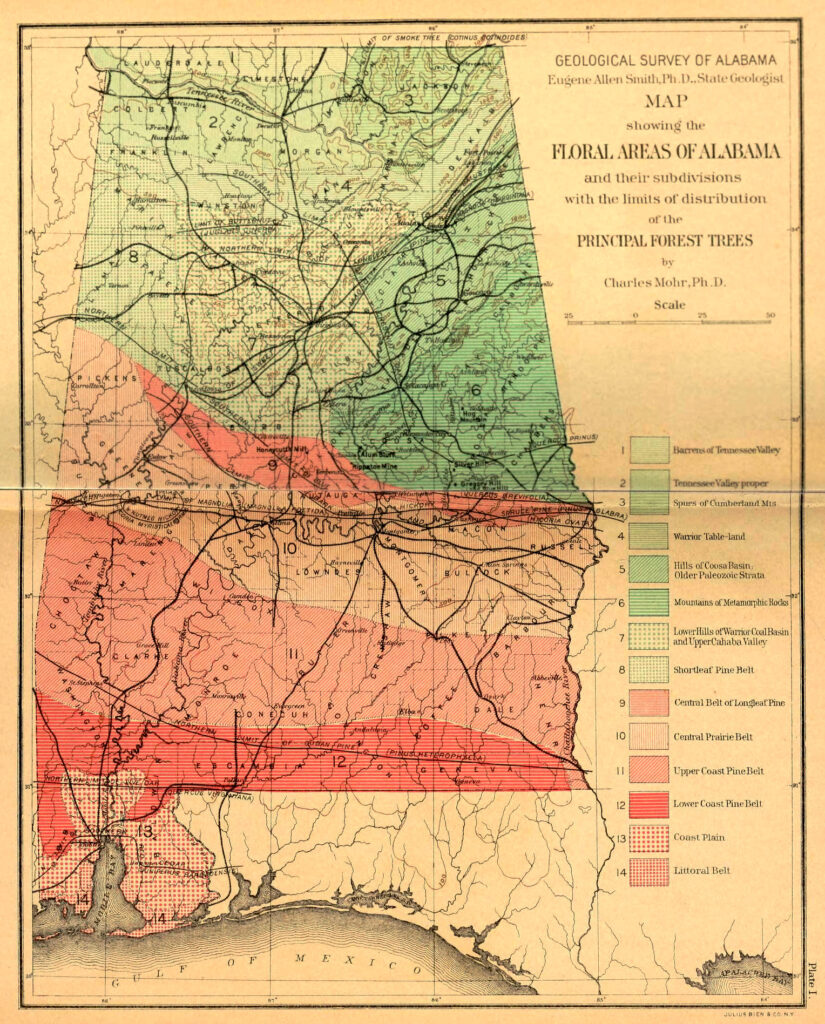
“A line drawn from the northwestern corner of the State to the lower part of Lee County, crossing the Coosa Valley near Childersburg, makes the limit of the highlands having an average elevation of 800 feet above sea level (E. A. Smith). This line coincides approximately with the isothermal line of 60 deg F., and may be regarded as the boundary in Alabama of the Upper and Lower Austral zones, therefore of the Carolinian and Austroriparian or Louisianian areas. It winds its way from northwest to southeast and southward to the “fall line.”‘ Accepting this zonal line, a botanical limit is gained, northward of which is found a flora different in character from that to the southward, generally described as the flora of the great Central Mississippi Valley, and distinguished by the feeble representation, if not total absence, of the subtropical element and the exclusive prevalence of deciduous forests. Various shrubs and trees coincide in their limits of northern and southern distribution closely with this boundary line, and serve as unerring guides in pointing out its course. Such truly zonal plants are:
Pinus virginiana (scrub [Virginia] pine), Prunus americana (American plum), Quercus acuminata [Q. muehlenbergii] (yellow bark chestnut oak) [Chinquapin oak], Azalea [Rhododendron] arborescens (sweet-scented azalea), Stuartia pentagyna [Stewartia malecodendron] (fringed stuartia) [silky camellia], Quercus prinus [Quercus montana] (mountain [chestnut] oak). Butneria fertilis (mountain spicewood or smooth Calycanthus) [Calycanthus floridus (Sweetshrub)], Quercus coccinea (scarlet oak), Quercus rubra (red oak), Rhus aromatica (aromatic sumac), Acer leucoderme (white-bark sugar maple) [chalk maple], Adelia [Forestiera] ligustrina (southern [glade] privet).
These all find in Alabama their southern limit on this line. Although the vegetation of the Carolinian area presents in its broad features great uniformity, particularly in its tree growth, there exist in its range of nine degrees of latitude differences in the latitudinal distribution of heat, which necessarily affect the distribution of plants within its limits and present insurmountable obstacles to the extension of a number of species northward. Due to this temperature element, there is a most pronounced limit beyond which the successful cultivation of the cotton crop can not be pushed, and which also presents a barrier to several trees and a number of other plants of Southern distribution that are only rarely met farther north, as for example, the willow oak (Quercus phellos), loblolly pine (Pinus taeda), longleaf pine (Pinus palustris) and cane (Arundinaria macrosperma [gigantea]). This line, roughly extending from the Atlantic Coast at the mouth of the Chesapeake Bay westward to southwestern Missouri and northern Arkansas, was located by Gray along latitude 30 deg 36′, and by him was regarded as the line of separation between the two principal floral divisions of eastern North America, namely, the flora of the northern United States and Canada and the flora of the Southern States. In Alabama it is only this lower belt of the Carolinian area, embracing the mountain region and the lower hills with which we are concerned.”
From the Plant Life of Alabama by Charles Mohr (1901) pp 57-58
Interior Plateau
“Prominent travelers like DeToqueville and landscape architects, like Jens Jensen, have pronounced the Tennessee Valley one of the most picturesque and charming regions of the world.”
From A History of Alabama and Her People by Albert Burton Moore, p. 2
LETTER XIV.
Well’s Tavern, 5 miles South of Fayetteville
23rd Dec. 1817.
Dear Matt,
I AM now within a short day’s ride of Huntsville. I have travelled slow, on account of my horses, the roads being deep and heavy, such as the pedlar described them. The cane has made its appearance for some days past, and my servant has been breaking whole arm’s full of pipe stems, and throwing them away alternately, as he finds they increase without ehi. Having never witnessed the growth of the cane before, I was much gratified to meet with it. It first appears scattering, very slender^ but tall, from eight to twelve feet high. It has blades like Indian corn, and some resemblance of a tassel on the top. It grows every where through the woods; but, as you proceed, it is larger and higher, and tons of it He on the ground, on each side of the road, broken to pieces and rotting; and where this is the case, the gre^n cane is extinct forever, doubtless. The cause of this I cannot learn. These stalks are larger than corn stalks, and must have been twenty feet in height!
The land increases in fertility as we advance; and this fertility extends a vast distance on each side of us. The land at this place, and FayetteviUe, resembles that north of the Cumberland^ as black as your bat, and level.
Context note: This early description of North Alabama and the Interior Plateau includes historical language from a historic source. I have updated some of the language to ensure it does not offend present-day readers and residents of North Alabama. The language is irrelevant to the underlying ecological descriptions and natural history, which is the main focus of this piece. The text is difficult to read in places, so I am reproducing it to the best of my ability. I have added punctuation and paragraph indents to aid in readability.
This fascinating piece includes early descriptions of the area from a settler who arrived in Madison County, Alabama, with his family between 1810-1820.
“I was born in Oglethorpe County, Georgia, in the year 1801, two miles from Lexington. My father was a native of Virginia and a soldier in the War of Independence. He entered the army in his 17th year and was first under fire at the Battle of Furimoth(?) [sic]. This battle was fought on one of the hottest days on record, and my father said that after the battle, many of the British were found dead on the field without any wound. He came to South Carolina in Light Horse, Harry Lee’s command, and participated in the many battles and skirmishes ending in the occupation, and in the close of the war had risen to the rank of Lieutenant of a cavalry company. He was in the disastrous charge at Bridge, where owing to misdirection of orders, the advance was not supported and out of twenty, only five made good their retreat, all the others being killed or captured. Twenty years afterwards, he and my father met at a horse race in Lexington and renewed their acquaintance under more favorable auspices. Coming southward at the close of the revolution, my father settled at Lexington, then near the Chickasaw frontier, where he married a Miss Jennings, a member of a prominent Georgian family, and as there was continual ill feeling between the Cherokees and whites, a scouting company was ordered, which my father commanded for over ten years.
The Georgians had suffered severely from [Native American] hostilities, and for many years through this tribe bore ostensibly peaceful relations toward the federal government, yet there was a constant…[unreadable] warfare waged between them and the white pioneers. The [Native Americans] stealing and occasionally massacring, and the whites retaliating with tenfold severity. Occasionally horses would be stolen, a house burned and its occupants murdered and taken captive, then would follow a sudden raid into the [Native American] country, captive frequently being rescued, towns burned and [Native Americans] indiscriminately slaughtered.
My first recollections are of a double log house near a pine forest, a large cleared field adjoining [and] cultivated by [African American] slaves. In summer a table of pine slabs was set in the yard between the dwelling house and cabin; around this near sunset gathered my six older brothers and my older sister, tall lithe and graceful as a fawn, while my mother with her kind, loving face sat at the head of the table with my three-year-old sister at her knees and my baby brother in her arms. My father who then was approaching middle age was frequently absent or was detained by business until we small children had retired to repose. The [Native Americans] by this time had been gradually forced back towards the mountains, and Lexington was no longer on the frontier. Yet there were scores of old soldiers of the revolution and veterans of the [Native American] wars in the country. And on the long winter evenings, they gather around each others’ hearths and fight their old battles again. Many were the marvelous tales of peril and adventure and of hardship that we listened to with greedy ears and glowing faces.
Our country was a veritable land of plenty; the woods were full of game and the rivers of fish, and cattle and sheep and swine fairly swarmed in the woods. We very seldom had wheat and bread, but we had Indian corn in greatest abundance from where food of endless variety was prepared. I didn’t think any cotton was raised, but we had linsey and jeans and every family had its flax wheel and a little patch of flax, and then we had plenty of buckskin – the never failing resource of the backwoods man. But this country was growing too thickly settled for the typical pioneer, and my father belonged to that class, so in the year 1806 with his wife and his nine children and about a dozen [African Americans], he loaded up his wagons and pack horses [and] he set his face westward.
My father and his two oldest sons rode in front, followed by our two wagons with their [African American] drivers; then came my mother and the two younger children on pack horses, followed by [African American] women and children and some on foot and some horseback, while two of my brothers, sixteen and eighteen years of age with a trusty [African American] servant brought up the rear.
We traveled for about 15 miles per day over roads not well opened and frequently had to cut timber out of the road to fill up excavations. And camping by the side of swollen streams to await patiently for them to subside. We occasionally passed through or near [Native American] villages and my father being well up in the Cherokee tongue was hospitably welcomed and entertained. After we got out of Oglethorpe County, we saw no more white people until we came to what is now Murfreesboro [TN] on [the] Duck River, where we found a few white settlers [and] a grist mill in course of erection. We had left Georgia about the first of March and it was now near the first of April. My father had for many years desired to go to the great bend of the Tennessee, so tarrying on [the] Duck River just long enough to lay on a month’s supply of bread and salt, he turned southward and traveled steadily for about a week.
And one fine spring evening, we came to [the] Elk River. The stream was clear and the adjoining land fertile, and near at hand was a bold clear stream pouring its swift waters into the main stream. We skirted along this stream for near two miles northward, when we came to a low limestone ridge from which the stream rose in the form of a fine, bold spray gushing from the face of the rock. Here we rested for the night; our tents were erected near the spring and when I arose [the] next morning a little after sunrise, the [African Americans] were dressing a fine venison my father had shot, and a large rattlesnake was suspended from the limb of a spreading beech tree near the camp. The day was devoted to an exploration of the country and everyone pronounced it a goodly land, and on the third morning the sound of the maul and ax, the crash of the falling timber arose the echoes[?] over the walls of a log cabin began to arise the ridge pole and pieces were put on board river from the heart of white oak covered it, from small logs split in the middle floored it. A chimney was built of split sticks and the white family moved in.
The [African Americans] at first slept under the trees, the weather very warm and pleasant. Night was hideous with the wailing of whipperwills, hooting of owls and screaming of wildcats and howling of wolves. In the morning day was heralded by the song of mocking birds and thrush, the cawing of crows and the gobbling of wild turkeys in the tall tree tops, all nature was animated and the forests and streams seemed dense and populated by beast and bird, flesh and fowl, everything except man. Our family was alone and for months we had no visitors. This region did not appear to have been intruded on even by the [Native Americans]. The [Native Americans] had no traces of settlement in the neighborhood. We had dropped into the midst of an immense hunting ground with no one to molest or make afraid. We lived from the forest and with an occasional pilgrimage to Murfreesboro the year was passed by our family in a state of complete isolation from the world. A large corn patch had been cleared up, and corn was planted in holes with a hoe among the stumps and roots, and bread was raised in more than sufficient quantity for the coming season. The Indian corn on these fresh virgin lands grew to a height of twelve or thirteen feet, and produced two or three dozen ears per stalk.
We were a mile from Elk River and the little creek on whose banks we settled still bears the name bestowed upon it by my father. We had been located here for a year and were in the midst of plenty. We had no sickness. During the year we had made enough corn for bread. We had made two hominy mortars by burning holes in the ends of two large hickory blocks and we worked the pestles with sweeps and in this way obtained very good bread. The wood furnished an endless variety of treats(?), and when winter came we started a sugar camp in the hills where the sugar maple stood thickest and made a considerable quantity of sugar and molasses. We had to bring salt from Nashville. And at the close of the year, a road was blazed out all the way, and as there was no other wide blazed road, no frontiersman could mistake the way. This was an agreeable experience after the solitude of the preceding year, and among the number were some of our own relatives who followed our footsteps from Georgia who received a warm welcome. But in a year or two, old hunters began to tell of a country still further south down toward the great Tennessee River. They reported this country to be of unexampled fertility, well watered by many streams flowing south, clear and sparkling as the Elk River itself, and one or two adventurous hunters reported that they followed these streams southward until they had all merged into the one strong, clear and rapid little river that they called Flint, and when they came to the junction of the two larger streams they found a well derived(?) path leading from it through thickets and canebreaks toward the mountains that could be seen in the distance. As night approached, they had reached the foot of the mountain and encamped near a spring. Next morning they ascended the mountain which was covered in leaf timber and from a cliff looked down on a vast swampy sequin(?) with water gleaming in the distance. They tread southward ascending as they went until just before reaching the mountain summit they came to a spring in a dark mountain gorge with waters of icy coldness, and skirting the mountain top they followed a sinuous mountain ridge covered with a heavy growth of cedar that shut from their view the surrounding country as they descended. Presently the cedar gave place to a magnificent oak and poplar growth and they knew they were at the mountain’s base, yet they found swamps and marshes on either side, and on the north side was a long dark ravine at the foot of almost perpendicular cliff and presently a round knoll covered with oak and cedar and rising some thirty or forty feet above the general level and skirting round its western side they stood on a perpendicular cliff of limestone from the foot of which issued a large stream of water that spread over the swampy country below.
Soon there was considerable inquiry concerning the new and wonderful region to which our hunters had penetrated, and my father began to talk of moving further south. We had been living on Elk River now for three or four years, and the settlements were gradually extending southward over from the new land just purchased from the [Native Americans] in Mississippi territory. My father and his boys and [African Americans] had cleared and cultivated some twenty acres mostly in corn and pumpkins, though we had a little flax patch and my mother had a flax wheel or two which was generally kept in motion. By this time a mill fall was built on Elk near the mouth of the little creek on which my father settled. At the time of which I speak, the creek was carried in a race to the highbank of the creek, and its waters projected against and over a hot wheel. The building was a mere shed to protect the works and grist from the weather. The works were crude in character, and the stones had been quarried from the adjacent mountains on highlands, but still crude though it was in character, yet it supplied the neighborhood.
Occasionally were seen the pack of horses of settlers from beyond the line in Mississippi Territory, and they attracted so much attention from our little community as a traveler from the Antipodes would now command. These tall, stalwart men in buckskin clothing were enthusiastic in the praise of the new country beyond the state line, and while a large number of settlers were pouring into the Elk River country, a considerable number of old pioneers were going further south. One reason for immigration was that Tennessee was a state and was extending its “larate” [sic] over its new settlements when in 1806-7 the [Native Americans] relinquished the vast triangle to the United States the base of which extended from the highlands and headwaters of Elk to the mouth of Elk River and whose apex was 100 miles southward on Chickasaw Island in [the] Tennessee River. There was a heavy migration southward and a little tavern began to spring up at Winchester. Many of the pioneers had spent the larger portion of their lives on the frontiers of civilization, and laws and regulations of settled communities was somewhat irksome. While they were naturally peaceable and orderly, yet habit had made them fond of old pioneer law that usually had been potent for the preservation of order in their communities, and when law was extended over them, generally declined appointments involving administration of the laws and held themselves aloof from the courts. Then by traveling a dozen milesm they could pass beyond the jurisdiction of state authority, [and] it did not take long for many of them to cross over the state line.
By this time a road had been blazed out from the old town of Winchester through the heavy forests to the state line near New Market, and this formed part of the great highway westward through Alabama and Mississippi to Natchez – the then capital of Mississippi territory. The reasons that somewhat retarded emigration induced my father to emigrate further south. The Chickasaws had generally been very friendly to the settlers but the settlers hated the Cherokees and their hatred was fully reciprocated. About this time the air was full of rumors of a general [Native American] war, and my father who had fought the Cherokees for some twelve or fifteen years felt the old war fire reviving and came down to Alabama in order to be in view of the battle, should hostilities actually commence. So in the Spring of the year 1820(?), he sold his improvement on Elk river and came southward down the newly cut road until he struck Flint River at old Brownsboro where there was a considerable colony of old friends who had preceded him, and who at that time formed the extreme southern settlement in the county east of the mountains. At this time a considerable village was forming at Huntsville’s Big Spring known as the town of Twickingham, and my father settled on a high hill north of Brownsboro. A horse path leading from Brownsboro to Huntsville had been made on the south boundary of the section lines from Flint River to Huntsville. The lands had been surveyed the year before and the settlers could follow the newly blazed section to the mountain from which to Huntsville a road was blazed out nearby on the line of the present Belle Fort road, but many years passed before a wagon road was opened.
All the people who lived on Flint drove wagons to town [and] went up the river to the old Winchester road, crossing the river to the factory then known as Woods Mill. On the west side of the river they skirted round the mountain through the open woods through the Mastin farm and round by the Green Bottom Inn just opened by John Connolly, a famous sportsman and prominent man in his day. Horton’s mill above the three forks and Brown’s mill half a mile west of old Brownsboro had not been built and our grinding was done at Huntsville at a mill put up west of town by John and William Bedlum. I being one of the younger boys officiated as a mill boy at first accompanied by an older brother or a[n African American] man or boy, but as I grew older I frequently made the trip alone. Men now living in this country can have but little conception of the richness and beauty of the region between Brownsboro and Huntsville. With the exception of the mountain spur now known as Cedar Ridge and then covered with a thick grove of stately cedars, it was one continued grove of magnificent poplar interspersed in the lowland with oak, walnut and hickory. It was a case of the survival of the fittest for there was little or no undergrowth and the forest titans had reserved so much space for light and ventilation, they were not frustrated by storms. Wagons could be easily driven anywhere over the woods, and in riding through the beautiful open forest, a door on the sun could be seen for a quarter of a mile away through the forest avenues. Roads then were not so necessary as at present when the undergrowth prevents driving and frequently riding through the forests.
The mountain was rather difficult especially on the eastern side. The path wound among low jagged cliffs of limestone and it took experienced steering at some points to prevent our meal bags from coming in rude contact with the sharp rocks looming up on each side of the trail. At this time little impression had been made on the unbroken forest east of the mountain, there was a house on the Nichols spring near cedar ridge and some two or three along the base of Monte Sano near the cool sparkling springs on the south side of the Moore plantation. From Huntsville to the Mountaintop was one unbroken forest with small clearings made south of the road one by Moses Vincount at Underwoods and another near the old Calhoun quarters. There was a few struggling log cabins on the path from Steels corner out as far as the Fleming place, and several new houses among the trees from Holmes street down Green street towards the pike from Steels Corner the road wound round a large pond where the water stayed all summer and which was full of green briars, old stumps and logs to where the ground began to rise into a considerable knoll where the courthouse stands. Here stood at that time a little frame building used as a courthouse and another north of it for a jail which in a year or two were replaced by brick buildings which were a source of wonder to the young natives. In the crowd was generally some older person who could put up rocks for unfortunate boys who were dragged off by the rocks or saplings or needles and thread also were forthcoming for repairs in case of damage.
We generally started at sunrise or before and reached our destination in two or three hours and as we tarried until all had obtained their grist, we reached home near night fall; thus we managed to spend the greater part of the day in town, and no exposition of the present civilized period ever delighted our souls as did the wonders of the now and growing little city. We wandered round the spring cliff and waded in the wide and sluggish waters in the swamp below. Somebody had started a tanyard just below the spring at the foot of the hill and making of leather was a new revelation to us. Then came the brickyard and bricklaying and the carpenters and masons at work, and there was also a cotton gin run by Dr. Moore and a distillary above the mill run by James Clemons; as evening approached we set out in time to reach home before night fall and turning around the cedar ridge and circling round the point we would frequently hear the scream of the catamounts that infested rough and honey combed rocks covering the upper ridge and listened to many blood curdling stories of adventurous hunters, who had encountered wild beast in their wild and difficult lairs up in the black cedar groves.”
From The History of Madison County, Alabama by Thomas Jones Taylor, pp. 116-126
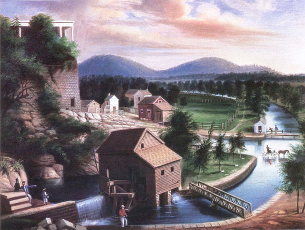
LETTER XVII
Huntsville, AL, January 1st, 1818
“You will expect something of this flourishing town. It takes its name from a man called Captain Hunt, who built the first cabin on the spot, where the Court House now stands, in 1802. In front of this cabin, which was built on a high bluff, there was a large pond, which is now nearly filled up by the citizens. Captain Hunt cleared a small field west of his cabin, the same year. This was between his cabin and the Huntsville Spring. He spent much of his time in waging war with the rattlesnakes, who were very numerous in his day, and had entire possession of the Bluff at the Spring. Thousands of them, it appears, were lodged amongst the rocks, and the Captain would shoot hundreds of a day, by thrusting long canes filled with powder, into the scissures* of the rocks.
Whether Hunt, or the snakes acquired the victory, I have not heard, as he was compelled to abandon his settlement to a more successful rival, who purchased the land.
* When they were digging the vault for the Huntsville Bank, they found a vast number of snake skeletons
The land around Huntsville, and the whole of Madison county, of which it is the capital, is rich and beautiful as you can imagine; and the appearance of wealth would baffle belief.”
From Letters from Alabama by Anne Royall (1818), pp. 43-44
LETTER XVIII.
Same date.
“Dear Matt,
To go on. The Huntsville Spring, is a great natural curiosity. This you, as well as myself, heard before. But I had no conception of it It flows from under the Bluff mentioned, and forms a stream large enough for the purposes of navigation and empties into Indian Creeks also navigable. The head of the spring is about sixty yards wide, but spreads out to a much greater length, covering about three acres of ground!!! The Bluff, at its head, forms a perpendicular of 60 or 70 feet in height, perhaps more, and is conical.”
From Letters from Alabama by Anne Royall (1818), pp. 44-45
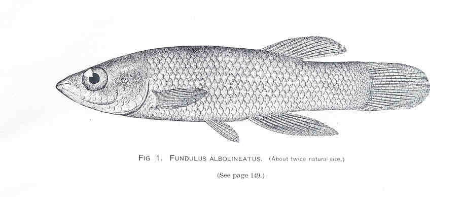
“Everybody lived in log houses of various grades from the humble cabin daubed with clay to the hewed log house with plank door, shingle roof, the rocks chinked and finished off or pointed with lime. Lumber was all sawn at saw mills by hand, and it was a serious task to saw out the planks for a first class dwelling. For the accommodations of my father’s large family, he built a square log house about 20 feet square with a side room. The floors were made of white ash plank sawn at saw pits by hand and covered with chestnut shingles and stood without being re-covered for near 50 years. The kitchen and smoke house and [African American] cabins were rude log cabins daubed with clay and several of them with dirt floors.
East of the house [in Brownsboro, AL] was a sluice or lagoon with many springs running with it and some boiling up from its bottom. The water in this lagoon was clear and cold with tuberoses growing in the streams and along its borders. It was always swarming with fish and a haul or two with a seine generally supplied both white and black with an awful supply of fine fish. From this sluice to the river was a body of rich bottomland covered with tall grown trees over topping the heavy cane break that covered the entire surface. The road from Huntsville skirted the hills and crossed the river half a mile above old Brownsboro and a thick grove of peach extended down the river on its eastern side. Small game was abundant and occassionally bears and wolves were slain in the river bottoms and catamounts and panthers in the mountains. … So every spring there was a new ground of several acres to be grubbed and the brush and logs piled and on the cane break part was planted and cultivated with hoe alone. … The soil was wonderfully fertile, the seasons regular and a failure in crops was unknown. Our hogs and cattle kept fat all the year round in the cane breaks, and a little corn fed to the hogs in the fall made plenty of fine pork for the whole year.” pp. 127-128
CLEARING THE LAND
William James Bennett after George Harvey (National Gallery of Art)
“When our forefathers came to this county it was covered everywhere with a magnificent forest. The trees were generally of the largest of their species; the poplar or lime tree [Liriodendron tulipifera] were exceptionally numerous and large and were found in perfection on the best soil. To remove the primitive forests or deaden them was a task of no little magnitude. To cut down and remove the trees from the land was impossible, and they were girdled round their trunks. The best time to effectively perform this task was in August and September, as when girdled at this period their vitality was effectually destroyed, the leaves fell off and were not renewed, and if fenced before spring, the crops were planted. But the first year it was not expected that they would produce a good crop as the trees stood so thick that they took a great deal of the tillable land, and their roots made thorough culture impossible. Besides, when spring opened, the undergrowth shot up in the rich soil, and the sprouts were removed with the old fashioned grubbing hoe or mattock that differed from it in having a blade for chopping on [the] upper end of the implement. Plowing among the roots was very unpleasant and slow business and the word “grub” was a synonym for the hardest of all kinds of manual labor. As a general rule, for the first 2 or 3 years the farms had to be grubbed over acre by acre, by which time the sprouts and the roots near the surface were gotten rid of and the plowing was less difficult. But about the second year, the small branches of the girdled trees began to fall, covering during the winter the surface with their debris, which had to be gathered and burnt in the spring before planting commenced.
Then the less durable timber began to decay and prostrated by the winter gales and had to be cut off, piled and burned before plowing could be done. At first this task was not so great as the smaller trees and limbs from larger ones could be easily handled, but when in course of time, the big hickory and oak and poplar soon began to tumble, the matter grew serious and involved a month or six weeks arduous labor. On large plantations where there was an adequate force of stout men and stouter oxen, the work was done by the hands on the plantation, but in a region of small farms, a cooperative system was introduced, and what was termed “log rolling” became the order of the day. In the first place, the owner of the field cut notches on the large logs at intervals of about ten feet and started a fire on each notch, and when the fire had well enough caught, he laid a large dry limb across the notch, which caught and burned until it fell in half on each side of the log. Morning and evening the logs were mounded(?) up, the burned and divided fragments were piled up and placed in the increasing gap made by the fire, and as the fire gnawed deeper, filling it up with combustible material until it cut the log in two, which was sometimes done as smoothly as if with a saw. Generally, the hickory, once fairly ignited, burned up root and branch, but the oak and poplar burned into cuts sometimes ten or a dozen to a tree. Generally, in favorable weather it took about a week to burn off the logs and just before log rolling day, the farmer went over the ground with his axe and cut off logs the fire had missed. As a rule, each farmer had one or two log rollings in spring, but he expected the help of all his neighbors and had to help them, so he calculated to spend 3 or 4 weeks in the business. There was generally an understanding on what day each man was to have his logrolling to prevent confusion in the work, and there was frequently a working force of forty or fifty stalwart men on the ground. They would go to the large trees and turn the second cut from the root at right angles and cut two or three others and roll them alongside as a base to the log heap and prying up the others, they would insert their long, strong dogwood hand spikes until they rested on as many as the length allowed, and then with a man at each end of every stick, the word would be given, the log would rise, and they would walk to the longheap with it. The men next [to] the long heap would place the ends of the stick upon it [and] go over to the other side, and the united strength of the whole party would elevate the hand sticks and slice the log to its place. Thus the work would go on in a marvelously short space of time; the heap would be completed by piling on the heavier part of the tree top. The portions the owner could handle were not touched as the object was to pile up the logs he could not lift, and they generally had no time to lose, except an hour at noon they generally worked until sundown or till the logs were all rolled, and the host expected them to remain until after supper even when there was no frolic or dance to detain them. …
The loads these men carried on their hand spikes was astonishing; sometimes the logs would be so large that a man could not see across it, and to a bystander on either side, it looked as if the huge log was crawling off with a single row of men walking on one side. Like all other feats of strength, there was a peculiar sleight in grasping the stick in carrying the body and in walking with the huge load, and the phrase to “tote fair” originated in the necessity of an equal division of the handspike under the log as between men of nearly equal strength two or three inches in the divide of the handspike made a huge difference in weight, each had to carry and where a strong man matched with a weaker one, the strong man’s end of the stick was shortened in due proportion. In a space of 2 or 3 weeks, the logs in the fields for miles around would be piled in vast heaps and set on fire, and at night, the whole neighborhood would be illuminated. …
Then [in April] there was another danger to meet, the sap part of the decayed trees got dry and burned like timber. Sometimes the wind would rise and sparks from the log heaps would catch and set the dead forest on fire, and the farmers would have to fight for their fences amid the fire and smoke and blazing branches from the falling trees; sometimes 30 or 40 acres would be on fire, and the whole neighborhood would come to the rescue. A blazing branch or a burning trunk would fall on the fence; the men would hasten to the point of danger and scatter the fence rails to the right and left out of reach of the flames. Then would come the cry “the fence is on fire” from some watchful sentinel, then a rush to the place and tearing down the fence and removing the rails, and so it would be kept up until the fire died out for want of fuel. The heavy forests on the mountains and near the fields would drop a heavy covering of leaves in the fall and winter, and they becoming dry in the spring accidentally would be set on fire. The fire would probably start on the mountains; night after night the fire would appear longer and wider, the wind would rise and it would get among the canebreaks, and the popping of the cane would sound like the skirmish line of opposing armies. The farmers would be set up in arms against it. They would clear land(?) lines round their fences and set them on fire in long continuous lines on the side next to the forest; soon the slower line of flames would be met by the faster, the flame would shoot up for a moment and then die out along the whole line, and the farmers with a sigh of relief would go to their homes to snatch a few hours of repose to fit them for the arduous labors of the approaching day. …
It generally was 7 or 8 years before the land was cleared generally of timber. The oak and poplar trees generally lingered longest and were sometimes destroyed by fire as they stood. While the falling and removal of the forest involved a vast amount of labor and no little injury annually to the growing crops, yet it is maintained that the mass of rubbish falling from the trees contributed materially to keeping up the land. The value of timber destroyed by fire in clearing our land is immense, and if on the land today would be quadruple in value of the lands at the highest figure they ever reached, and it is unfortunate for the country that the poorer shoals had not been left in timber as the value of the lands could be greatly enhanced thereby. Timber at that time was of little or no value and as far as could be foreseen, the supply seemed inexhaustible. Our county has reached its crowning point of agricultural prosperity about the year 1850 when pretty well all the available lands on the old farms had been cleared up and put into cultivation, and at that period very little cleared land was lying idle.
But in the nearer portions of the county, especially on Flint and Paint Rock, the river lands once considered of very little value have been cleared since the war and is the main reliance of those parts of the county for corn and grain. While the disappearance of the timber from the fields has rendered them more liable to the washing of the heavy rains, and they have greatly depreciated in producing fewer(?), the county is undeniably healthier. There is less deposit of vegetation matter in the sloughs for creation of miasma, and many noxious lands and bayous have filled up and are in cultivation. There is less obstruction of the creeks and rivers, and the drainage of the country is materially improved. But with the diminution of the forest area, the seasons have become more uncertain, the rainfall decreased and droughts more frequent. Many fine springs which 40 or 50 years ago furnished water the year round have either totally disappeared or run for part of the season only. Nearly all of our lands that are worth cultivating have cleared and a considerable area of the older lands turned out as worthless. While as a rule we have sufficiency of timber for fuel, yet good timber for fencing and bailing is growing scarce. The worn out lands in the country ought to be planted in good timber plants and taken care of until the saplings could take care of themselves. A country shorn of its timber is likely to become a desert, and there is no greater benefit we could confer on coming generations than the inauguration of timber culture. The timber on land is its most valuable production, and its destruction ought to be stopped, and its area extended. The western prairies when 30 years ago a stick of timber could not be seen for miles now have extended areas of young forests planted by the present generation that will soon be sufficient for ordinary purposes, and it is our task not to remedy the evils of a timber famine when it is upon us but to prevent it by taking measures to preserve the present supply as well as to utilize our worn out fields by making them the source of future supplies.”
From The History of Madison County, Alabama by Thomas Jones Taylor, pp. 66-70
“It was well their [doctors] numbers were large, for thousands of acres of timber were killed by belting, and the trees were left to rot where they stood, and fall, limb by limb, to the ground, tainting the atmosphere with deadly miasma. The consequence was, malarial epidemics, which carried off great numbers of the people.”
From Early Settlers of Alabama by Col. James Edmonds Saunders, p. 43
“After some years of prosperity, his [William Watkins] imagination was inflamed by accounts of the great fertility of Maury county, Tennessee; and he moved to that county, and, at length, when his relatives began to settle in North Alabama, he moved to Madison county, about 1819; a poorer man than when he left Georgia. He had been worsted in his encounter with the tall, thickly heavy timber of Tennessee. The farmers had not learned to girdle the timber, let it die, cut down the cane, and then at some dry time, set fire to it, and when everything is as hot as an oven, the burning is complete. Such a conflagration where thousands of canes heated by the fire are exploding every minute, resembles a battle of musketry. The settlers didn’t know, or had not time to wait for this process. William Watkins encountered the forest in the “green tree,” and not in the “dry,” and was badly defeated.”
From Early Settlers of Alabama by Col. James Edmonds Saunders, p. 236
“Emigrants were arriving [to Nashville in 1780]; the sound of the woodsman’s axe was heard from many places in the forests; log-cabins and worm fences were to be seen in all directions; the noble forest trees were “girdled” or cut down; men, women, and children were busily engaged in the burning of the brush,” clearing off the ground, and opening the virgin soil for the various seeds and grain, from which they confidently anticipated an abundant harvest, to be gathered in the joy and quiet of autumn.”
From A History of Middle Tennessee by Professor A. W. Putnam (1859) pp. 219
LETTER XLIX.
Huntsville, April, 1822.
Dear Matt,
I have not, as you suppose, forgotten you, though you are a sad boy. But I will lay the matter over till we meet. You have heard and read of tornadoes. We had the most dreadful tornado, last week, that was ever known in this country. The ravages of this dreadful calamity was confined to a ridge of high poor land, the nearest part of which, is about three miles from hence, though we had a severe gale here, the hardest by far I ever witnessed. It prostrated every thing before it in its career, trees, houses, fences, all raised to the foundation. Trees were said to be carried fifteen miles, twisted and split to atoms, and though strange, no lives were lost; most of the people were bruised and mangled, and lying on the ground, unable to disengage themselves from the fallen trees and houses; some with broken legs, some with broken arms, and all more or less injured, excepting one man and a few children. There they lay, and the rain pouring on them in torrents and as dark as Egypt. It happened a little before midnight. By daylight, next morning, their situation being discovered, by their nearest neighbors, several expresses on horseback came into Huntsville, for surgeons, doctors, and assistance of every sort, as their clothing, and every atom they had in their houses were blown off, and never seen afterwards.”
From Letters from Alabama by Anne Royall (1818), pp. 136-137
LAWRENCE COUNTY & MOULTON VALLEY
“Alabama, dusky maiden – lovely Pocahontas among her sister states – stepping out from the dawn, now beckoned evermore the weary emigrant to her “Happy Valley,” where the silver Tennessee trailed its sparkling waters past wooded islands, and laughing shoals, ever crowned by the great forest monarchs!”
From Early Settlers of Alabama by Col. James Edmonds Saunders, p. 7
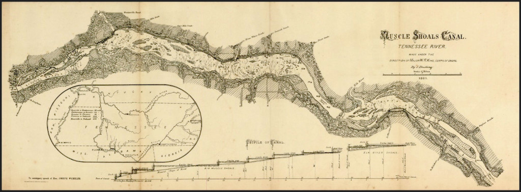
“The country of the Cherokees was described by the early historians as the most beautiful and romantic in the world; as abounding in delicious springs, fertile valleys, lovely rivers and lofty mountains; the woods full of game and the rivers of fish. But none of these early writers had ever seen the country about the Muscle Shoals, which was last settled and most highly valued by those [Native Americans]. The buffaloes roamed over the plains in countless numbers. As late as 1826, at the licks in this county, their paths, knee deep, radiated in every direction. In 1780, the small colony which made a crop of corn that year at Nashville, Tenn., had to leave three men to prevent the buffaloes from destroying the crop, whilst the rest returned to East Tennessee for their families. –(Guild’s “Old Times in Tennessee.)” Deer, wild turkeys and the smaller game continued abundant, even after the whites took possession of the country. As many as sixty deer were counted in a single herd. The Tennessee River and its effluents swarmed with fish, for there never was anywhere a better inland feeding ground for them than the Muscle Shoals. Its shallow waters stretch for fifteen miles along the channel, and spread out two or three miles wide, and produce a thick growth of aquatic plants (called moss), which come to the surface and sport the tips of their leaves on the swift, sparkling current. These plants, roots and leaves are freely eaten by fish, and wild fowls also. Of these last, swans [sic], wild geese and ducks (which annually visited their feeding ground in old times) the number was fabulous. Added to this, the bottom of the river was strewn with mussels and periwinkles, which are not only highly relished by the fish and fowl, but by the [Native Americans], who had them a sure provision against starvation in times of scarcity. I could well imagine that the last prayer of the Cherokee to the Great Spirit, when he was leaving this scene of beauty and abundance, would be that he might, when he opened his eyes in the next world, be permitted to see such another hunters’ paradise as this.”
From Early Settlers of Alabama by Col. James Edmonds Saunders, p. 34
“The Cherokee [Tennessee] river has been navigated 900 miles from its mouth. At the distance of 220 miles from thence, it widens from 400 yards (its general width) to between two and three miles, and continues this breadth for near 30 miles farther. The whole of this distance is called the Muscle Shoals. Here the channel is obstructed with a number of islands, formed by trees and drifted wood, brought hither at different seasons of the year, in freshes and floods. In passing these islands, the middle of the widest intermediate water is to be navigated, as there it is deepest. From the mouth of the Cherokee river to Muscle Shoals the current is moderate, and both the high and low lands are rich, and abundantly covered with oaks, walnut, sugar [maples] trees, hiccory, etc. About 200 miles above these shoals is, what is called the whirl, or the suck, occasioned, I imagine by the high mountain, which there confines the river (supposed to be the Laurel mountain). The whirl, or suck, continues rapid for about three miles; its width about fifty yards. Ascending the Cherokee river, and at about 100 miles from the suck, and upon the south-eastern side of that river, is Highwasee River. Vast tracts of level and rich land border on this river; but at a small distance from it, the country is much broken, and some parts of it produce only pine-trees. Forty miles higher up on the Cherokee River on the northwestern side, is Clinch’s river. It is 150 yard wide, and about 50 miles up it several families are settled..”
From A Topographical Description of the Western Territory of North America (1797) by Gilbert Imlay p. 498
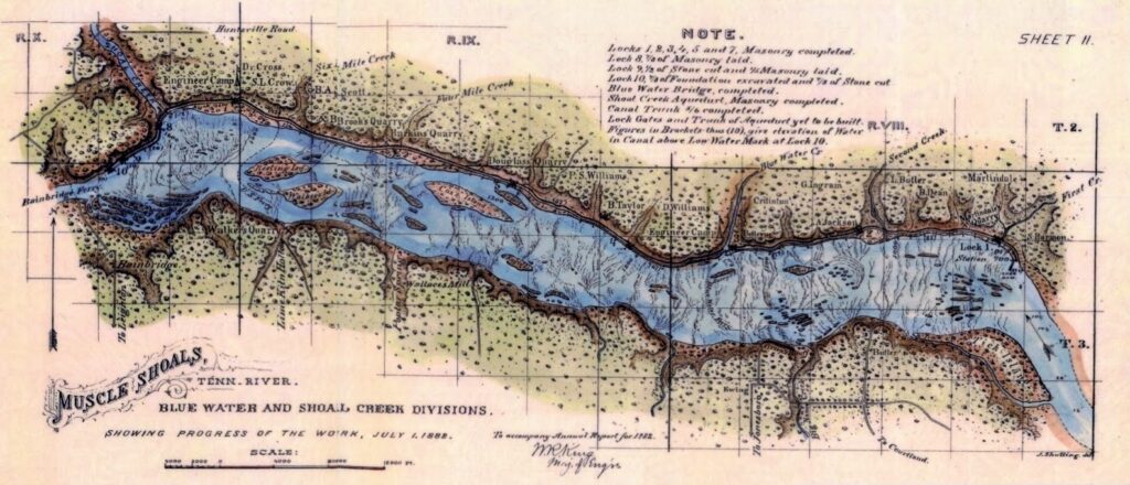
“[Captain Robertson’s expedition, 1780] And thus had they safely arrived near the mouth of Blue Water, and in hearing of the rapids of the Tennessee…They encamped some miles distant, but within sound of the falls or shoals, in the evening. Most of the men were very anxious to have a view of these rapids, of which they had heard some marvellous accounts. As they were sitting around their camp-fires, many inquiries were made of some of the men who descended the Tennessee and crossed over these shoals with Colonel Donelson and his party of emigrants, on Sunday, I2th March, 1780.
.. The Chickasaw guides had described the situation of the Indian town near the great Cave Spring, the Indian name for which signified “Cold Water.” The citizens of the beautiful town of Tuscumbia, Alabama, now obtain their supplies of pure, fresh, and cold water from this spring. It flows from beneath a bluff of limestone — a beautiful little river as it gushes forth.
..The question of difficulty now was, how to cross the river..Before the break of day they learned that it would require hours of travel through the cane before they could reach the river…This party discovered some [Native Americans] on the opposite bank, apparently looking for the approach of the army. These spies ” lay close.” They had found a secure hiding-place in the cane and bush, and from this concealment they narrowly watched the path, the crossing, and the enemy.
..The river was at a low stage, so that although they were in the water for a distance of three-fourths of a mile, they could wade most of the distance…Having ascended the bank, and proceeded a short distance, they entered the Barrens, and discovered a plain path, with a westerly direction.”
From A History of Middle Tennessee by Professor A. W. Putnam (1859) pp. 259-263
“Gen. John Coffee found a ford for his mounted men across the Muscle Shoals. They entered the river near the mouth of Blue Water creek, waded about three miles and emerged from it just below Green’s Bluff; and ascending the steep and lofty bank they found themselves, in what is now, Lawrence county, but then the choice hunting grounds of the Cherokees. As they beheld the level but elevated valley, which stretched out before them, apparently, a broad prairie interspersed, thinly, with trees, it was a sad day for the poor [Native Americans]! for many a soldier’s heart glowed with admiration and covetousness.”
From Early Settlers of Alabama by Col. James Edmonds Saunders, p. 36
“The Shoals are described as being at that time [1780] dreadful to behold. The river was swollen beyond its wont, the swift current running out in every direction from piles of driftwood which were heaped high upon the points of the islands. This deflection of the stream made a terrible roaring, which might be heard for many miles. At some places the boats dragged the bottom, while at others they were warped and tossed about on the waves as though in a rough sea.”
From The Early History of Middle Tennessee by Edward Albright, p. 64
LETTER XXIV.
Melton’s Bluffs January 14th, 1818.
“You have heard that this country consists of table and bottom land, also, of the Bluffs. These Bluffs happen where there is no bottom land, but the table land running up to the river forms a high precipice, called a Bluff. This is the case at Melton’s Bluff, the highest I have seen.
..No language can convey an idea of the beauties of Melton’s Bluff. It is said to be the handsomest spot in the world, off the seabord; and rich as it is beautiful. I can sit in my room and see the whole plantation; the boats gliding down the river, and the opposite shore, one mile distant. The ducks, geese, and swans, playing at the same time on the bosom of the stream, with a full view of the many islands. It is, after all, the great height of the site that pleases.
..The term beauty is applied to any thing which excites pleasant feelings. Beauty is said to be a uniformity amidst variety; a proportion of parts adapted to a whole; fitness of things to an end; quantity and simplicity. All this is realised on the scenery of Melton’s Bluff. Here is a noble river which combines in itself all you can conceive of grandeur and utility, adorned with islands spangled with boats, and enlivened with wild fowl.
..You may thus form some idea of this farfamed Bluff. Here the green islands look like floating meadows.
..Here the wild fowl arrayed in glossy plumes, wantons as she lists. Here the distant billows breaking o’er the Shoals, echo back in murmuring sounds, and mingling sweetly with the music of the boatman’s viol swells upon the ear and softly dies away upon the breeze. To crown the whole, here the majestic swan [likely a trumpeter or tundra swan], robed in dazzling white, moves in all her graceful attitudes. These are beauties which may be felt but cannot be described. This combination at objects, each beautiful in itself, and some materially useful, constitutes the beauty of Melton’s Bluff.”
From Letters from Alabama by Anne Royall (1818), pp. 61-62
“Dear Matt,
I was three days on the road to this place. Melton’s Bluff is at the head of Mussel Shoals. But to see more of the lands shortly to be sold, I went direct to the foot of the Shoals, 70 miles from Huntsville, crossed the river, and came up on the south side of Tennessee river. We had a soaking rain the first day, but the road was fine, the country being a level plain, and the land as rich as any in the world, doubtless, and well watered. Many houses are already built on the road side, and good entertainment The lady, however, where we staid the first night, said it was very sickly.
The second day, towards evening, as Mr. Beech (my fellow traveller) and I were at our ease, chatting on different subjects, my servant, behind us, cried out “Looky! looky! what a great river!” We had heard a roaring sometime, and Mr. B. who was acquainted with the country, observed we could not be far from the foot of the Shoals. Upon turning our horses out of the road a few steps, we saw the river – a most sublime picture it was! That part which first burst on our view, was three miles in width! the largest body of water I ever saw. It was at this time very high and muddy; and the noise produced by the water washing over the rocks was tremendous.
We saw a boat hung on a rock, about the middle of the stream, and many persons around it on the rocks, endeavoring to get it off; the waves and white caps were dashing furiously around them; and unable even to bail them, we proceeded, being near our destination.
The sun was verging upon the horizon, while I was musing upon the fall in the river (which was evident). Having travelled over level ground from Huntsville, we began to descend rapidly, almost a precipice, the road making a sud*den bend to the left; and shortly the house, at which we were to spend the night, stood before us, on the bank of the river. But it here flowed in a smoothe current; yet, upon looking up the river, the wide spreading Shoals were seen. The grandeur of the scene engrossed my attention, until night-fall compelled me to retire into the house.
Mr. Beech going no farther, I took a guide, one of the pilots, and crossed the river next morning, in a ferry boat. I should have found it difficult, on account of several creeks which were backed up by the river, without a guide. The Tennessee river is wider at the foot of the Shoals than the Ohio, at any part I have seen, and equally beautiful perhaps superior. It has not those high banks which confine the Ohio, if we except what the people, in this country call Bluffs. These are steep ledges of rocks which appear at very con« siderable intervals, sometimes on one side of the river, and sometimes on the other – and from appearances I would suppose it often inundates the bottom lands. These are covered with cane, as thick as the hairs on your head, and look like so many fields of green wheat. These, contrasted with the leafless forest, are singularly beautiful. Not only the islands, but the bottoms are so thickly covered with cane, that you could not see a man on horseback five steps from you.”
Dear Matt,
Upon leaving the ferry, I was pensive and melancholy for, being told by my guide I was to pass by several [Native American] farms, it struck a damp on my spirits, of which he was unconscious. He speaks of the [Native Americans] and their departure with perfect indifference.
On leaving the river the beauties of this deservedly extolled country broke on my view by degrees. To compare it with the Elysian fields of the ancients, would give but a feeble idea of it. The diminutive vale of Tempe and their thousand sylvan shades, vanish into nothing, compared with this. As you are partial to any thing I say or do, I shall throw my thoughts together for your amusement, and you may arrange them at your leisure.
It is unnecessary to state what you have learned from the newspapers, that this land was abandoned last fall by the [Native Americans]. The fires were still smoking when the white people took possession. Although I had travelled through a beautiful country the two preceding days, and my mind had been raised to the highest pitch of expectation by repeated descriptions of this land; yet, it far exceeded all I anticipated. On quitting the impervious river-bottom, I emerged into an open country, high and dry. The exuberance of cane and timber subsides. This enables the eye to see to a great distance — no hill nor dale — neither is it a perfect level; but the surface is gently undulating, or alternately elevated or depressed like waves. The eye can range without control in all directions. This is what charms; and this I was not prepared for.
But what struck me with most wonder was that I always appeared to occupy the highest ground; and, all from that point, seemed to descend; and when I gained the extreme boundary of view from a given point, it was the same thing as before – this appeared the highest; that which I had left, the lowest. A warm hospitality seemed to breathe among the trees: they have something cheering in their aspect. They do not terrify by their gigantic looks — they open on all sides, as if to let you pass, and welcome your approach. The sun throws a shining lustre over them. How unlike the cold, dreary, hard frozen hills of Monroe, or in fact any thing in our country.
About ten o’clock we came in sight of the first [Native American] farm— but [Native American] farm no longer! The smoke was issuing slowly through the chimney. Why, these Indians have been like us!—could not be savage [sic] — cornfields — apple trees, and peach-trees. Fences like ours, but not so high—trusted to their neighbor’s honesty — perhaps these being more civilized had more reason to fear their neighbor. Provoked with my guide because he could not tell me the original cause of these enclosures among the [Native Americans]— from four to five rails high — this would not do among us- ‘twould breed a civil war. — There were the lusty corn-stalks— looked grayish — some were standing erect, some were broken off at the middle and hung together still, some were prostrate. The bouse looked tight and comfortable; the fruit-trees are large and show age — there the [Natives] sat under their shade, or stood up and plucked the appIes-wonder he did not plant more — suppose he did not know how to make cider. Blockhead! — better than whiskey.
My guide says peaches are delightful in this country.
Poor Gourd! That was the [Native’s] name; had he still been there, I would have called to see him: but I felt no desire to see his successor. Guide says Gourd was very kind; he knew him for fifteen years. He helped to subdue the Creeks, and made an excellent soldier. There was a portico over the door — there Gourd used to sit in the warm summer days. We rode close to the fence, built by his hands, or perhaps his wife’s; no matter which it was, it was no less dear! — It was his home! The sun, at this moment, overcast with clouds, threw a solemn gloom upon the [Native American] farm. Nothing moved but the smoke from the chimney — all was silent and hushed as death! — Poor Gourd had to leave his home, his cornfield and his apple trees.
There could not exist a greater evidence of unbounded avarice and ambition which distinguished the Christian world, than the one that lay before me. There was a time when the owners of this beauteous country flattered themselves that distance alone would screen them from the intrusion of the whites. Vain hope!”
From Letters from Alabama by Anne Royall (1818), pp. 54-56
“You cannot imagine a sight so beautiful as this country exhibits to this place. But the sight of the Bluff at a mile’s distance fairly entranced me. It is an even high plain and resembles a hanging garden. The sun favored us with his rays as we drew in sight, and shed a beautiful lustre on the Bluff. — This land is so clear of undergrowth that you may drive a wagon any where through the woods; and this body extends, I am told, twenty miles in width. We passed many [Native American] houses in the day, and some beautiful springs.”
From Letters from Alabama by Anne Royall (1818), p. 58
LETTER XXVI.
Melton’s Bluff, January I6th, 1818.
Dear Matt,
I AM here for the winter, doubtless, and shall while away the time between writing to you, viewing the country, and “chatting with the beaux.” As you are desirous to hear a particular account of this beautiful region, I shall finish what I began sometime back.
I said the land was divided into bottom, table land, and Bluffs. It also contains Bayous and mountains. The bottom land is held in little estimation; for, though more fertile than the table land, it is hard to clear, being thickly covered with heavy timber, and often not only by these bayous, but often overflowed; this renders it too wet, for cotton, which delights in dry soil. These bayous are formed by the water of the river forsaking the channel, and, running off in various directions, returns to the river and unites with it again. The cotton, or table land, is separated from the bottom land, by the Bluffs, and though they are only called Bluffs where they meet the river, they are evidently the same elivation which divides the bottom from the table land. The table land is not a dead level, but waving, and varies from 20 to 25 miles wide; then comes the mountain, a narrow strip of pine land, very little higher than the table land generally, and, though stony, might be tilled. Then comes the table land again; next mountain. These varieties run parallel with the Tennessee river.
Then comes the long moss, sixty miles on this side of Cahawba, running in the same direction; and beyond it the table land appears again. In the region of this moss it is sickly, as it also is, on the rivers; but keep off the rivers and it is as healthy as any climate, or perhaps more so, than any part of the Union. There is no such thing as consumption. Those families subject to it perfectly recover from it in this climate. Of this I have been an eyewitness.
I saw some of the moss just mentioned. It looks like hay when cured in the sun, though much finer. It has joints like timothy grass. A gentleman who brought some of it in his saddle bags to this place, informed me that it hangs loosely upon the trees, as though it were thrown on by the hand, and has no connection whatever with the branch upon which it hangs. This is most singular. He said that trees of all descriptions were enveloped with it, from the top to the bottom, hanging down to the ground; and that cattle lived on it. I ought to have said that a narrow blade branches out from the joints of the moss. When it is soaked in water, it discharges a thin coat with which the stem is enveloped; it is then black, and resembles horse hair, and matrasses are made out of it.
.. I have seen no meadows since I left Tennessee; and though clover grows well in Madison county, north of the river, the soil is said to be unfavorable to grass. Vast numbers of cattle are raised here upon the cane.“
From Letters from Alabama by Anne Royall (1818), pp. 64-66
LETTER XLIV.
Courtland, June 2d, 1821.
“..This is the region of the Carolina pink [Silene caroliniana] and Colomba root [Frasera caroliniensis]. Wagon loads of the latter may be gathered any where in the woods; it, and the pink, cover the ground. The pink grows much like the garden pink, and the flower is similar in size and figure, but is of a scarlet [perhaps this reflects confusion with another Silene species with scarlet flowers]. I am sure I have seen it in some part of the Union before, but cannot tell where. The woods are alive with it here, and a profusion of other beautiful flowers. It is quite a treat to ride through the woods. The Colomba root has several broad leaves near the ground, in the shape like the hound’s tongue, of a yellowish green — the leaf thick and fuzzy, and a stem runs up from these from one to two feet in height, without leaves, and has a flower near the top — but it is not now in bloom.
The greatest curiosity here, is the sensitive brier. It is in its nature, (but not in shape,) like the sensitive plant, though with this difference, only that part of the plant shrinks which you touch. For instance, if you touch one leaf, it draws up instantly, but this does not affect the other leaves — not so the brier: It grows like the raspberry brier, long, and still more slender, with narrow leaves; if you touch the stem at one end, the leaves instantly pucker themselves up from one end of the brier to the other, the most astonishing phenomenon I have witnessed in the vegetable kingdom. The brier grows spontaneously. Those I saw were from one to five feet high, and about the thickness of a wheat straw. The leaves are very small, narrow, and notched, not larger than the smallest pink leaf. I amused myself sometime in tormenting these little’ whimsical rogues.
Since I have began with the curious, we have another great curiosity here, viz: the jointed snake, which, if struck with a stick flies to pieces with a jingling noise. No blood is emitted from the broken parts, and it is said the pieces unite again. This I was told was a fact, though I did not see the snake. The Camelion is also a native of this place. They are found every where; but the prairies abound with them. They are called the “Green Lizard” by the inhabitants.-Mrs. Burlison informed me, that its general color was green, but if provoked, it changed to a grayish color, and the throat, “Which swells to a great size, when it is made angry, changes to a pale crimson. I did not happen to see one, as you may ride for days through the prairies without being able to distinguish them from the grass, of which color they are. Speaking of prairies–these prairies are too damp for cotton, but corn grows well on them and in the season for stawberries, you may gather wagon loads of them; and these are of a superior flavor to any in our part of the country. You cannot walk through a prairie in stawberry time, they take you up to the ankle.
Another curiosity — Tobacco grows spontaneously in this state! It grows in Madison county in the forest, and attains the same height as when cultivated — but the leaves are thin, and unfit for use. It is also found in West Tennessee. It was found in Madison, by the first white people who visited the country, nor can the oldest Indian account for its origin. — Some think it is a native, and others, again, suppuse it possible the seed might have been scattered by some Adventurous traveller.”
From Letters from Alabama by Anne Royall (1818), pp. 138-139

LETTER XXV.
“As we walked along, thousands of paroquets flew over us in flocks. They are very handsome, green and yellow. The squirrels were likewise chattering in the trees, shelling their nuts, whilst the friendly jay was sporting in the boughs, and the red bird, in his brilliant scarlet plumage, hopping familiarly before us, and his kindred songsters, were serenading us in the adjoining forest. It is like our springs, music and beauty greet you whichever way you move; and yet I am told foreigners say we have no scenery in America. I do not envy them their barren heaths and tottering castles. We have one here, Melton’s castle, but like their own it only serves to remind us of the rapine and bloodshed of its former owner.”
From Letters from Alabama by Anne Royall (1818), p. 63
Little Mountain
“The inhabitants of our county are so familiar with it that they seem not to be aware that the county affords some of the finest scenery east of the Rocky Mountains. Mr. Jefferson said there were men living within a half dozen miles of it who had never seen the Natural Bridge in Virginia. So it is here. The Tennessee River, in many parts of its course, presents scenes of uncommon beauty. Here is a river, tumbling with a dull roar, which can be heard for miles, over ledge after ledge of rocks, extending from bank to bank. Here are large islands, and sometimes an archipelago of small ones, with the branches of the trees trailing in the current. Here are rugged shores, deep shady nooks, cool springs, lofty precipices and ancient legends – all furnishing material for the pencil of the painter and the pen of the poet. Again, on the bluff side of the Little Mountain, all along, are scenes of great interest.”
From Early Settlers of Alabama by Col. James Edmonds Saunders, p. 38
“To enable the reader to understand the many local allusions I shall have to make in the course of these articles it will be necessary to speak of the physical features of this county. On the north, it is bounded by the Tennessee River, in that part of its course which includes all the Elk-River Shoals and nearly all of the Muscle Shoals. The
southern boundary rests on the northern rim (which is the highest part) of a chain of mountains, which runs across the state, from east to west. Our people have been in the habit of calling these the Warrior Mountains; but the state geologist, in his report of 1879, calls them the Sand Mountains, because they are so called farther-east; and we consider it best to adopt this designation. In this rim, which is several miles wide, the streams which, respectively, run south to the Gulf of Mexico, and north to the Tennessee River, take their rise; sometimes interlocking and forming narrow valleys or covers, of romantic beauty, in the bosom of towering mountains. These were settled as early as the two great valleys, by men who had been accustomed in the States from
which they emigrated to ice-cold springs, and rugged scenery. They are, generally, lonely and sequesterd..
The soil of the county when first settled by the whites, was warm, mellow and productive. Its foundation is the St. Louis or coral limestone, which was once the bed of a sea, and the rock is full of fossil shells, which indicate the fact clearly. This rock passes under the Little Mountain and forms the floor of both the Tennessee and Moulton valleys (Geo. Report 1879). The first-mentioned valley [Tennessee] was easily reduced to cultivation, for timber was thinly scattered over the surface, and was low and gnarled, owing to the annual fires kindled by the Indians to consume the tall grass.
In comparing the old soil, which we are now working, with the new, the great difference is, that we have lost, by fifty-seven years’ cultivation, one-half of the humus (or vegetable matter), one-half the potash, and wonderful to tell, 4/5s of the phosphoric acid (bone)!
The foundation of the Moulton Valley is the same as that of the Tennessee Valley. But there is this difference in the soil, that there is a large proportion of fine creek land in the Moulton Valley. Town and Big-Nance creeks and Flint river rise in this valley, and their head branches spreading wide furrows to the riches alluvion. The drawback to its maximum production has always been a lack of natural drainage. Individual efforts have done something to cause the surface water to pass off, but not enough.”
From Early Settlers of Alabama by Col. James Edmonds Saunders, pp. 38-39
“It was well their [doctors] numbers were large, for thousands of acres of timber were killed by belting, and the trees were left to rot where they stood, and fall, limb by limb, to the ground, tainting the atmosphere with deadly
miasma. The consequence was, malarial epidemics, which carried off great numbers of the people.”
From Early Settlers of Alabama by Col. James Edmonds Saunders, p. 43
“Their home, sixty years ago, was on a lofty hill overlooking the Tennessee river, opposite Watkins’ Island, called “Tick Island” on the map. From its summit could be seen some for the finest scenery on the Muscle Shoals, and on its western slope a spring of pure, cool water, embowered by beech trees, bubbled up from the pebbles.”
From Early Settlers of Alabama by Col. James Edmonds Saunders, p. 254
“When the whites first came to this county the cabins of the [Native Americans] were still standing. Near every house was a pile of muscle and periwinkle-shells. There were monuments of occupation, which seemed to have existed for a long time, in mounds and fortifications. On “Watkins’ Island” at the head of the Muscle Shoals — there are a half dozen of them — and on the upper end several acres are covered with shells, as if the natives had occupied it for many ages. On the mainland, also, you can find them. One above the mouth of Town creek is very large. Near Oakville are several, one of which is very broad but flat on the top and about eight feet high. The people have a cemetery on top of it now.”
From Early Settlers of Alabama by Col. James Edmonds Saunders, p. 36
MOULTON VALLEY SUBSECTION
In the Moulton Valley, most of the land, except for rocky outcrops, is under cultivation, with very little forest land left (Harper, 1943a). Harper ( 1943a ) indicates that dry woods are dominated by Quercus stellata [post oak], Q. alba [white oak], Pinus echinata [shortleaf pine], Q. falcata [southern red oak], Q. velutina [black oak], H. alba ( = C[arya]. tomentosa) [mockernut hickory], Nyssa sylvatica [black gum/tupelo] and Cornus florida [flowering dogwood]. Juniperus virginiana [eastern red cedar], however, is much more abundant (TVA , 1941) on the limestone substrate than are pines. This has been my personal observation, as well. Most of the “cedar glades” of Alabama occur in the Moulton Valley in Morgan, Lawrence and Franklin Counties (Mohr, 1901; Rollins, 1963; Lloyd, 1965; Baskin and Quarterman, 1968). Even in cultivated fields and pastures, such winter annuals as Leavenworthia [gladecress] and Lesquerella [Paysonia] spp [bladderpod] persist, completing their seed production before spring plowing occurs. The perennial glade species, such as Psoralea subacaulis [Pediomelum subacaule] [Nashville breadroot], Astragalus tennesseensis [Tennessee milkvetch], and others are restricted to rocky outcrops where the substrate is not regularly disturbed.
From the Potential Ecological/Geological Natural Landmarks on the Interior Low Plateaus by Elsie Quarterman and Richard L. Powell (1978) p. 14
LITTLE MOUNTAIN SUBSECTION
Little Mountain, capped with Hartselle Sandstone, affords a different substrate from that of the limestone valleys immediately surrounding it. Here, pines (Pinus echinata [shortleaf pine] and P. taeda [loblolly pine]) make up about half the forest (Harper , 1943 ; TVA , 1941), intermixed with a number of oaks such as Quercus stellata [post oak], Q. falcata [southern red oak], Q. alba [white oak], Q. prinus [Q. montana] [chestnut oak], Q. marilandica [blackjack oak], Q. velutina [black oak], Q. coccinea [scarlet oak] and a few other hardwoods, including Carya tomentosa [mockernut hickory] and Nyssa sylvatica [black gum/tupelo]. The understory is dominated by Cornus florida [flowering dogwood]. The southward dip of Little Mountain is gentle, with the sandstone disappearing without a break beneath the limestone of the Moulton Valley. The north side, however, is a bold escarpment that is cut by deep ravines that expose the limestones underlying the sandstone cap (Harper , 1943). These ravines support rich woods having considerable diversity of species. Fagus grandifolia [American beech], occasionally Tsuga canadensis [Eastern hemlock], Liriodendron [tulip poplar], Acer saccharum [sugar maple], Quercus alba [white oak], Magnolia macrophylla [bigleaf magnolia], Juglans cinerea [butternut], Ilex opaca [American holly] and a rich assortment of herbaceous species may be found in such ravines. Near the western end of the mountain, in Colbert Co., there is at least one occurrence of Jamesianthus alabamensis [Alabama warbonnet], one of the rarest of the Alabama endemics (Harper, 1943b; Kral , 1977).
From the Potential Ecological/Geological Natural Landmarks on the Interior Low Plateaus by Elsie Quarterman and Richard L. Powell (1978) p. 14
TIMBER WEALTH
“More than one-half of Northern Alabama may still be classed as timber lands. In many sections of it there are unbroken forests of heavy timber of many square miles in extent that are as yet untouched by the woodman’s ax. These forests comprise, as has been stated, over 125 species of arborescent growth, and include in their heavy timber almost every kind of tree of any economical value. The prevailing timber, however, of most of these forests is yellow pine, though some of them are of the hardwoods, or of oak, hickory, gum, beech and cedar, with, in some localities, a considerable sprinkling of ash, poplar, cypress and walnut. The prevailing timber, however, of any one locality is closely dependent on the nature of the soil or the geological strata from which the soil is derived. So true is this, that the timber belts of the State closely correspond to the outcroppings of certain geological formations, and hence the different geological formations can frequently be recognized and mapped off, approximately, by their peculiar growth. In a general way, the prevailing timber is of hard woods over a calcareous or limey soil, and of the soft woods over a silicious or sandy soil. The prevailing timber, therefore, over the sandy plateaus is yellow pine, and in the limestone valleys, oak, hickory, etc.”
From Northern Alabama Historical and Biographical Illustrated, p. 34
MADISON COUNTY
“Madison county, Alabama, is at the head of the famed Tennessee valley, and has an area of 872 square miles, with a frontage on the Tennessee river of thirty miles. The salubriousness of its climate, fertility of soil, abundance and purity of water, agricultural resources, beautiful, grand and picturesque scenery, educational advantages, cultured and refined society, and noted healthfulness, give it such substantial charms as to make it one of the most desirable sections for residence in the South. Madison is the banner county of the cereal belt. It leads all others in wealth and the production of cotton. The soils of the county vary, but generally are of the red clay subsoil. Its shape is almost square. The county is remarkably well watered, there being twelve creeks and rivers running through it from the north to south. These are Barren Fork. Indian, Prices’ Fork, Beaver Dam, Frier’s Fork, Mountain Fork, Hurricane, Aldridge, Limestone and Huntsville Spring creeks, and Flint and Paint Rock rivers. In the mountainous portion of the county, eastward, and on the Whitesburg pike to the Tennessee river south of Huntsville, are found farms which are devoted to raising-clover, small grain and stock with great success. This county occupies medium ground between the tropical and temperate producing regions, with many characteristics peculiar to both. Its soil yields cotton, but is most naturally adapted to the raising of grasses, grain, corn and stock..
The immense water power of this county, its abounding timber, and its splendid climate are attracting repeated accessions of population. Its various advantages are unequaled. No causes for local disease exist, and the elements of wealth are in close proximity. The timber is chiefly post, black, white, Spanish oaks, and beech, poplar and sugar maple. A world of the finest cedar is in the adjoining county of Jackson, through which the Memphis & Charleston Railroad runs. Labor is abundant and cheap. Lands are cheaper than anywhere in the South, considering their intrinsic value, though they are gradually increasing in value.”
From Northern Alabama Historical and Biographical Illustrated, pp. 59-60
LIMESTONE COUNTY
The southern portion of the county exceeds in fertility that of the northern. The southern has a more uniform surface and is capitally adapted to the growth of all the cereals. The lands in this section are almost entirely cleared and are in a fine state of cultivation. The bottom lands which skirt the numerous streams are exceedingly fertile.
In many parts of the county are forests of timber in which are found hickory, poplar, chestnut, red and white oak, beech, maple, red and white gum, ash, walnut and cherry.
Along the southern border of the county runs the Tennessee river, several of the large tributaries of which penetrate the territory of Limestone. Elk river flows through the northwest, and at certain seasons is navigable for light crafts. This stream will be of vast local advantage when the obstructions are removed from the Tennessee. Big Poplar, Round Island, Swan, Piney, Limestone, and Beaver Dam creeks streak the county in every section with waters of perpetual flow. These are reinforced by many large springs in the mountain and hill regions. Mineral springs also exist and are said to be equal to any in the State. The streams abound in remarkably fine fish, vast quantities of which are caught every year.
From Northern Alabama Historical and Biographical Illustrated, pp. 71
LAUDERDALE COUNTY
“..It has a diversity of soil, as is abundantly indicated in the variety of crops grown. In the northern portion of the county the surface is somewhat more uneven than is that in the southern end. The prevailing soil in the northern portion is of a grayish hue, but yields quite readily. In the south the lands are reddish in character. This is due to the presence of iron. These lands are quite fertile, and though some of them have been in cultivation seventy-five years, they are still productive without the aid of fertilizers.
The country is abundantly supplied with perpetual streams of water. Shoal, Cypress, Blue Water, Bluff and Second creeks flow through the county from the north.
Striking the southwestern boundary of the county is the Elk river. Besides these there are many bold mountain springs, containing both limestone and freestone water. There are springs in several parts of the county that have medicinal properties, the most noted of these being Bailey’s Springs, but a short distance from the town of Florence: though Taylor’s Springs have a local reputation. In every part of the county are to be found local industries, such as gins, and grist, and saw mills.
There are forests of valuable timber in every part of Lauderdale County. These comprise several varieties of oak, poplar, chestnut, beech, hickory, walnut, cherry, and short leaf pine. The forests, in many places, are heavily wooded with these valuable timbers. Facilities for transportation of products to market are already good, but are destined to be greatly increased at no remote period.”
From Northern Alabama Historical and Biographical Illustrated, pp. 90-91
THE LOAMS OF THE VALLEYS
“These soils vary in color from a deep red to almost a deep black. They arc commonly of a clayey nature and form some of the best farming lands in the State.
They are noted for their fertility and durability, and are susceptible of the greatest improvement. They contain within themselves all the ingredients that are necessary for plant food, and hence, if properly cared for, can be made to last or be kept rich, for an indefinite length of time, without the addition of a single handful of extraneous manure of any kind. They, however, as a general thing, have been badly abused, some of them for as long as seventy-five years, and still, though they have never received any outside help, are comparatively fertile wherever they lie so as not to be easily washed away. Unlike the silicious soils of the highlands and table-lands, they are very retentive of all organic matter, and manures placed on them show their effects for years. They are well suited for a great variety of crops, though they have ever been cultivated in cotton and corn.”
From Northern Alabama Historical and Biographical Illustrated, p. 11
REGION OF THE TENNESSEE RIVER VALLEY.
Physiographical Features and Climate
“West of the detached spurs of the Cumberland Mountains, which form the northeastern continuation of the tablelands south of the basin of the Tennessee River, this valley is marked as an area of erosion, in which the waters have cut their channel altogether in the subcarnoniferous limestone, the surface rock. The most distinctive feature of the vegetation of the Tennessee Valley consists in deciduous forests, generally of a mesophile composition, with decidedly northern types prevailing, and containing species in common with the Carolinian area in the Ohio Valley which are not found in any other part of Alabama. For example, of trees and shrubs there occur here:
Aesculus octandra [Aesculus flava] ([common] buckeye), Staphylea trifolia (bladderwort [American bladdernut]), Aesculus glabra ([Ohio] buckeye), Symphoricarpos symphoricarpos [orbiculatus] (coral-berry), Acer saccharum (sugar maple), Cladraslis tinctoria [lutea] (yellowwood)
Pines are almost totally absent in this valley, and it is only at its western limit, and chiefly south of the Tennessee River, in Colbert and Franklin counties, where deposits of sandy loams and gravels overlie the subcarboniferous strata, that the character of the forest flora changes by the appearance of the short-leaf pine among the hardwood trees. The climate of the valley is somewhat extreme.
VEGETATION OF THE TABLE-LANDS AND HIGHER RIDGES.
Xerophile forests (cedar glades). — The limestone strata of the foothills which form the lower terraces of the higher ridges, undermined and dislocated by the action of water, are almost bare of soil. On these rugged grounds the red cedar (Juniperus virginiana) predominates, but a few other trees gain a foothold. Among them is the blue ash (Fraxiniis quadrangulata), a fine timber tree of the Alleghenian area, which reaches its southern limit here, where it is of stunted growth, being rarely more than a tree of medium size. A peculiar varietal form of the white ash (Fraxinus americana curtissii) is not infrequently found with the last. It is readily distinguished by its low habit of growth, almost always beginning to branch below a height of 8 to 12 feet, the spreading branches .somewhat drooping, the foliage pale, and the fruit smaller. In this locality the seeds have the embryo well developed. This tree has also been found by Curtiss in the calcareous hills of Eufaula, on the eastern border of the State, and is apparently not rare in the cedar brakes of central and southeastern Tennessee.
On the rugged foothills and mountain slopes, and particularly on the broad, barren limestone flats in the eastern part of the valley north and east of the Tennessee River the red cedar [Juniperus virginiana] forms extensive woods, of pure growth, interrupted only by bare openings where the rocky ground scarcely affords a foothold to shrub or herb. The trees in the cedar glades or cedar brakes are closely set and attain a height of from 50 to 75 feet, the trunk from 15 to rarely 24 inches in diameter breast-high, frequently deeply ridged toward the base, knotty, and with the crown from 30 to 50 feet or more above the ground. Under these severe soil conditions the growth of the trees is exceedingly slow, particularly during the later stages of life. By counting the annual rings trees of the dimensions mentioned were found to be from 140 to 175 years old. Large supplies of the valuable timber of the cedar, used for piling and for telegraph and telephone poles, are drawn every year from the cedar glades. On the gentler slopes with a deeper soil covering, and in the narrow valleys with a damp and rich soil, red cedar occurs scattered among the hard woods and here reaches its greatest perfection. The trunk is smooth from the base and free from knots and limbs for the greater part of its height; the wood is straight-grained, soft, and easily worked, and possesses all the qualities for which it is so eagerly sought in the manufacture of pencil casings and the best qualities of hollow ware. Not long since this tree was abundant in the narrow valleys and rich coves south of the Tennessee River, but these resources are now becoming rapidly exhausted.
On the sunny exposures, in the openings and borders of the forest which covers the calcareous hills, where the soil is deeper, a variety of xerophile trees of small size and of shrubs of the lower belt of the Carolinian area are found mingled with the red cedar. Examples are:
Rhamnus caroliniana [Frangula caroliniana] (Carolina buckthorn), Crataegus coccinea (red hawt[horn]), Bumelia [Sideroxylon] lycoides (bumelia) [buckthorn bully]. Cornus asperifolia (rough-leaf dogwood), Bumelia [Sideroxylon] lanuginosa (shittimwood) [gum bumelia], Viburnum prunifolium [probably referring to Viburnum rufidulum] (black haw), Ostrya virginiana (hop hornbeam).
Xerophile herbaceous plant associations. — The herbaceous associations are naturally, in the main, of xerophile character. On the exposed rocky flats tiny cruciferous winter annuals fill every crevice. Leavenivorthia aurea [possibly L. alabamica], L. uniflora and L. torulosa [necklace gladecress] the first harbingers of spring, are followed by Draba caroliniana [Tomostima reptans] [Carolina draba] and D. brachycarpa [Abdra brachycarpa] [shortpod draba]. With the advent of warmer weather all herbaceous vegetation withers on these arid cedar glades, which then continue to present the aspect of absolute barrens.
On the rocky banks and shelves of the sunny hillsides a varied array of characteristic herbs makes its flowery display. In the height of springtime, as observed on the southern slopes of Monte Sano (near Huntsville) and on the northern declivity of the Warrior table-land near Moulton, the following prefer the slightly sheltered rocky shelves:
Allionia nyctaginea [Mirabilis nyctaginea] [heart-leaf four o’clock], Lithospermum canescens [Hoary puccoon], Ranunculus fascicularis [early buttercup], Lithospermum tuberosum [southern stoneseed], Arabis laevigata [Borodinia laevigata] [common smooth rockcress], Salvia urticifolia [nettle-leaf sage], Claytonia virginica [Virginia spring beauty], Scutellaria campestris[?] [Skullcap sp], Arenaria serpyllifolia [exotic: large thyme leaves sandwort], Polymnia canadensis radiata [leafcup], Opuntia rafinesquii [likely O. humifusa] [Eastern prickly pear], Bellis integrifolia [Astranthium integrifolium] [eastern western-daisy], Geranium maculatum [wild geranium].
Sedum pulchellum [widow’s cross] and Phacelia purshii [Miami mist] adorn the interstices of the rocky fragments, and Arenaria patula [Sabulina patula] [lime-barren sandwort] the bare rocks. During the first summer months the golden flowers of Hypericum aureum [Hypericum frondosum] [cedarglade St. John’s wort] and Hypericum sphaerocarpon [barren St. John’s wort] adorn the hills, giving way in the latter part of the season to blue and purple asters — Aster [Symphyotrichum] oblongifolius [shale barren aster], A. laevis latifolius [Symphyotrichum laeve] [smooth blue aster], A. [Symphyotrichum] cordifolius [blue wood aster] and others of the more commonly diffused species — and to the bright flowers of goldenrods, such as Solidago amplexicaulis [likely Solidago auriculata] [eared goldenrod]and Brachychaeta [Solidago] sphacelata [limestone goldenrod] (B. cordata Torr. & Gr.), which are confined to the lower southern Appalachian ranges.
West of the spurs of the Cumberland highlands isolated knolls rise above the wide river plain with its seemingly interminable fields of cotton, corn, and small grain. These hillocks, of a siliceous limestone which has resisted erosion, support with their scanty covering of soil a stunted growth of chinquapin oak (Quercus acuminata) [Q. muhlenbergii], wild plum (Prunus americana), honey locust (Gleditsia triacanthos), hop hornbeam (Ostrya virginiana), and shrubs common on dry calcareous soil, and are frequently destitute of large trees. The plants which find a refuge in these localities form an interesting combination of xerophile, campestrian, and sylvan associations. Under the shades of the denser clumps of the low trees have been noted:
Poa spp., Dentaria laciniata [Cardamine concatenata] [cutleaf toothwort], Leptorchis liliifolia [Liparis liliifolia] [large twayblade], Meibomia pauciflora [Hylodesmum pauciflorum] [few-flowered tick trefoil], Cypripedium parviflorum [small yellow lady’s slipper], Mertensia virginica [Virginia bluebells], Delphinium tricorne [dwarf larkspur].
In exposed places the following species of the open plain have established themselves:
Arenaria [Sabulina] patula [lime barren sandwort], Euphorbia obtusata (rare) [woodland spurge], Isanthus brachiatus [Trichostema coeruleum] [glade bluecurls], Kuhnistera gattingeri [Dalea gattingeri] [Gattinger’s prairie clover], Anemone caroliniana [Carolina anemone], Grindelia lanceolata [narrowleaf gumweed], Hypericum prolificum (frequent) [shrubby St. John’s wort], Amphiachyris dracunculoides [prairie broomweed].
The Kuhnistera [Dalea] [prairie clover] is rendered attractive by its numerous spikes of rose-purple flowers. The last two are remarkable outposts, if not waifs, from the plains west of the Mississippi River.”
Mesophile forests. — North of the Tennessee River the detached spurs of the Cumberland Mountains, capped with the sandstones and conglomerates of the Coal Measures, rise to an elevation of from 1200 to 1500 feet above sea level. Their summits spreading into table-lands of comparatively limited extent support a more varied and heavier tree growth than the table-lands of the Warrior Basin, differing chiefly by the total absence of pines and the appearance of species common also to the forests of the Ohio Valley, and as yet not observod in other parts of the State. Oaks form the predominating forest growth of these highlands – white oak [Quercus alba], mountain oak [Quercus montana] [chestnut oak], and fine black oak [Quercus velutina]. As observed on Monte Sano and the adjoinging ridges, the typical sugar maple (Acer saccharum) of the North is not rarely met with on the smumit and the highest flanks in the richest spots. Its variety (Acer saccharum barbatum) [Acer floridanum] [southern sugar maple] with smaller and sharper-lobed leaves, is more frequent and is widely diffused over the rocky hills which extend southward to the tertiary ridges of the Upper Division of the coast pine belt, associated with the cucumber tree [Magnolia acuminata], silver-leaf linden (Tilia heterophylla), and sweet buckeye (Aesculus octandra) [Aesculus flava]. A group of fine trees of this last species, which is rare in Alabama, was observed on a terrace of rich soil a short distance below the brow of Monte Sano. The trees measured from 25 to 30 inches in diameter and from 75 to 85 feet in height. This truly Alleghenian type, extending from the headwaters of the Ohio River in Pennsylvania along the mountains to the northwestern corner of Georgia, finds its southern limit at this point.
The valleys skirting the detached spurs of the Cumberland Mountains are for the greater part still covered with the original forest, which is practically untouched by the ax. It can be said that a considerable portion of the most valuable hardwood timber found in the State is hidden in these secluded valleys — as, for example, in the valley of the Paintrock River. It is stated that in this valley, of about 35 miles in length, the tulip tree or yellow poplar (Liriodendron tulipifera) abounds in its largest dimensions, with white oak [Quercus alba], linden [Tilia americana], white ash [Fraxinus americana], large sassafras [Sassafras albidum], and black walnut [Juglans nigra], and with red cedar [Juniperus virginiana] of superior quality occupying the damp rocky recesses.
The ridges of Subcarboniferous limestone rarely exceed an elevation of 1,200 feet. Their tree growth is the same as that of the forests which cover the gentler slopes of the limestone ledges cropping out beneath the sandstones which cap the summit of the higher ranges. On the flanks, with a deeper soil covering, the tulip tree becomes more frequent among the oaks, associated with the maples mentioned, and, more rarely, with white ash [Fraxinus americana] and shell-bark hickory (Hicoria ovata) [Carya ovata]. Black walnut (Juglans nigra) and wild cherry (Prunus serotina) are but rarely found even on the richest spots. Fetid [Ohio] buckeye (Aesculus glabra) is of rather rare occurrence on the more exposed slopes of the calcareous hills, and red cedar [Juniperus virginiana] is mingled with the hardwood trees. Of the trees of smaller size, the American smoke tree (Cotinus cotinoides) [Cotinus obovatus] makes its appearance on the calcareous summits and upon the shelves where the sandstones overlie the calcareous rocks on the flanks of the higher mountains. This highly ornamental tree, one of the rarest of the Atlantic forests, is confined in the State to the mountains of Madison County, where it attains a height of from 30 to 60 feet, with a diameter of from 8 to 12 inches. The American smoke tree was first discovered by Nuttall on the limestone cliffs bordering Grand River, near the northeastern limit of Indian Territory. It was subsequently found in Alabama by Buckley, and has also been detected as far west as the Medina Valley, in western Texas. Having disappeared from the locality where it was first discovered, and subsequent to its discovery in Alabama not having been seen by any botanist, the tree remained in obscurity for the next forty years, until it was again brought to light by the writer in 1881. Later it was found hy Mr. Bush in southwestern Missouri, and since then Professor Trelease has found it in several localities in the Ozark Hills of the same region. Being in the Tennessee Valley exposed to a temperature falling not rarely nearly to zero, this tree will prove hardy in almost every locality where the cultivation of its European relative is possible. In its native location it is readily reproduced by sprouts from the stump, almost all of the vigorous coppice growths which it forms — for instance, the one observed on the Gurley place (near Gurley) — being of this origin. Red [American] plum (Prunus americanca), red buckeye (Aesculus pavia), aromatic sumac (Rhus aromatica), redbud (Cercis canadensis) with seedlings of the red cedar, form the bulk of the undergrowth of the high forests, and coral-berry [Symporicarpos orbiculatus] and shrubby St. John’s wort (Hypericum prolificum) the bushy covering of the ground.
Mesophile herbaceous plant associations. — The herbaceous flora on these forest-clad heights is represented chiefly by mesophile plant associations, which seek the shelter of the forest, or its borders and more or less shady openings. Besides the species common throughout the mountain region, a number of others are here found which are widely distributed to the northern limit of the Carolinian area, but occur rarely if at all in other regions of the State. Examples are:
Disporum lanuginosum [Prosartes lanuginosa] [yellow Mandarin], Thalictrum dioicum [early meadow rue], Uvularia puberula [Carolina bellwort], Dentaria laciniata [Cardamine concatenata] [cutleaf toothwort], Uvularia grandiflora [large flowered bellwort], Pimpinella [Taenidia] integerrima [yellow pimpernel], Caulophyllum thalictroides [blue cohosh], Washingtonia [Osmorhiza] claytoni [bland sweet cicely], Anemone virginiana [thimbleweed].
On the densely shaded bluffs of the Tennessee River at Sheffield landing [near Muscle Shoals] a few mesophile species have been observed which deserve to be mentioned. Of woody plants the Northern yellow wood (Cladrastis tinctoria), a representative type of the lower southwestern Alleghenian ranges, frequent from Kentucky southward, reaches here its extreme southern station, reduced to a shrubby growth. A peculiar form of Alsine [Stellaria] pubera (var. tennesseensis) [star chickweed] found by Dr. Short in Kentucky, according to Dr. Small, with Heuchera hispida hirsuticaulis [Heuchera hirsuticaulis], inhabitas the deeply shaded, damp rocky shelves and clefts with Cystopteris fragilis [fragile fern], and the delicate fronds of the Northern Cystopteris bulbifera [bulblet bladder fern] with the Southern maidenhair (Adiantum capillus-veneris) overhang dripping rocks.
VEGETATION OF THE LOWLANDS, COVES AND BLUFFS.
Mesophile forest. — South of the Tennessee River the lowlands bordering Catoa, Flint, and Big Nancy creeks are covered with extensive hardwood forests. The dense tree cover consists chiefly of cow [swamp chestnut] oak [Quercus michauxii], Texas [Shumard] oak [Quercus shumardii], willow oak [Quercus phellos], Spanish [southern red] oak [Quercus falcata], and more sparingly of mockernut hickory [Carya tomentosa], beech [Fagus grandifolia], and white ash [Fraxinus americana], with hornbeam [Carpinus caroliniana], papaw [Asimina triloba], deciduous [possumhaw] holly (Ilex decidua), and hawthorns [parsley, cockspur & littlehip hawthorn] (Crataegus apiifolia [C. marshallii], C. crus-galli, C. spathulata), common in damp fresh soils, as undergrowth.
The cow [swamp chestnut] oak [Quercus michauxii] abounds in the bottoms along the streams in the perfection of its growth, trees from 30 to 40 inches in diameter not being rare. Three trees felled, representative of the average size of this valuable hardwood timber, showed the following dimensions:
The Texas oak or Southern red [Shumard] oak [Quercus shumardii], the frequent companion of the above, is often found from 2.5 to 3 feet in diameter and from 80 to 100 feet in height, dimensions attained at an age of from 150 to 175 years. The timber of the Southern red oak is considered little inferior to that of the white oak.
White ash (Fraxinus americana) is found scattered throughout the forest, particularly along the base of the declivities bordering the lowlands. Trees from 2.5 to 3 feet in diameter have been observed in the valleys, as well as occasionally in other localities, extending to the border of the Louisianian area. Not being of gregarious habit, this tree is not abundant in anu locality.
The benches of the Mountain Limestone which form the terraces of the wide fertile coves surrounding the head waters of the streams named are covered by a deep fresh soil rich in humus, productive of an excellent timber growth. On these terraces oaks predominate, and, above all, the white oak [Quercus alba] (in this region called ridge white oak to distinguish it from the swamp white oak or cow oak), together with post oak [Quercus stellata], Southern [Carolina] shagbark hickory (Hicoria [Carya] carolinae-septentrionalis), black oak [Quercus velutina], Spanish oak [Quercus falcata], and more rarely black walnut [Juglans nigra], the last becoming scarce wherever it is accessible.
On these bench lands the white oak [Quercus alba] takes the place of the cow [swamp chestnut] oak [Quercus michauxii]. There can be little doubt that the largest supplies of white oak timber in the State are preserved in these coves of the Tennessee Valley. The full-grown trees average from 2 to 3 feet in diameter. Four trees felled for investigation were of the following dimensions:
Five or six trees of these dimensions have frequently been counted upon an acre.
The Southern shellbark [Carya carolinae-septontrionalis] or shagbark hickory is also abundant in these coves, and large quantities of this timber are annually shipped to the manufacturing centers North and South. The saplings of this tree form the greater part of the undergrowth in the more open forest.
The Spanish [southern red] oak (Quercus digitata (Q. falcata Michx.)) is at its best where the terraces merge into the lowland. Its sturdy trunk averages from 2 to 3 feet in diameter, with a total height of from 90 to 100 feet, affording clear sticks of timber 36 to 48 feet long. The age of such trees of full growth varies between 135 and 175 years.
The willow oak (Quercus phellos) is most abundant in wet, undrained flats of an impervious soil. In Alabama it is rarely found outside of this valley, but extends sparingly southward to the Central Prairie region. This oak seldom exceeds 80 feet in height, with an average diameter breast high of 25 inches, and spreads its massive limbs at a height of from 30 to sometimes 40 feet from the ground.
The large amount of hardwood lumber sawn at the mills on the banks of the Tennessee River (chiefly at Decatur) and at the numerous smaller factories along the Memphis and Charleston Railroad exhibits the rapid development of the industries depending upon the timber wealth of the Tennessee Valley.
Mesophile herbaceous plant associations. — The herbaceous flora of the forests of the bottom and bench lands comprises but a small number of mesophile species growing under their dense shade. Late in autumn the writer observed Chimphila maculata [Pipsissewa] and Galium circaezans [licorice bedstraw], both northern types extending to the Canadian zone, and also Mitchella repens [partridge berry] common throughout temperate eastern North America.
VEGETATION OF THE BARRENS AND RIVER HILLS.
In the northern part of the Tennessee Valley and west of the outlying spurs of the Cumberland Mountains rises an undulating; plain from 200 to 300 feet above the river level, broken by the deep narrow channels of the numerous tributaries of the river which take their rise in the ”Highland Rim” of Tennessee. The soil is a sandy compact loam of whitish color, destitute of lime and vegetable matter and deficient in underdrainage, being underlaid by an impervious clay or hardpan. This plain is covered with an open forest of the upland oaks, which are common in the mountain region, black jack [oak] [Quercus marilandica] prevailing, accompanied by mockernut hickory [Carya tomentosa]. The trees are all of stunted growth, scarcely above medium size, with an undergrowth of dogwood [Cornus florida], black haw [viburnum] [Viburnum prunifolium], sourwood [Oxydendrum arboreum], and sumach [Rhus spp.]. A low willow (Salix tristis) [possibly Salix humilis or Salix interior] covers acres of the level expanse, imparting by the ashy hue of its foliage a peculiar aspect to the low, bushy, deciduous forest. The herbaceous flora of these barrens exhibits the same want of variety as their woody growth. As noticed on a single visit to the barrens between the forks of Cypress and Shoal creeks, in Lauderdale County, in the early part of June, the paucity of the glumaceous plant formations was a surprise. Of grasses and Cyperaceae,
Andropogon virginicum [broomsedge], Eleocharis tenuis [spikerush], Agrostis hiemalis [small bentgrass], Cyperus ovularis [C. echinatus] [round-headed flatsedge], Panicum [Dichanthelium] commutatum [variable witchgrass],
were scantily scattered between the herbaceous perennials, indicating a cold, ill-drained, rather poor soil. The following were among the herbaceous plants observed, the first being the most abundant:
Phlox maculata [meadow phlox], Meibomia [Desmodium] canescens [hoary tick trefoil], Steironema lanceolatum [lanceleaf loosestrife] Meibomia [Desmodium] dillenii [perplexum] [perplexing tick-trefoil], Steironema ciliatum [fringed loosestrife], Coreopsis [Anacis] tripteris [tall coreopsis].
On the more exposed declivities, which admit of ready surface drainage, the same associations of xerophile herbs prevail which inhabit similar localities all over the State, mostly Leguminosae, consisting of bush clovers (Lespedeza spp.), tick-trefoils (Meibomia spp.), Stylosanthes [pencil flowers], Psoralea [possibly Pediomelum], Cracca [Tephrosia] [bush pea], and of other families, Coreopsis senifolia [Anacis major] [woodland coreopsis], Ceanothus americanus [New Jersey tea], and Polygala [Senega] incarnata [pink milkwort]. Tick-trefoils, chiefly Japanese clover (Lespedeza striata) [Kummerowia striata], which overruns the ground around dwellings, afford the only pasturage to live stock.
On their descent to the river plain the channels of the water courses intersecting the barrens widen and the highland becomes divided by broader valleys into ridges, which encroach more or less upon the banks of the Tennessee River. These hills are mostly steep and densely wooded. With the dip of these strata toward the south the soil becomes looser and calcareous and the vegetation more luxuriant. The timber growth is of great diversity and of fair quality. White oak [Quercus alba], post oak [Quercus stellata], and Spanish [southern red] oak [Quercus falcata] are most frequent, with [American] chestnut [Castanea americana], basswood [Tilia americana], and tulip trees [Liriodendron tulipifera]. As has been observed, the trees on these hills are of rather rank growth. Of smaller trees and shrubs, forming the dense copses and bordering the high forest, small-leaf sugar maple, redbud [Cercis canadensis], dogwood [Cornus florida], and hazelnut [Corylus] prevail. Box elder [Acer negundo], winged elm [Ulmus alatus], willow [Salix spp.], with azaleas [Rhododendron spp.], whortleberries, farkleberry, and the poison [mountain] laurel (Kalmia latifolia) shade the rocky banks of the swift mountain streams. The Carolina silverbell tree (Mohrodendron (Halesia) carolinianum) also makes its appearance here, a strictly southern Appalachian type, frequently met with from the lower ranges of southwestern Virginia, along the mountains, to the lower hills in Alabama.
CULTURAL PLANT FORMATIONS.
Of the 4,500 square miles embraced within the region of the Tennessee Valley about 2,430 belong to the Valley proper, their red soil resting upon the more or less siliceous limestones of the subcarboniferous strata. Being highly productive, these lands are mostly cleared and under cultivation. Mainly in the hands of small owners, they are under a high state of cultivation, the effort being directed to the development of all the possibilities of the farm. Hence, proper attention is given to the raising of every kind of live stock and the cultivation of all the crops needed on the farm for the sustenance of man and beast. Fields of corn and small grain alternate with fields of cotton, in which crop from 12 to 15 per cent of the whole area of the valley is planted. The fresh green of the meadow and the clover field greet the eye, and, as in the gardens and orchards of the Warrior table-land, all the vegetables, root crops, forage plants, and a large part of the fruits of the temperate zones of the globe can be successfully grown in this valley. Peaches, pears, and apples are raised in perfection on the hills, and for the cultivation of the grape no other section of the State appears to be so well adapted. Red wines of high quality can be produced on the sunny slopes of the calcareous hills.
What has been said of the agricultural plant formations of this valley applies generally to the Coosa Valley proper and to the smaller outlying valleys from the foot of Lookout Mountain westward to Blount’s Valley.
From the Plant Life of Alabama by Charles Mohr (1901) pp 80-89
“Although the Western Mesophytic Forest Region has no ecological dominants that characterize it, a few species are especially indicative of its plant communities. Two species that are occasional to rare elsewhere, Cladrastis lutea [kentuckea] (yellowwood) and Pachysandra procumbens (Allegheny spurge), are abundant in certain localities (Braun , 1950). Yellowwood is currently on several state endangered species lists and is thus in danger of depletion. Trillium recurvatum [prairie trillium] is a characteristic herbaceous species of mesic sites and Hypericum dolabriforme [glade St. John’s wort] is endemic to the Western Mesophytic Forest Region (Braun , 1950).
The area is transitional floristically as well as ecologically and thus includes the northernmost locations of many southern species and the southernmost locations of some northern species. Perhaps the most notable northern disjuncts are Betula lutea [alleghaniensis] var macrolepis [yellow birch] in Crawford County, Indiana (Deam , 1940) and in Edmondson and Todd Counties, Kentucky (Braun , 1950) and Thuja occidentalis (arborvitae) [northern white cedar] known from as far south as Putnam and Van Buren Counties, Tennessee (Caplenor , 1965; Caplenor and Speirs , 1975). Appalachian disjuncts occur even west of the Interior Low Plateaus in Arkansas (Braun , 1950) and the portion of the Shawnee Section in southern Illinois boasts a number of species with Appalachian affinities (Voigt and Mohlenbrock , 1964).
Relict prairies occur in the southern parts of Illinois , Indiana and Ohio and the Barrens of Kentucky and Tennessee. The eastern distribution of cedar glades (others occur west of the Mississippi River in the Interior Highlands) centers in the Central Basin of Tennessee, although outliers with attenuated floras occur in Kentucky, Alabama and northwest Georgia. The cedar glade flora is rich in prairie disjuncts and endemic species. Most of the endemic plants of cedar glades are considered to be threatened or endangered. Other azonal ecosystems are the swamps that have developed in sinkholes and other subsidence areas and on some floodplains of major streams. Many of the wetlands have now been drained and water levels in some of the few that remain are influenced by their close proximity to artificial water reservoirs and to other manipulations affecting the water table in the area. Such habitats support a few Coastal Plain species, but not as many as occur on the adjacent Cumberland Plateau. Coastal Plain species occurring in cypress swamps of the Wabash and Green Rivers may represent recent advances, rather than relict conditions (Braun , 1950). Wetlands of southern Illinois (Voigt and Mohlenbrock , 1964) support a number of Coastal Plain species.
The most significant natural fauna of the Interior Low Plateaus is that associated with the numerous caves of the region. For example, some 200 kinds of animals occur in the passages of the Mammoth Cave in Kentucky (National Park Service , 1976), many of which are to be found in other caves, as well. These include blind cavefish, cave shrimp, cave beetles, snails, crayfish and blind crayfish, salamanders, and many other forms, a number of which are endemic to the Interior Low Plateaus (Barr , 1967). In fact, some terrestrial species are often endemic to a single cave, e.g., out of 98 species of carabid beetles found in caves, 54 are endemic to a single cave (Krekeler and Williams , 1966). Aquatic species, on the other hand, are likely to have been distributed from cave to cave by interconnected stream systems (Krekeler and Williams , 1966). Caves are also prime habitats for bats that fly out nightly to feed in the surrounding area. These animals include a number of threatened and endangered species. The few remaining free-flowing streams in the area provide habitats for increasingly rare species of fishes and mussels, and swamps and forests shelter waterfowl and other birds.”
From the Potential Ecological/Geological Natural Landmarks on the Interior Low Plateaus by Elsie Quarterman and Richard L. Powell (1978) pp 9-11
SOUTHERN HIGHLAND RIM SUBSECTION
“Vegetation of the Southern Highland Rim Subsection is principally an upland hardwood type whose major dominants are Quercus falcata [Southern red oak] and Q. alba [white oak] with a dogwood [Cornus] understory , and with local areas where Pinus echinata [shortleaf pine] and P. taeda [loblolly pine] are intermixed (Harper , 1942 , 1943 ; Braun , 1950 ; TVA , 1941). The pines are especially important in Limestone and Madison Counties, Alabama, where Harper (1953) described “a sort of pine island.” Ravine slopes support forests of a mixed mesophytic type including Fagus grandifolia [American beech], Liriodendron tulipifera [tulip poplar], Acer saccharum [sugar maple], Carya ovata [shagbark hickory], Juglans nigra [black walnut], Tilia heterophylla [white basswood], and Fraxinus americana [white ash], with an understory of Ostrya [hophornbeam], and Cercis canadensis [eastern redbud]. On limestone bluffs , Cladrastis lutea [kentuckea] [yellowwood] occurs (Harper , 1942 , 1943 ; Braun , 1950). Along the major streams, where bottomlands are present the forests include Nyssa spp. [gum], Quercus phellos [willow oak], Q. nigra [water oak], Q. lyrata [overcup oak], Betula nigra [river birch], Acer saccharinum [sugar maple], and Salix spp. [willows] (Harper , 1943). Although Kuchler (1964) mapped cedar glades in the Alabama portion of this subsection, all of the glades cited by Lloyd (1965) and Rollins (1955 , 1957 , 1963) occur south of the Tennessee River in the Moulton Valley Subsection.
From the Potential Ecological/Geological Natural Landmarks on the Interior Low Plateaus by Elsie Quarterman and Richard L. Powell (1978) pp 12