
Allegheny Plateau (Ohio, Pennsylvania, West Virginia)
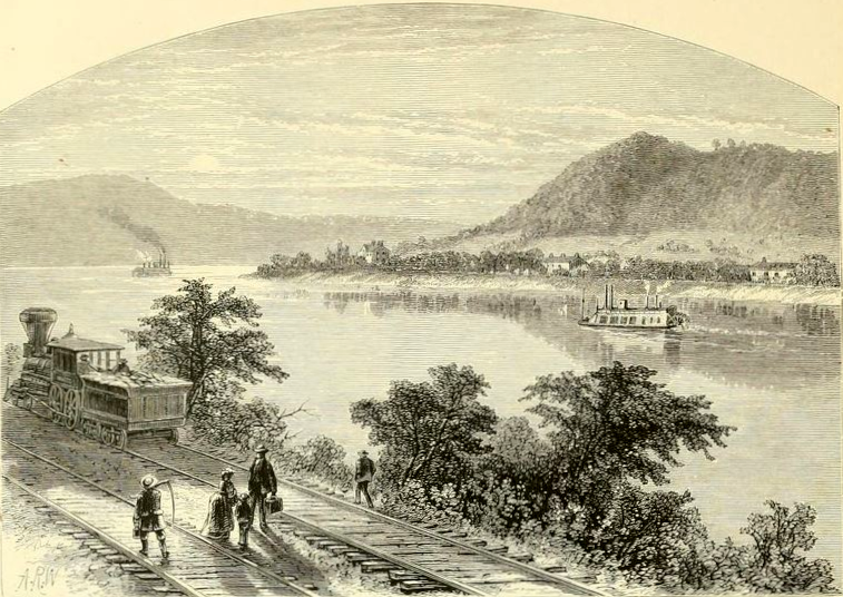
“On one occasion M’Arthur and Davis stopped at the mouth of the Scioto river, where Portsmouth [Ohio] now stands, and went across the bottom to watch a deer-lick, well known, near the foot of the hill…
As a further illustration of a backwoods life, I will here give the reader an account of some deeds of noble daring which occurred in Ohio:
As early as the year 1790 the block-house and stockade above the mouth of the Hockhocking [Hocking] river was a frontier post for the hardy pioneers of the North-western territory. There nature was in her undisturbed livery of dark and thick forests, interspersed with green and flowing prairies. Then the forest had not heard the sound of the woodman’s ax, nor the plow of the husbandman opened the bosom of the earth. Then the beautiful prairies waved their golden bloom to the God of nature; and among the most luxuriant of these were those which lay along the Hockhocking valley, and especially that portion of it on which the town of Lancaster now stands [NOTE: The area described, in Fairfield County, Ohio, which is at the intersection of 3 ecoregions, including the Allegheny Plateau, is almost certainly a reference to the Eastern Corn Belt Plains ecoregion]. This place, for its beauty, its richness of soil, and picturesque scenery, was selected as a location for an Indian [sic] village…
…And on one of those balmy days of Indian summer, took leave of their fellows and moved on through the thick plum [Prunus] and hazel [Corylus] bushes with the noiseless tread of the panther, armed with their unerring and trusty rifles. They continued their march, skirting the prairies, till they reached that most remarkable prominence, now known by the name of Mount Pleasant [Ohio: this location is in the Allegheny Plateau], the western termination of which is a perpendicular cliff of rocks of some hundreds feet high, and whose summit, from a western view, towers to the clouds and overlooks the vast plain below.”
From Autobiography of Rev. James B. Finley by James B. Finley (1854) p. 47
“In the spring of 1796, about the last of April, another company met at Manchester [OH] for the purpose of proceeding to the Scioto Valley and raising a crop of corn, and making other preparations for removing in the fall or winter, and so make a permanent settlement. Some of this company proceeded by land, and others by water. Those who took the land route took their horses well ladened, and those who went by water carried the farming utensils and the necessary breadstuffs. There was no road, not even a path or a way blazed through the deep forest. In all the route there was no inhabitant. All was a perfect and continuous wilderness [from Manchester, OH] to Wheeling, Virginia…
This fall Mr. Zane, by a contract with the Government, marked out a trace, through the wilderness, from Wheeling [WV] to Maysville [KY]. This was done by merely blazing the trees and bushes; and with this guide the traveling commenced.”
From Autobiography of Rev. James B. Finley by James B. Finley (1854) pp. 102-103
“13th [September] This morning being clare we persued our journey at sunrise and after passing a few riffles over which we had to lift the boat we arrived at Marietta [OH], the mouth of the Muskingum river, at 7. O Clock in the evening observed many pigeons passing over us pursuing a south East course.”
From The Journals of Captain Meriwether Lewis and Sargeant John Ordway by Meriwether Lewis (1803)
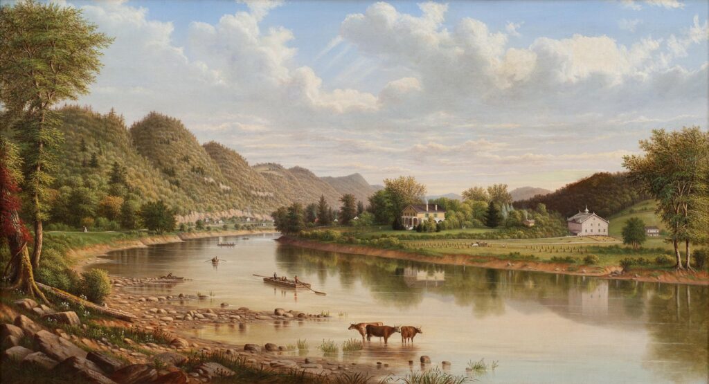
“On that same day we crossed the ridge which takes more particularly the name of Alleghany Ridges. The road we took was extremely rugged, and covered with enormous stones. We attained the summit after two hours painful journey. It is truly astonishing how the vehicles of conveyance pass over so easily, and with so few accidents this multitude of steep hills or ridges, that uninterruptedly follow in succession from Shippensburgh to Pittsburgh, and where the spaces between each are filled up with an infinity of small mountains of a less elevation.
Alleghany Ridge is the most elevated link in Pensylvania; on its summit are two log-houses, very indifferently constructed, about three miles distant from each other, which serve as public houses. These were the only habitations we met with on the road from Bedford; the remaining part of the country is uninhabited. We stopped at the second, kept by one Chatlers, tolerably well supplied with provisions for the country, as they served us up for dinner slices of ham and venison fried on the hearth, with a kind of muffins made of flour, which they baked before the fire upon a little board.
Notwithstanding a very heavy fall of rain, we went to sleep that day at Stanley Town, a small place, which, like all those in that part of Pensylvania, is built upon a hill. It is composed of about fifty houses, the half of which are log-houses; among the rest are a few inns, and two or three shops, supplied from Philadelphia; the distance is about seven miles from Châtier’s; the country that separates them is very fertile, and abounds with trees of the highest elevation; those most prevalent in the woods are the white, red, and black oaks [Quercus alba, Q. rubra, Q. velutina], the beech [Fagus grandifolia], tulip [Liriodendron tulipifera], and magnolia acuminata [cucumber magnolia].
The horse we bought at Shippensburgh, and which we rode alternately, was very much fatigued, in consequence of which we travelled but very little farther than if we had been on foot; in the mean time the American officer, my companion, was in haste to arrive at Pittsburgh, to be present at the fête of the 4th of July in commemoration of the American independence. In order to gain a day, he hired a horse at Stanley Town, with which we crossed Laurel Hill, a distance of four miles. The direction of this ridge is parallel with those we had left behind us; the woods which cover it are more tufted, and the vegetation appears more lively. The name given to this mountain I have no doubt proceeds from the great quantity of calmia latifolia [Kalmia latifolia, mountain laurel], from eight to ten feet high, which grows exclusively in all the vacant places, and that of the rhododendrum maximum [great rhododendron], which enamel the borders of the torrents; for the inhabitants call the rhododendrum laurel as frequently as the calmia latifolia. Some describe the latter shrub by the name of the colico-tree, the leaves of which, they say, are a very subtle poison to sheep, who die almost instantaneously after eating them. At the foot of Laurel Hill begins the valley of Ligonier, in which is situated, about a quarter of a mile from the mountain. West Liberty Town, composed of eighteen or twenty log-houses. The soil of this valley appears extremely fertile. It is very near this place that the French, formerly masters of Canada, built Fort Ligonier, as every part of the United States west of the Alleghany Mountains depended on Canada or Louisiana.”
From Early Western Travels by Francois Andre Michaux (1803) pp. 146-148
“On the 4th of July I left Archibald’s, and posted on toward Greensburgh, which is about eleven miles from it. I had not gone far before I had to cross Chesnut Ridge, a very steep hill, the summit of which, for an extent of two miles, presents nothing but a dry and chalky soil, abounding with oaks [Quercus] and chesnut [Castanea dentata] trees, stunted in their growth: but as I advanced toward Greensburgh the aspect of the country changes, the soil becomes better…
Prior to my arrival at Greensburgh, I had an opportunity of remarking several parts of the woods exclusively composed of white oaks, or quercus alba, the foliage of which being a lightish green, formed a beautiful contrast with other trees of a deeper colour. About a mile from the town, and on the borders of a tremendous cavity I perceived unequivocal signs of a coal mine. I learnt at Greensburgh and Pittsburgh that this substance was so common and so easy to procure, that many of the inhabitants burnt it from economical motives. Not that there is a scarcity of wood, the whole country being covered with it, but labour is very dear; so that there is not a proprietor who would not consent to sell a cord of wood for half the sum that coals would cost, provided a person would go a mile to fell the trees, and take them home.
“What many, perhaps, are ignorant of in Europe is, that they build large vessels on the Ohio, and at the town of Pittsburgh. One of the principal ship yards is upon the Monongahela, about two hundred fathoms beyond the last houses in the town. The timber they make use of is the white oak, or quercus alba; the red oak, or quercus rubra; the black oak, or quercus tinctoria [Quercus velutina]; a kind of nut tree, or juglans minima; the Virginia cherrytree, or cerasus Virginia [Prunus virginiana]; and a kind of pine, which they use for masting, as well as for the sides of the vessels which require a slighter wood. The whole of this timber being near at hand, the expense of building is not so great as in the ports of the Atlantic states.”
From Early Western Travels by Francois Andre Michaux (1803) p. 160
“The sugar-maple [Acer saccharum] is very common in every part of Pennsylvania which the Monongahela and Alleghany water. This tree thrives most in cold, wet, and mountainous countries, and its seed is always more abundant when the winter is most severe. The sugar extracted from it is generally very coarse, and is sold, after having been prepared in loaves of six, eight, and ten pounds each, at the rate of seven-pence per pound. The inhabitants manufacture none but for their own use; the greater part of them drink tea and coffee daily, but they use it just as it has passed the first evaporation, and never take the trouble to refine it, on account of the great waste occasioned by the operation.”
From Early Western Travels by Francois Andre Michaux (1803) p. 163
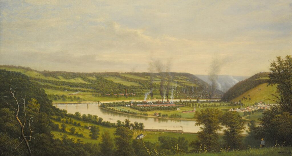
“The Ohio may be, at Pittsburgh, two hundred fathoms broad. The current of this immense and magnificent river inclines at first north west for about twenty miles, then bends gradually west south west…This river runs so extremely serpentine, that in going down it, you appear following a track directly opposite to the one you mean to take. Its breadth varies from two hundred to a thousand fathoms. The islands that are met with in its current are very numerous. We counted upward of fifty in the space of three hundred and eighty miles. Some contain but a few acres, and others more than a thousand in length. Their banks are very low, and must be subject to inundations. These islands are a great impediment to the navigation in the summer. The sands that the river drives up form, at the head of some of them, a number of little shoals Again, it so happens, that in the course of the summer heavy and incessant rains fall in the Alheghany Mountains, which suddenly swell the Ohio: at that time persons may go dovm it with the greatest safety; but such circumstances are not always to be depended on.
The banks of the Ohio are high and solid; its current is free from a thousand obstacles that render the navigation of the Mississippi difficult, and often dangerous, when they have not skilful conductors. On the Ohio persons may travel all night without the smallest danger; instead of which, on the Mississippi prudence requires them to stop every evening, at least from the mouth of the Ohio to Naches, a space of nearly seven hundred and fifty miles.
The rapidity of the Ohio’s current is extreme in spring; at the same time in this season there is no necessity for rowing. The excessive swiftness it would give, by that means, to the boat would be more dangerous than useful, by turning it out of the current, and running it upon some island or other, where it might get entangled among a heap of dead trees that are half under water, and from which it would be very difiicult to extricate them; for which reason they generally go with the current, which is always strong enough to advance with great celerity, and is always more rapid in the middle of the stream…”
From Early Western Travels by Francois Andre Michaux (1803) pp. 164-166
“Within a mile and a half of West Liberty Town [West Virginia] the road passes through a narrow valley about four miles long, the borders of which, elevated in many places from twenty-five to thirty feet, present several beds of coal from five to six feet thick, growing horizontally. This substance is extremely common in all that part of Pennsylvania and Virginia; but as the country is nothing but one continued forest, and its population scarce, these mines are of no account…
The trees that grow in this valley are very close together, and of large diameter, and their species more varied than in any country I had seen before.”
From Early Western Travels by Francois Andre Michaux (1803) p. 171
“On the 18th of July in the morning we purchased a canoe, twenty-four feet long, eighteen inches wide, and about as many in depth. These canoes are always made with a single trunk of a tree; the pine [Pinus] and tulip tree [Liriodendron tulipifera] are preferred for that purpose, the wood being very soft…
Leaving Pittsburgh, the Ohio flows between two ridges, or lofty mountains, nearly of the same height, which we judged to be about two hundred fathoms. Frequently they appeared undulated at their summit, at other times it seemed as though they had been completely level. These hills continue uninterruptedly for the space of a mile or more, then a slight interval is observed, that sometimes affords a passage to the rivers that empty themselves into the Ohio; but most commonly another hill of the same height begins at a very short distance from the place where the preceding one left off. These mountains rise successively for the space of three hundred miles, and from our canoe we were enabled to observe them more distinctly, as they were more or less distant [85] from the borders of the river. Their direction is parallel to the chain of the Alleghanies; and although they are at times from forty to a hundred miles distant from them, and that for an extent of two hundred miles, one cannot help looking upon them as belonging to these mountains. All that part of [West] Virginia situated upon the left bank of the Ohio is excessively mountainous, covered with forests, and almost uninhabited, where I have been told by those who live on the banks of the Ohio, they go every winter to hunt bears.
They give the name of river-bottoms and flat-bottoms to the flat and woody ground between the foot of these mountains and the banks of the river, the space of which is sometimes five or six miles broad. The major part of the rivers which empty themselves into the Ohio have also these river-bottoms, which, as well as those in question, are of an easy culture, but nothing equal to the fertility of the banks of the Ohio. The soil is a true vegetable humus, produced by the thick bed of leaves with which the earth is loaded every year, and which is speedily converted into mould by the humidity that reigns in these forests. But what adds still more to the thickness of these successive beds of vegetable earth are the trunks of enormous trees, thrown down by time, with which the surface of the soil is bestrewed in every part, and which rapidly decays. In more than a thousand leagues of the country, over which I have travelled at different epochs, in North America, I do not remember having seen one to compare with the latter for the vegetative strength of the forests. The best sort of land in Kentucky and Tenessea, situated beyond the mountains of Cumberland, is much the same; but the trees do not grow to such a size as on the borders of the Ohio. Thirty-six miles before our arrival at Marietta we stopped at the hut of one of the inhabitants of the right bank, who shewed us, about fifty yards from his door, a palm-tree, or platanus occidentalis [American sycamore], the trunk of which was swelled to an amazing size; we measured it four feet beyond the surface of the soil, and found it forty-seven feet in circumference [~7.5′ diameter]. It appeared to keep the same dimensions for the height of fifteen or twenty feet, it then divided into several branches of a proportionate size. By its external appearance no one could tell that the tree was hollow; however I assured myself it was by striking it in several places with a billet. Our host told us that if we would spend the day with him he would shew us others as large, in several parts of the wood, within two or three miles of the river. This circumstance supports the observations which my father made, when travelling in that part of the country, that the [tulip] poplar [Liriodendron tulipifera] and palm [Platanus occidentalis, American sycamore] are, of all the trees in North America, those that attain the greatest diameter.
‘About fifteen miles,’ said he, ‘up the river Muskingum, in a small island of the Ohio, we found a palmtree, or platanus occidentalis, the circumference of which, five feet from the surface of the earth, where the trunk was most uniform, was forty feet four inches, which makes about thirteen feet in diameter. Twenty years prior to my travels, General Washington had measured this same tree, and had found it nearly of the same dimensions. I have also measured palms in Kentucky, but I never met with any above fifteen or sixteen feet in circumference. These trees generally grow in marshy places.
The largest tree in North America, after the palm [American sycamore, Platanus occidentalis], is the [tulip] poplar, or liriodendron tulipifera. Its circumference is sometimes fifteen, sixteen, and even eighteen feet: Kentucky is their native country; between Beard Town and Louisville we saw several parts of the wood which were exclusively composed of them. The soil is clayey, cold and marshy; but never inundated.
The trees that are usually found in the forests that border the Ohio are the palm, or platanus occidentalis -, the poplar, the beach-tree [Fagus grandifolia], the magnolia acuminata [cucumber magnolia], the celtis occidentalis [common hackberry], the acacia, the sugar-maple [Acer saccharum], the red maple [Acer rubrum], the populus nigra [Populus deltoides], and several species of nut-trees; the most common shrubs are, the annona triloba [pawpaw], the euonimus latifolius [Euonymus americanus, hearts-a-bustin], and the laurus bensoin [Lindera benzoin, spicebush].”
From Early Western Travels by Francois Andre Michaux (1803) pp. 172, 174
“On the 23d of July, about ten in the morning, we discovered Point Pleasant, situated a little above the mouth of the Great Kenhaway, at the extremity of a point formed by the right bank of this river, which runs nearly in a direct line as far as the middle of the Ohio. What makes the situation more beautiful is, that for four or five miles on this side the Point, the Ohio, four hundred fathoms broad, continues the same breadth the whole of that extent, and presents on every side the most perfect line. Its borders, sloping, and elevated from twenty-five to forty feet, are, as in the whole of its windings, planted, at their base, with willows [Salix] from fifteen to eighteen feet in height, the drooping branches and foliage of which form a pleasing contrast to the sugar maples [Acer saccharum], red maples [Acer rubrum], and ash [Fraxinus] trees, situated immediately [96] above. The latter, in return, are overlooked by palms [Platanus occidentalis, sycamore], [tulip] poplars [Liriodendron tulipifera], beeches [Fagus grandifolia], magnolias of the highest elevation, the enormous branches of which, attracted by a more splendid light and easier expansion, extend toward the borders, overshadowing the river, at the same time completely covering the trees situated under them. This natural display, which reigns upon the two banks, affords on each side a regular arch, the shadow of which, reflected by the crystal stream, embellishes, in an extraordinary degree, this magnificent coup d^œil.
…The Great Kenhaway, more known in the country under that denomination than by that of the New River, which it bears in some charts, takes its source at the foot of the Yellow Mountain in Tennessea, but the mass of its waters proceed from one part of the Alleghany Mountains. The falls and currents that are so frequently met with in this river, for upward of four hundred miles, will always be an obstacle to the exportation, by the Ohio and the Mississippi, of provisions from the part of Virginia which it waters. Its banks are inhabited, but less than those of the Ohio.”
From Early Western Travels by Francois Andre Michaux (1803) pp. 181-
“William Craig was the first man who drove a wagon and team to Chilicothe [Ohio], over Zane’s trace. It was a most tedious and difficult undertaking; for he had to cut his way through for a distance of seventy miles. Patience and perseverance, however, had its reward, and he with his family finally succeeded in reaching the encampment.
It would be impossible for me to describe the beauty of these rich bottoms. The soil itself for richness was not exceeded by any in the world. The lofty sugar-tree [Acer saccharum], spreading its beautiful branches; the graceful elm [Ulmus americana], waving its tall head, the monarch of the forest; the black and white walnut [Juglans nigra and Juglans cinerea]; the giant oak [Quercus], the tall hickory [Carya]; the cherry [Prunus serotina] and hackberry [Celtis]; the spicewood [Lindera benzoin], with its fragrance; the papaw [Asimina triloba], with its luscious fruit; the wild plum [Prunus]; the rich clusters of grapes, which, hanging from the massy vines, festooned the forest; and, beneath all, the wild rye [Elymus canadensis], green as a wheat-field, mixed with the prairie [Dalea] and buffalo clover [Trifolium stoloniferum] — all formed a garden of nature most enchanting to behold. The clear and beautiful rivulet creeping through the grass, and softly rippling over pebbly bottoms, the gentle zephyrs freighted with nature’s incense, pure and sweet, regaled our senses, and filled us with delight. All nature had a voice which spoke most impressively to the soul; and while all the senses were pervaded with an unutterable delight, the solemn stillness seemed to say, God reigns here. The song of the lark and nightingale, the melancholy wail of the dove or whistle of the whippowil, the low hum of the bee, the chirping of the grasshopper, the bark of the squirrel, the drumming of the pheasant, the bleat of the fawn, the growl of the bear, the hoot of the owl, the howl of the wolf, the scream of the panther, and the yell of the Indian [sic], were all that broke the silence in this deep and beautiful forest.”
From Autobiography of Rev. James B. Finley by James B. Finley (1854) pp. 105-106
“6 mo. 3. — Tlie country continued open a few miles below White’s, where it rose into hills of considerable magnitude; but I could not perceive that they extended in any regular direction. After climbing and winding among them for two or three miles, we came to the Conequenessing, a fine creek which flows westward. Here we saw a coal mine. On examination, we found the incumbent strata to be shale, or clay slate, very similar to what we had seen on the shore of lake Erie. We observed both yesterday and to day, that slaty Stones appeared in many places where the road was dug, and, doubtless, coal would soon be discovered by exploring. It is sold at the pit’s mouth for sixpence a bushel, and is preferred by the inhabitants to wood for fuel, — the blaze being so brilliant as to supersede the use of candles, even for sewing,
We breakfasted late, near Breakneck Creak, which flows westward. Here limestone is found in a quarry…
At Breakneck, our attention was arrested by a most singular phenomenon in the progress of vegetation. The hills, which are several hundred feet high, exhibit three well marked gradatioris. The oak trees, for almost half way up, have not yet opened the buds, and appear as naked as in winter. Such as are higher up, and reaching towards the top are opened in the down, of a whitish grey colour; while those on the summit are completely expanded in the full green of summer. We have not observed any difference of soil, sufficient to account for this extraordinary appearance..
…The country for twenty miles back is of the most uneven kind. in all that distance, if we except some small flats on the creeks, we believe that not one acre of level land can be found. Nor could I perceive that the hills had any regular course. Its configuration greatly resembles that part ot Chester county, in this state, which includes Pikeland and Vincent..
Near the summit of every hill, we observed an ochreous earth, reddish, and greasy to the touch. Coal, limestone, iron ore and sandstone are still discovered along this road; but the last is found but in few places, suitable for building. Strata of this stone, which break up small on removal from the quarry, are very abundant, and contain mica. The particles of this substance are thin, and in perpendicular fractures scarcely perceptible.
…6 mo. 4. — The same singular appearance, respecting the greenness of the trees on the summits of the hills, contmues. It is so very distinctly marked in its height, that the lower buds of the same tree have not expanded, while the upper branches are perfectly green..
…Four miles from Pittsburgh, I noticed upland hickory [Carya] on the hills. Black walnut [Juglans nigra], which we have rarely seen since we left Erie, appears in considerable quantities; and here we passed the northern boundary of that land where the locust [presumably, based on later context, Gleditsia triacanthos, honey locust] and persimmon [Diospyros virginiana] are indigenous.
Pittsburgh was hidden from our view, until we descended through the hills within half a mile of the Alleghany river. Dark dense smoke was rising from many parts, and a hovering cloud of this vapour, obscuring the prospect, rendered it singularly gloomy. Indeed, it reminded me of the smoking logs of a new field.
…The shafts of these mines extend far into the hills. The pick-ax, and the shovel, are the instruments used; and on wheel-barrows, the coal is removed to the entrance, where it is placed on scaffolding, from which waggons are conveniently loaded. The citizens are supplied in their yards for 7 or 8 cents a bushel.
…The bark of the trees literally “gather blackness;” and a large honey locust (Gleditsia triacanthos) growing near one of the founderies, could receive no darker coat from the painter’s brush. Contrasted with the green leaves, the aspect is strikingly singular.
A species of Chrysosplenium? [Chyrsosplenium americanum, golden-saxifrage] with ternate leaves, abounds in moist places round this city [Pittsburgh].
…On the south-east brow of this hill [overlooking the Monongahela, I observed the following plants. To the intelligent agriculturist, they will form the best comment on what I have said of its fertility.
Juglans nigra (black walnut), Juglans cinerea (butternut), Juglans squamosa (shell-bark) [Carya laciniosa, shellbark hickory or Carya ovata, shagbark hickory], Juglans amara (white or bitter nut) [Carya cordiformis, bitternut hickory], Juglans glabra (upland hickory) [Carya glabra or tomentosa, pignut or mockernut hickory], Laurus benzoin (spice-wood) [Lindera benzoin], Laurus sassafras (sassafras) [Sassafras albidum], Quercus alba (white oak), Quercus prinos v. palustris (swamp chestnut oak) [Q. michauxii], Quercus rubra (red oak), Quercus tinctoria [Q. velutina] (black oak), pin? oak [or] black-jack [oak] [probably Q. marilandica] (*Leaves long and smooth with neither serratures nor indentures; *to the westward this is known as black-jack. It is, however, a different species from the true black-jack, which is, or ought to be, Quercus triloba), Robinia pseud-acacia (black locust), Gleditsia triacanthos (honey locust), Cercis canadensis (fish blossom) [eastern redbud], Vitis vinifera/labrusca (grape vine) [V. labrusca, fox grape], Sanguinaria canadensis (red root) [bloodroot], Actea racemosa (black snakeroot) [Actaea racemosa, black cohosh], Arum triphyllum [Arisaema triphyllum, common jack-in-the-pulpit], Pyrus coronaria (crab apple) [Malus coronaria, sweet crabapple], Podophyllum peltatum (mandrake or May-apple), Platanus occidentalis (buttonwood or sycamore), Rubus villosus (black berry), Rhus typhinus (stag’s horn sumach) [R. typhina], Morus rubra (common mulberry) [red mulberry], Acer saccharinum (sugar maple) [A. saccharum]; and doubtless there are many not noticed. “
From Travels through the Western Country in the Summer of 1816 (1819) by David Thomas pp. 45-67
“Towards Canonsburg [PA] the country becomes less hilly…White oak [Quercus alba], neither large nor lofty, is the principal timber of the country, though hickory [Carya], pin oak [Quercus palustris], black oak [Quercus velutina], black walnut [Juglans nigra], &c. form a part.”
From Travels through the Western Country in the Summer of 1816 (1819) by David Thomas p. 73
“The features of this country [on the road to Middletown, WV, from Cannonsburg, PA] are singularly interesting. For mile after mile, we saw strata of earth and of stone, in both sides of these rounded hills, at equal heights; we saw the same on the sides of the next hill, if equally elevated; but sometimes we passed a considerable distance over those which did not rise up to that level; and on ascending some which are higher, again the same strata appeared. Never have I seen a land whose internal structure is so easily ascertained; and the idea is clearly presented that the vallies were cleared out after the strata had been formed by depositions.
A stratum of limestone, near the summits of the higher hills, particularly engaged our attention. It rests on one of a dark slaty earth, which is doubtless a residuum of coal…
..During the preparations for our breakfast [in Middletown, WV], my attention was excited by a red-bird, (Merula marilandica?) confined in a cage. No prisoner was ever less reconciled to his cell; and time, that eases the burden of life by adjusting it, seemed to have treated the poor fellow with neglect. He had never learned to articulate, “I can’t get out!” but wearied with jumping down, and then up, he broke forth at last in his own language with notes expressive of grief and anger.
Our landlord said that he had procured a companion for him, of his own species, which he received with the utmost animosity; and in a few minutes, after its introduction, he found it dead in the cage.
These birds are of a beautiful red colour, with a dark crest. As they are natives of this quarter, and also of Cayuga, it is probable that they inhabit all the intermediate country. They are not partial to the haunts of man, and I suspect are incapable of domestication. — There is a singular wildness in their notes.
“We have never seen better sandstone than this region furnishes…”
From Travels through the Western Country in the Summer of 1816 (1819) by David Thomas p. 76
“This part ot Virginia, is a strip, here seven miles wide, but becoming narrower to the north, and terminating about thirty miles above Charleston [WV]. After a long descent between the hills, we reached that town; and here we had the first fair view of the Ohio.
This river is not strikingly beautiful, though it is a fine flowing stream; and at this place more than 600 yards wide. The singular luxuriance of vegetation that decorates its hills, whether precipitous or sloping, constitutes its principal beauty, and in this respect it is probably unrivaled.* We refer the cause of this to the admixture of earths from the different strata, and which produces a soil perpetually fertile.
Agreeably to what I have remarked, it has formed, for ifself, a valley 500 or 600 feet deep. The flats appear to possess an equal width with the channel; and though fertile, are scarcely first-rate, as sand forms too large a proportion of the soil…
…Soon after landing in the state of Ohio [near Warrenton], I first observed, in its native soil, the [yellow] buck-eye (Aesculus flava) which grows abundantly on these banks. Sometimes it attains a diameter of more than two feet. Its foliage is beautiful; but the wood is soft, and of little value…
..On the flats, near this [Long] Run [near Short Creek, OH], the Jeffersonia diphylla [twinleaf] grows in abundance. I have never seen it in any other place, excepting the western parts of Scipio.”
From Travels through the Western Country in the Summer of 1816 (1819) by David Thomas pp. 79-80
“In this district, the brown rabbit, the raccoon (ursus lator) and the woodchuck, or ground hog (Arctomys monax) are numerous. The hare of the lake country is unknown…
…Up hill and down hill constitutes more of the roads throughout this country than of any others that we have ever travelled. The fatigue, which is induced by calling into action only one set of muscles, is here unknown. Endeavours have been made, however, to lead the roads round the winding summits of the hills, but this adds greatly to the distances between places.
In this district, the bottoms, or flats, even on small creeks, though clayey, have become quite extensive; and the hills commonly have less relative elevation than those of Short creek, though we have crossed some which commanded distant prospects. We first noticed this change six or eight miles west of Mount Pleasant; but perceive no other material difference in the formation of the country. Perhaps coal is less plenty, though some is still found.
The principal timber on the hills is white oak [Quercus alba]; along the streams, sugar maple [Acer saccharum]. In some places, black oak [Quercus velutina] and black walnut [Juglans nigra] are interspersed with hickorv [Carya], but chestnut [Castanea dentata] and locust are rare. The wild plumb tree [Prunus americana?] alone retains its fruit.
From Travels through the Western Country in the Summer of 1816 (1819) by David Thomas pp. 84-87
“April 25th, 1821
…I presume your curiosity has, in a considerable degree, been excited by the great number of scribblers and land speculators, who are swarming our Eastern States, and, in very high and eloquent strains, for lucre’s sake, representing it as a land flowing with milk and honey. However this may be with you, one fact, I think, will be taken for granted, that the Western country [Kentucky and Ohio] does possess advantages and disadvantages, over every other portion of the globe, as you will find satisfactorily exhibited in the sequel of the subsequent pages.
…I have now arrived at Pittsburgh, a pleasant and flourishing town, where the Alleghany from the north and the Monongahela from the east, unite and form the beautiful river Ohio, one of the handsomest streams of water in the known world, as allowed by all travellers, both European and American.”
From Letters from the West by George W. Ogden (1823) p. 25
“This river [the Ohio at Pittsburgh] is, generally speaking, very deep, sufficiently so for the navigation of large vessels. Its aspect is placid and clear; and when the waters are high, they are expansive and beautiful. It contains a great many Islands, and is stored with fish and fowl of almost every kind. — This river sometimes rises to an enormous height, and greatly endangers the settlements upon its banks. Sometimes too, the river is low and appears inconsiderable. — Its meanderings are numerous, and in the spring of the year, the abrasive effect of the floating ice and trees upon its banks is very great.
In descending this river, the traveller is struck with surprise at the beauty of the country…The luxuriant growth which covers its banks; the ease and opulence of its inhabitants; its beautiful windings; its rich meadows, and numerous flocks and herds, added to its romantic prospect and variegated scenery; presents a grandeur both pleasing and sublime.
That part of Virginia which lies on the Ohio, extends from about forty miles below Pittsburgh to the Great Sandy River, the line dividing this state from Kentucky…West of the Blue Ridge till you reach the river the land is mountainous and uneven, but it is, nevertheless, very productive..and an excellent grazing country.
..I had often heard a degraded character of the settlers of the western part of Virginia, and I had now opportunity of seeing it verified. The great abundance of wild game allures them to the forest; and from it they obtain the greater part of their miserable subsistence”
From Letters from the West by George W. Ogden (1823) pp. 30-31
“Ebensburg, the capital of Cambria County [in the Central Appalachians], is an inconsiderable place, consisting of wooden buildings, forming not much more than one broad, unpaved street… The surrounding country is very mountainous and woody, and is said to abound in all sorts of game, as indeed the many skins of lynxes, racoons, martens, and minks, fastened against the houses, prove; bears, stags, and wolves, are said not to be uncommon, as lofty and dark forests surround the town within a couple of hundred paces. Ebensburg derives some profit from the numerous wagons, drawn by two, four, or six strong horses, that pass through it on the high road to Pittsburg.
Our hunting excursions in this rude country were very interesting. We proceeded first in a northern direction into the forest, which we found to be quite a primeval wilderness. The mountains rise peak above peak, with deep ravines, where pines, beeches, chestnuts, birches, maples, and walnut trees of various kinds, form a gloomy forest, and fallen and decayed trunks check your advance at every step; cool, sylvan brooks rushed foaming through all the defiles, and we had continually to cross them on natural bridges, formed by the fallen trunks of trees. Such old trunks are covered with a whole world of mosses, lichens, fungiwood, sorrel, ferns, &c.; nay, even young shoots of maple, beeches, and tulip trees, had taken root on them. We clambered over the trunks, went round the fallen giants of the forest, and found everywhere, on the ground, traces of the numerous squirrels (Sciurus cinereus), in the remains of fruit and shells, especially, of the chestnut.
But there was also an interesting wilderness in the opposite direction. Here a very extensive fall of timber had been commenced —a gigantic labour, as in Brazil, where the wood is burnt afterwards, as soon as it is sufficiently dry. The sturdy woodcutters were of German extraction, and spoke German. From this place a dark narrow path led through an old pine forest, where the little creeping Michella repens [partridge berry], here called ground berry, with its beautiful red berries, grew among the moss, and often covered the ground. Several small runs and muddy ditches crossed the forest, over which I walked or rode on trunks of trees that served as bridges; in doing which my clothes suffered not a little. Woodpeckers abounded here, especially the great black woodpecker (P. pileatus), which we had not seen before. It is nearly as large as a crow, and its splendid bright red tuft is conspicuous at a great distance. They were very shy; knocked and hammered on the dead pine trees, which stood like the ruins of a colonnade, and were pierced and bored by their strong bills. This fine large bird is called here, and in general, woodcock. A young man who lived in the forest, some miles off, told me that bears, stags, and other wild animals, were very numerous, particularly the pheasant, or cock of the wood [Ruffed grouse] (Tetrao umbellus), one of which we shot. There is a saw-mill here, among the lofty pines, on an arm of Conomaugh Creek, in a wild, lonely spot. The owner was not a little astonished at my double-barrelled percussion gun. After we had spent two days here in exploring the woods, our travelling companions, Dr. Saynisch and Mr. Bodmer, at length joined us, on the 26th, but as the latter still had need of rest, on account of his wound, we took their places, and set out immediately for Pittsburg.
[The next section is focused on the Central Appalachians]
Seven miles from Ebensburg is the place which is looked upon as the boundary of the Alleghanys, properly so called; here begins the ridge called the Laurel Hills, for these mountains consist of several parallel chains, many of which have distinct names. The forest now assumes a different character. Oaks of various species succeed the pines and beeches; the forest is not so high, rude, and thick, and from an elevated spot on the road there is a fine view as you look back on the long wooded chain of the Alleghanys.
The traveller soon sees before him a deep and wide valley in which the Conomaugh River flows, and beyond it a long ridge, covered with verdant woods, called the Chestnut Ridge, in which there is a gap, through which both the river and the canal pass. The eminences are uniformly wooded, and the chestnut and chestnut oak appear to predominate. We changed horses at Further Laurel Hill, and at Amagh, and then passed the gap. In the meadows and fields, the stumps of the trees that had been cut down were still standing, for the whole country was formerly one unbroken forest.
In the woods of this district, we everywhere remarked that the tops of the branches, for about a foot or a foot and a half, were hanging down and withered, which is caused by a kind of cricket (locust, Cicada septem decem, Linn.). This insect, which, as is well known, appears only once in seventeen years, but then, like the cockchafer with us, in prodigious numbers, had abounded in Pennsylvania in 1832, and in many places was a real scourge; it does not, however, appear everywhere at the same time. But a few weeks before, they were so numerous in these forests, that the noise they made almost overpowered the human voice. On examining the withered twigs, we found the bark, as it were, ripped open in many places, the wood quite dry, and in the sap, a whitish substance, which consists of the eggs of the insect.
As we drove rapidly down the hills, we saw before us the extensive valley of the Conomaugh, for the most part covered with woods, and gently rising on all sides, in which, a little higher up, the small town of Indiana [PA] is situated. We stopped at a lonely inn by the road-side, watered our horses, and hastened forwards. On every side we saw extensive forests, and from the next eminence looked down into another valley, in which the Conomaugh runs by the town of Blairsville, a pretty little place, with many respectable houses, and a very good inn, in a broad main street, which runs directly across the valley. The country is hilly, or mountainous, well cultivated, and with neat farm-houses scattered around. From this place, it is ten miles to New Alexandria, a village with tolerably good wooden houses, many of which are painted. Beyond it runs the Loyalhanna, a small stream, which was at this time very shallow, with a covered bridge over it. At nightfall we reached New Salem, then Millersburg, and about midnight, Pittsburg.
Pittsburg is an old, large, but by no means handsome town… Coal mines in the immediate neighbourhood (a part of which is now on fire), afford an ample supply of fuel for the numerous steamengines, stoves, &c…
This town lies on the tongue of land between the rivers Monongahela and Alleghany, which, by their union, form the Ohio; this river is not very considerable here; yet, at certain seasons, when the water is high, it is navigable by steam-boats, of which I counted sixteen on the banks of the Monongahela. Over the Alleghany there is a covered bridge, 500 paces in length, which has, on each side, an additional covered footpath; and a covered aqueduct, of the same length, is likewise carried across the river. A similar long and colossal bridge is built over the Monongahela.
…The rapidity with which these settlements (Old Harmony, New Harmony and Economy) sprung up, amidst thick forests, proves the judgment and prudence of their founder…
…The country about Pittsburg has some zoological rarities, specimens of which my travelling companions had collected during my absence. Among them are, in particular, many interesting fresh water shells of the Ohio. Several American naturalists have written on these Bivalve testacea; and there is, probably, no other country so rich in beautiful and manifold productions of this kind. On their excursions in the neighbouring islands in the Ohio, they met with trees of colossal size, and especially a maple, that measured twenty French feet in circumference at the height of twelve feet from the ground, where it divided into four thick parallel stems, from which [63] the branches issued. Among the remarkable and interesting natural productions of these rivers, we must mention the soft shell turtles of the Americans (Trionyx, Aspidonectes, Wagl.), of which there are two or three species. They grow to a great size, and are often seen in the markets. Another very remarkable animal, which is very numerous here, is the great Alleghany salamander [Hellbender] (Menopoma, Harlan), which is here called alligator, – and of which I obtained many specimens alive, so that Mr. Bodmer was able to make an accurate drawing from the life. Then there is the Triton lateralis, Say., or Menobranchus lateralis, Harlan, which differs from the preceding by the tufts at the gills, which remain even in old age. America is well known to abound in these singular enigmatical animal forms, which are nearly akin to the European Proteus, or Hypochthon.”
From Travels in the Interior of North America by Maximilian, Prince of Wied (1843) pp. 135-143
“THE Ohio, called by the French La Belle Riviere, was at this time too shallow at Pittsburg to be navigated by steamboats, and we were therefore obliged to go by land to Wheeling [WV], a distance of fifty-seven miles; by the river, it is ninety-five miles. After taking leave of Dr. Saynisch, who returned to Bethlehem, we crossed the Ohio, near the town, in a well contrived ferry, the wheels of which were moved by four horses. Our stage was drawn rapidly, by four good horses, along the path of the mountains, where the road passed through lofty forests, great part of which was, however, ruined and cleared. The foliage was adorned with the most beautiful varied tints of autumn, a circumstance which distinguishes North America, at this season, from all other countries. In the Brazils, it is the spring, or the transition from the rainy to the dry season, that adorns the forest with the most beautiful diversity of tints, which, however, are chiefly produced by the flowers, which frequently appear before the leaves. North America, on the other hand, has but few such flowering trees; most of them have catkins (amenta), and it is the foliage, which assumes in the autumn so great a variety of colours.
On the next eminence, the road leaves the river, and turns to the south-west. Strata of coal appear in some places, and workmen were busy in removing the earth above them. We frequently met with European emigrants, most of them in their peasant’s dress, with faces burnt by the sun, and carrying their children. The country consists of high hills and forests, and we frequently saw the robinia pseud-acacia [black locust], which is partly planted for the sake of its timber..As the sun shone with intense heat, the birds were all life, twittering on the high trees, where the loquacious blackbirds flew about in companies. The woods, presenting a beautiful mixture of yellow, vermilion, purple and green, gave us much pleasure, and we reached Chattier or Shirtee Creek, which, after numerous windings, falls into the Ohio, near Wheeling. We proceeded along its valley, where colossal planes [Platanus occidentalis] and elms [Ulmus], as well as robinia [black locust] and willows [Salix], afforded a welcome shade. We had passed several covered bridges before we reached Cannonsburg, eighteen miles from Pittsburg,..We now traversed the valley of the Chattier Creek, where the plane trees were very lofty and spreading. They were covered with their round fruit, from which the Americans have given the tree the name of button-wood.
At noon we reached Washington, a village, beyond which the country presented an alternation of forests and fields, where stumps of trees showed that the whole country east of the Mississippi was a primeval forest. We found an ample variety in the splendid woods, where the lime (Tilia grandifolia) [Tilia americana, northern basswood], with its colossal leaves, was not uncommon, and the willow-leaved oak (Quercus phellos), was likewise in great abundance, the foliage of which resembles our white willow, but the bark and fruit are exactly like those of the oak. After passing a village called Alexandria, or more properly Alexander we reached the boundary of the’state of Pennsylvania, and entered Virginia, which last state has a narrow strip of land on the eastern bank of the Ohio. The land here is said to be fruitful, and very well cultivated, though we did not immediately perceive this in the narrow valley of the Wheeling Creek, through which we drove… It was a beautiful moonlight evening when we passed the Mean Creek, which joins that above-mentioned, and both together forming Wheeling Creek…From an eminence we saw before us numerous lamps in Wheeling, and the Ohio sparkling in the light of the moon, and then took up our quarters at an inn at that place. Wheeling is a rapidly improving town, containing 5,200 inhabitants, where at this time they were building whole streets, and is situated on a ledge of the mountain, on the bank of the Ohio…The Ohio at this place is about as broad as the Moselle near its mouth. The banks are moderately high wooded mountains, the uncultivated places in which are often overgrown with Datura [jemsonweed]…The river was, at this time, very low, and its banks, from forty to fifty feet high, consisted of yellowish red clay and strata of sand.
..On the banks of the river lay pirogues, composed of the trunk of a tree hollowed out, like those in Brazil, and small habitations were scattered in the lofty and picturesque forests…The eminences on the banks of the Ohio are, in general, rounded, steep, wooded hills, separated by valleys or ravines. In many places stacks of wood were piled up for the steam-boats, and some was already in boats…Near Fishing Creek, which falls into the Ohio, we saw the white-headed eagle soaring in the air, while the kingfishers flew about the banks, and the note of the black crow sounded in the tall forests. Near the village of Sistersville, on the right bank, in the state of Ohio, the sand-banks in the river were covered with the yellow blossoms of some plant, which, however, I was not able clearly to distinguish; but it was an autumnal flower, and the wind reminded us of the approach of the cold season, blowing quantities of leaves from the forest, in some places entirely covering the surface of the water with them. Towards noon, the sun shone bright, and the gay tints of the forest appeared more lovely than ever; colossal planes [Platanus occidentalis], maples [Acer], tulip trees [Liriodendron tulipifera], beeches [Fagus grandifolia], elms [Ulmus], ashes [Fraxinus], limes [Tilia americana], walnuts [Juglans], and other trees, grow to a great height, and beneath their shade we saw many rustic bridges, or planks, thrown picturesquely across the little brooks. The trunks of the trees, covered with the Hedera quinquefolia [Parthenocissus quinquifolia, Virginia creeper], which made them look like scarlet columns, and the varied tints of the foliage, charm the beholder. All along the Ohio, Mississippi, and Lower Missouri, the papaw tree (Asimina triloba Dunal) grows as underwood. Its fruit, resembling a small cucumber, was now ripe, and great quantities were brought on board our steamer. This tree has a beautiful light green, large, smooth leaf, and violet brown flower, which grows isolated, but it does not attain a greater height than between twenty and thirty feet. The fruit has a pleasant taste, but. the/smell is disagreeable. It contains a whitish, juicy pulp, and twelve thick black kernels.
A heavy fall of rain was very welcome to us, the water in the river being so low that our boat frequently grounded. At a narrow part of the river we came to the village of Newark, and then to the mouth of the Muskingum River, at the town of Marietta, which was founded in 1788…We have read much about the ancient Indian [sic] remains and ramparts, between the Ohio and the Muskingum. Smith Barton, Attwater, Schultz, and especially Warden, have written on this highly interesting subject, and given ground plans of the Indian ramparts, which are met with at many places in the state of Ohio, at Cincinnati, Wheeling, Chillicothe, as well as in all the States west of the Alleghanys, and respecting which Warden has collected everything that is known; but most of these interesting remains have been entirely annihilated by the love of devastation, or the negligence of the new settlers. Thus Marietta is built just on the fore part of the Indian works, and many of them are no longer to be seen. It is much to be lamented that the government of the United States suffers all this to be done without any attempt to prevent it. It looks on unmoved, while the plough continues from year to year the destruction of these remains of ages long since past, the only historical monuments of this country. Schultz gave, in 1820, a ground plan of the ramparts near Marietta, as Smith Barton and Warden did more recently; and Mr. Thomas Say made a sketch of them in 1815, which he communicated to me. A great part of them has been since ploughed over.
From Marietta we came to the Island of Muskingum, and then to Vienna Island; opposite to which, on the left bank, lies the village of Vienna. Swallows, which had long since left Pennsylvania, were still flying about here. We everywhere heard accounts of the great flood in the Ohio, when the steam-boats were on a level with the second story of the houses in Marietta.
We saw tall forest trees, among the thick branches of which the river had deposited beams and other pieces of wood. Below Parkersburg, a village on the southern side, the little Kenhava River issues from the high bank opposite Belpie, a settlement of a few houses. A steam-boat, which had been entirely crushed by the ice, proved how violent the effects of the breaking up of the ice in the Ohio sometimes are. Our captain lay to for the night, on the right bank, which was necessary, on account of the unfavourable weather; the rain being so heavy, that it drenched the upper row of beds in the large cabin.
On the 11th October the weather was fairer, but very cool. The appearance of the bank was the same as before — an unbroken, thick forest, with here and there some little settlements. We reached, at an early hour, the Little Hocking River, which comes from the state of Ohio. Ducks, particularly teal, flew past us, and we observed, also, many other birds of passage on their flight. Near Shade Creek, the banks of the river consisted of stratified, rocky walls, which appeared to be Grauwacke slate; we observed, in the forest, trees of remarkable forms and colours; the trunks, covered with the scarlet foliage of the five-leaved ivy, were particularly beautiful. We frequently met, in the river, with flat boats, which are built all along the banks of the Ohio, from Pittsburg, and are sent with the produce of the country to New Orleans. These boats are large four-cornered chests, composed of beams and planks, are often heavily laden, draw much water, and, having neither masts nor sails, proceed very slowly. They are propelled with large oars, and can only go down the river; they are many months on the voyage to New Orleans, and the rowers are commonly new European emigrants, hired for low wages, and often merely for a free passage. Many of these boats are wrecked, and they are, therefore, frequently insured; at New Orleans they are sold for lumber.
The woods in the valley of the Ohio are more lofty and luxuriant than on the other side of the Alleghany Mountains; vines twine round the trees, and present a faint image of the woods of warmer countries. The kingfisher was common; the swallows had not yet taken their flight, and in some places the sandpiper was seen upon the bank…here, too, the papaw tree was sometimes planted in rows. The river increased in breadth, but not in depth, of which we had the proof before us, for a flat boat had run aground, and the people stood in the water, trying to get it afloat…The soil is extremely fruitful, and needs no manure. The dwellings of these people are small log-houses, exactly like the huts in Switzerland. Towards noon, before we reached Point Pleasant, we saw, in many places on the Ohio, considerable coal-pits, the sulphureous smell of which was perceptible in the steamer.. After we had passed Point Pleasant, a village on the left bank, where fine forests cover the low bank of the great Kenhava River, which here falls into the Ohio, we reached, in about twenty minutes, Gallipolis, on the right bank, an old French colony, the inhabitants of which still speak the French language. Immediately below that town, there is a fine forest of beech trees [Fagus grandifolia]; on the water-side, thickets of plane [Platanus occidentalis], and between them the papaw tree [Asimina triloba] took the place which, in Pennsylvania, is occupied by the Rhododendron maximum [great rhododendron]; willows [Salix] grew in front of the planes [Platanus, scyamore].
The sun disappeared behind the hills on the bank; the evening sky was clear and serene, and the bright mirror of the Ohio extended unruffled near Racoon Creek, where we saw large flocks of ducks. We intended to continue our voyage during the night; but, about nine o’clock, we struck violently on a sand-bank, near the Indian Guyandot River, where there is a small village of the same name, and, as a thick fog arose, we lay to, six miles below Guyandot.
On the 12th of October, in the morning, a dense fog covered the river, and the thermometer was, at half-past six o’clock, at 10° Reaumur, above zero. We passed the mouth of Symes Creek, and then Burlington, a small scattered village in Lawrence County, where our boat struck upon some stones, and was thrown a little on one side. On the left bank was Cadetsburg, with Big Sandy Creek, then Hanging Rock, a small village, where most of the iron utensils for the whole of Ohio are shipped. The situation of the place is picturesque, surrounded with forests and rocks… The beech woods on this part of the river were remarkably fine, their foliage green and yellow. On our right hand was the little Scioto River; we then came to the village of Portsmouth, at the mouth of the Scioto River, on the Ohio bank, where the celebrated Ohio Canal begins, which connects that river with lake Erie…From this place, fine forests covered the bank, in which were tall poplars (Populus Angulata, or Canadensis), which I had not before observed. Here, too, I noticed some interesting forms of mountains, which in general are very rare in this country. Most of the summits are round, some broad, but very few pointed. Towards evening we came to the village of Rockville, on the right bank, which was not marked on our map, and lay to, at nightfall, when we learned that our vessel had caught fire, but happily it was already extinguished…”
From Travels in the Interior of North America by Maximilian, Prince of Wied (1843) pp. 144-154
“Afterwards I undertook to cross the Alleghany mts. for the 3d time, as a pedestrian botanist. From Frederic I went to the Cotocton mts. forming the fluvial gap of the Potowmak R. From Harper’s ferry I nearly followed that river to Cumberland, over many hills and mts. where I met many fine plants.. Ailer visiting the Coal mines of Cumberland, I ascended the central table land of the Alleghanies, where I discovered on a peak the rare Clintonia parviflora [Clintonia umbellulata, speckled wood lily] or N. G. Onyxula.”
From A Life of Travels and Researches in North America and South Europe (1836) by Constantine Rafinesque pp. 59-60
Kenutcky
“Having thus well explored Western Kentucky, I prepared to visit in August and September the eastern part of the State, and the Wasioto or Cumberland mts. separating it from Virginia, being the western range of the Apalachian mts. I again went by Danville and Shelby; but took here the eastern road to Stanford, following the knobs as far as Hall’s gap where I ascended them, to reach the table land at the source of Green R. Thence I went to Somerset thro’ it.
After Somerset my way was thro’ wild and hilly places, nearly unsettled, having some times to go 14 miles without meeting a Cottage. I crossed Rockcastle R. at the mouth, and visited the two falls of the Cumberland, which few travellers have seen. The largest and easterly is 70 feet perpendicular. I had to take a hunter for a guide, and walk 24 miles with him in one day, out of the settlements, among Bears and Deer. But I was rewarded by many new and rare plants; I took also the maps and views of it.
Going afterwards to Barboursville, and to the water gap of the R. Cumberland, where it issues from the mts. here called Pine mts. to the N. and Poplar mts. to the S. I wished to penetrate those mts. to the N. E. but I was prevented by heavy rains and the unsettled country. Therefore I came back by the Virginia road, thro’ Hazlepatch, mt. Vernon and Crab Orchard to Stanford again, &c. with a fine collection of plants, fossils and drawings.”
From A Life of Travels and Researches in North America and South Europe (1836) by Constantine Rafinesque pp. 70-71
Tennessee
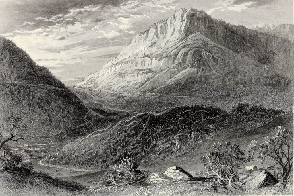
“[23rd April] We travelled about 12 miles and encamped on Crooked Creek. The mountains are very small hereabouts and here is a great deal of flat Land. We got through the Coal today.
[24th April] We kept on Westerly 18 miles, got Clear of the mountains and found the Land poor and the woods very Thick beyond them, and Laurel [Rhododendron maximum] & Ivy [Kalmia latifolia] in and near the Branches. Our Horses suffered very much here for want of food. This day we Came on the fresh Track of 7 or 8 Indians [sic], but could not overtake them.
[25th April] We kept on West 5 miles, the Land continuing much Same, the Laurel [Rhododendron maximum] rather growing worse, and the food scarcer. I got up a tree on a Ridge and saw the Growth of the Land much the same as Far as my Sight could reach. I then concluded to return to the rest of my company. I kept on my Track 1 mile then turn’d Southerly & went to Cumberland River at the mouth of a water Course, that I named Rocky Creek.
[26th April] The River is 150 yards wide and appears to be navigable from this place almost to the mouth of Clover Creek. Rocky Creek runs within 40 yards of the River Bank then turns off, and runs up the River, Surrounding about 25 Acres of Land before it falls into the River. The Banks of the River and Creek are a sufficient Fence almost all the way. On the Lower side of the mouth of the Creek is an Ash [Fraxinus] mark’d T W, a Red Oak [Quercus sp] A P, a white Hiccory [Carya] C. C. besides several Trees blazed Several ways with 3 Chops over Each blaze, we went up the North Side of the River 8 miles, and Camped on a Small Branch. A Bear Broke one of my Dogs forelegs.
[28th April]…We kept up the River to our Company whom we found all well, but the lame Horse was as bad as we left him, and another had been bit in the Nose by a Snake. I rub’d the wounds with Bears oil, and gave him a drench of the same and another of the decoction of Rattle Snake root some time after. The People I left had built an House 12 by 8, clear’d and broke up some ground, & planted Corn, and Peach Stones. They also had killed several Bears and cured the meat…
[30th April] I Blazed a way from our House to the River. On the other side of the River is a large Elm [Ulmus] cut down and barked about 20 feet and another standing just by it with the Bark cut around at the root and about 15 feet above. About 200 yards below there is a white Hiccory [Carya] Barked about 15 feet. The depth of water here, when the lowest that I have seen it, is about 7 or 8 feet, the Bottom of the River Sandy, ye Banks very high, & the Current very Slow. The bitten Horse being much mended, we set off and left the lame one. He is white, branded on the near Buttock with a swivil Stirrup Iron, and is old. We left the River and having Crossed Several Hills and Branches, Camped in a Valley North from the House.”
From Journal of Dr. Thomas Walker by Dr. Thomas Walker (1748) pp. 47-49
“The Cumberland Mountains are but a continuation of Laurel Mountain [east of Pittsburgh on the Allegheny Plateau], which itself is one of the principal links of the Alleghanies. These mountains, on the confines of Virginia, incline more toward the west, and by the direction which they take, cut obliquely in two the state of Tennessea, which, in consequence, divides East and West Tennessea into two parts, both primitively known by the names of the Holston and Cumberland settlements, and which afford each a different aspect, both by the nature of the country, and by the productions that grow there.”
From Travels to the West of the Allegheny Mountains by Francois Andre Michaux (1805) pp. 272-273
“This country is exceedingly mountainous, we could not make above forty-five miles the first day, although we travelled till midnight. We encamped near a small river, where there was an abundance of grass; and after having made a fire we slept in our rugs, keeping watch alternately in order to guard our horses, and make them feed close by us for fear of the natives, who sometimes steal them in spite of all the precaution a traveller can take, as their dexterity in that point exceeds all that a person can imagine. During this day’s journey we saw nothing but wild turkies, thirty or forty in a flight.
The second day after our departure we met a party of eight or ten Indians, who were searching for grapes and chinquapins [Castanea pumila], a species of small chesnuts, superior in taste to those in Europe. As we had only twenty miles to go before we reached West Point, we gave them the remainder of our provisions, with which they were highly delighted. Bread is a great treat for them, their usual food consisting of nothing but venison and wild fowl.
The road that crosses this part of the Indian territory cuts through the mountains in Cumberland; it is as broad and commodious as those in the environs of Philadelphia, in consequence of the amazing number [214] of emigrants that travel through it to go and settle in the western country. It is, notwithstanding, in some places very rugged, but nothing near so much as the one that leads from Strasburgh to Bedford in Pennsylvania. About forty miles from Nasheville we met an emigrant family in a carriage, followed by their negroes [sic] on foot, that had performed their journey without any accident. Little boards painted black and nailed upon the trees every three miles, indicate to travellers the distance they have to go.
In this part of Tennessea the mass of the forests is composed of all the species of trees that belong more particularly to the mountainous regions of North America, such as oaks, maples, and nut trees. Pines abound in those parts where the soil is the worst. What appeared to me very extraordinary was, to find some parts of the woods, for the space of several miles, where all the pines that formed at least one fifth part of the other trees were dead since the preceding year, and still kept all their withered foliage. I was not able to learn the causes that produced this singular phenomenon. I only heard that the same thing happens every fifteen or twenty years.
Near the fort [West Point] is established a kind of warehouse where the Cherokees carry ginseng and furs, consisting chiefly of bear, stag, and otter skins.”
From Travels to the West of the Allegheny Mountains by Francois Andre Michaux (1805) pp. 261-262, 264
“Sunday 26 went to Himans 13 miles to breakfast, we were now to encounter the Cumberland Mts. but although extremely steep the road was kept in good order principally causeway and far superior to those we had crossed in the Blue Ridge. Spencer’s hill on the mountains is the greatest descent I have seen. We walked down it and it was with great difficulty that we kept a sure footing, it is I think a mile and were you to slip there would be no resting place until you reached the foot of it – from the summit of one of the highest mountains we had a most enchanting view of the world below for several hundred miles, our horizone was bounded by the distant mountains which soared above the clouds and vied with their ethereal blue – ’twas a scene worthy of the pencil of Claude Lorraine…
Monday 27 – we were yet on the mountains yet the road was so perfectly level that one could scarcely realize it. It appeared more like a valley encompassed with mountains which encircled you – covered with beautiful wildflowers…soon commenced gradually to descend in many places steep and rocky and we entered before the dark the town of Sparta, having rode 40 miles…”
From the Journal of Juliann Conner (1827)
“During this year [1783], the road, as directed in the act, was opened, from Clinch River to Nashville. Emigrants had heretofore reached Cumberland, by the original route through the wilderness of Kentucky. Hereafter the route was more direct — for not only horsemen, but wagons, and immense numbers of the more wealthy people of the Atlantic sections, sought the Cumberland through the new road, which ran nearly over the same track still pursued as the stage road, by the way of Crab-Orchard. The top of the mountain is described as being then a vast upland prairie, covered with a most luxuriant growth of native grasses, pastured over as far as the eye could see, with numerous herds of deer, elk, buffalo, gamboling in playful security over these secluded plains, scarcely disturbed in their desert wilds at the approach of man, and exhibiting little alarm at the explosion of his rifle or fright at the victim falling before its deadly aim. The frowning cliffs and precipices, that everywhere surrounded the mountain to its summit level had hitherto, excluded even the hunter and the Indian [sic] from an easy access to it in pursuit of game; and the boundless natural meadow with its lofty enclosures of rock, erected by omnipotent masonry with its lofty enclosures of rock erected by primeval solitude, quiet and security. This aspect it wore no longer. The mural escarpment and the mountain waterfall, yielded to the energy of the troop and the guard. Nature doffed her power, her beauty, and her dominion, and succumbed to the reign of art and civilization.”
From The Annals of Tennessee by J. G. M. Ramsey (1853) p. 501
“Westward of this valley lies the Cumberland Table-land, the eastern boundary of which is high and almost unbroken from Kentucky to Alabama, while the western boundary is very irregular, with less elevation and with numerous valley and stream indentations. Though the table-land contains many streams and small valleys, it is, in the main, of uniform surface, but broken with mountainous ridges and knobs, particularly in the northeastern portion. The mean elevation is about 2,000 feet, and the extent is about 5,100 square miles.”
From a History of Tennessee by Westin A. Goodspeed (1886) p. 14
“After a few miles of level ground in luxuriant tangles of brooding vines, I began the ascent of the Cumberland Mountains, the first real mountains that my foot ever touched or eyes beheld. The ascent was by a nearly regular zigzag slope, mostly covered up like a tunnel by overarching oaks. But there were a few openings where the glorious forest road of Kentucky was grandly seen, stretching over hill and valley, adjusted to every slope and curve by the hands of Nature — the most sublime and comprehensive picture that ever entered my eyes. Reached the summit in six or seven hours — a strangely long period of up-grade work to one accustomed only to the hillocky levels of Wisconsin and adjacent States.”
From a A Thousand-Mile Walk to the Gulf by John Muir (1867) p. 16
“I found splendid growths of shining-leaved Ericacece [heathworts] for which the Alleghany Mountains are noted. Also ferns of which Osmunda cinnamomea (Cinnamon Fern) is the largest and perhaps the most abundant. Osmunda regalis (Flowering Fern) is also common here, but not large. In Wood’s* and Gray’s
Botany Osmunda cinnamomea is said to be a much larger fern than Osmunda claytoniana. This I found to be true in Tennessee and southward, but in Indiana, part of Illinois, and Wisconsin the opposite is true. Found here
the beautiful, sensitive Schrankia [Mimosa microphylla], or sensitive brier. It is a long, prickly, leguminous vine, with dense heads of small, yellow fragrant flowers [possibly this passage refers to Desmanthus illinoensis].
Vines growing on roadsides receive many a tormenting blow, simply because they give evidence of feeling. Sensitive people are served in the same way. But the roadside vine soon becomes less sensitive, like people getting used to teasing —Nature, in this instance, making for the comfort of flower creatures the same benevolent arrangement as for man. Thus I found that the Schrankia vines growing along footpaths leading to a backwoods schoolhouse were much less sensitive than those in the adjacent unfrequented woods, having learned to pay but slight attention to the tingling strokes they get from teasing scholars.
It is startling to see the pairs of pinnate leaves rising quickly out of the grass and folding themselves close in regular succession from the root to the end of the prostrate stems, ten to twenty feet in length. How little we know as yet of the life of plants — their hopes and fears, pains and enjoyments!”
From a A Thousand-Mile Walk to the Gulf by John Muir (1867) p. 18-19
“September II. Long stretch of level sandstone plateau, lightly furrowed and dimpled with shallow groove-like valleys and hills. The trees are mostly oaks, planted wide apart like those in the Wisconsin woods. A good many
pine trees here and there, forty to eighty feet high, and most of the ground is covered with showy flowers. Polygalas [milkworts], solidagoes [goldenrods], and asters were especially abundant. I came to a cool clear brook every half mile or so, the banks planted with Osmunda regalis, Osmunda cinnamomea, and handsome sedges. The few larger streams were fringed with laurels [likely Kalmia] and azaleas. Large areas beneath the trees are covered with formidable green briers and brambles, armed with hooked claws, and almost impenetrable. Houses are far apart and uninhabited, orchards and fences in ruins — sad marks of war.
About noon my road became dim and at last vanished among desolate fields. Lost and hungry, I knew my direction but could not keep it on account of the briers. My path was indeed strewn with flowers, but as thorny, also, as mortal ever trod. In trying to force a way through these cat-plants [Smilax] one is not simply clawed and
pricked through all one’s clothing, but caught and held fast. The toothed arching branches come down over and above you like cruel living arms, and the more you struggle the more desperately you are entangled, and your
wounds deepened and multiplied. The South has plant fly-catchers. It also has plant man-catchers.”
From a A Thousand-Mile Walk to the Gulf by John Muir (1867) p. 26-27
September 12. Awoke drenched with mountain mist, which made a grand show, as it moved away before the hot sun. Passed Montgomery, a shabby village at the head of the east slope of the Cumberland Mountains. Obtained breakfast in a clean house and began the descent of the mountains. Obtained fine views of a wide, open country, and distant flanking ridges and spurs. Crossed a wide cool stream [Emory River], a branch of the Clinch River.
There is nothing more eloquent in Nature than a mountain stream, and this is the first I ever saw. Its banks are luxuriantly peopled with rare and lovely flowers and overarching trees, making one of Nature’s coolest and most hospitable places. Every tree, every flower, every ripple and eddy of this lovely stream seemed solemnly to feel the presence of the great Creator. Lingered in this sanctuary a long time thanking the Lord with all my heart for his goodness in allowing me to enter and enjoy it.
Discovered two ferns, Dicksonia and a small matted polypod on trees [likely Pleopeltis michauxiana – resurrection fern], common farther South. Also a species of magnolia with verylarge leaves and scarlet conical fruit. Near this stream I spent some joyous time in a grand rock-dwelling full of mosses, birds, and flowers. Most heavenly place I ever entered. The long narrow valleys of the mountainside, all well watered and nobly adorned with oaks, magnolias, laurels, azaleas, asters, ferns, Hypnum mosses, Madotheca [Scale-mosses], etc. Also towering clumps of beautiful hemlocks [Tsuga canadensis]. The hemlock, judging from the common species of Canada, I regarded as the least noble of the conifers. But those of the eastern valleys of the Cumberland Mountains are as perfect in form and regal in port as the pines themselves. The latter [pines] abundant. Obtained fine glimpses from open places as I descended to the great valley between these mountains and the Unaka Mountains on the state line. Forded the Clinch, a beautiful clear stream, that knows many of the dearest mountain retreats that ever heard the music of running water. Reached Kingston
before dark. Sent back my plant collections by express to my brother in Wisconsin.“
From a A Thousand-Mile Walk to the Gulf by John Muir (1867) p. 30-32
“The eastern part of the County (White County, TN) for six or eight miles is Cumberland Mountain Plateau. It is mostly gently rolling and is suitable for fruits and vegetables and fine for grazing…Coves and small valleys cut their way into the mountain on its Western side. These coves are very fertile. Leaves washed down make a rich mold. These coves often open into wider valleys, as the Valley of the Calfkiller which runs through the County, widening as it reaches Southward. Through the center of the County west of Calfkiller Valley there runs a narrow mountain range, the highest peak being the Gum Spring Mountain, named from a gum [Nyssa] around a boiling spring. The peak is twenty-seven feet higher than the opposite Cumberland mountain.”
From a History of White County, Tennessee by Monroe Seals (1867), p. 53
“The area of the coal-bearing strata amounts to 5,100 square miles, and over this vast extent of country from one to sixteen seams occur. The coal fields include the counties of Scott, Morgan and Cumberland, the greater portions of Pickett, Fentress, Van Buren, Bledsoe, Grundy, Sequatchie and Marion; considerable portions of Claiborne, Campbell, Anderson, Rhea, Roane, Overton, Hamilton, Putnam, White and Franklin, and small portions of Warren and Coffee. About 1,000 square miles of the northeastern portion of this tract consists of a series of short irregular mountain chains, breaking away from the main Cumberland Mountain ridge, and casting heavenward numerous peaks of great height. The remainder of the coal tract, except certain portions in the southern part, is the true Cumberland Table-land or plateau. The upper coal measures embrace one or two principal sandstones (one of which may be a conglomerate) and an equal number of coal horizons in which one or more beds of coal may be expected. These and their accompanying strata compose the upper plateau, and have a thickness of from 200 to 300 feet, but are not typical of the tract of 1,000 square miles, to which reference was made above. The conglomerate sandstone [Crab Orchard Mountains Group], upon which the upper coal measures rest, usually contains numerous small white quartz pebbles, and is sometimes a double seam, embracing an important coal horizon. The lower coal measures consist of a series of sandstones and shales with from one to three or four coal veins, and constitute the most important division of the carboniferous period in the State and over a considerable area the only one available as a source of coal. Excluding the Cliff rock the thickness of this division ranges from a few feet to 300. These characteristics are, in general, typical only of the southern, western and northwestern portions of the table-land, as the northeastern portion and a strip along the eastern side, in the counties of Claiborne, Scott, Campbell, Anderson and Morgan, have a thickness of the upper coal measures, in some places of over 2,000 feet. The coal measures above the conglomerate have been much denuded, particularly on the western side of the table-land, and at points where the formations are much elevated, the reverse being true where the elevations are low. Where the coal measures are thickest the conglomerate is depressed and the waste by denudation is measurably compensated by the superior development, at many points, of the lower coal measures.”
From a History of Tennessee by Westin A. Goodspeed (1886) pp. 27-28
“The northern coal district is made to embrace that part of the tableland lying north of Van Buren and Bledsoe Counties and west of the Crab Orchard range, and a line running through Montgomery and Huntsville, and within its limits are parts of White, Cumberland, Morgan, Putnam, Overton, Fentress, Pickett and Scott Counties. Here the top of the table-land is usually a flat surface, and back from the slopes appears an upper plateau..”
From a History of Tennessee by Westin A. Goodspeed (1886) p. 31
“The soil of the Cumberland Table-land, which covers over 5,000 square miles of the State, is sandy and thin, though there are areas of moderate fertility at the foot of knobs and ridges, where fertile washings from the slopes are gathered. All the valleys are fertile, and accordingly productive. No lime appears, all being sand, and compost soon sinks below plant roots. The yellowish red subsoil, with a thin coating of humus, is more valuable than that with less iron and little or no humus. The former, with care and proper composts, may be made highly productive; not so the latter, which is too porous and tender, and, when uncultivated, produces nothing but shrubby trees, hardy, coarse weeds and grass, lichens and mosses. The glades and wet lands along the streams may be made valuable by drainage and by the use of alkalies to neutralize the abundant acid liberated by the decomposition of a superabundance of vegetable remains.”
From a History of Tennessee by Westin A. Goodspeed (1886) p. 27
“..the western iron region, which occupies a belt of high lands contiguous to the western valley and a part of the valley itself, and extends from Kentucky to Alabama..
“Several wild or indigenous grasses grow spontaneously, one of which is the barren, or prairie grass [likely Schizachyrium scoparium or Little Bluestem]. It covered all the prairie lands when the country was first settled by white people. It springs up about the 1st of April, grows to the height of two feet, and affords good pasturage from April to the 1st of August, when it becomes hard and woody so that stock refuse to eat it. Wherever the forest is not so dense as to exclude the light and heat of the sun, on the streams and tablelands of the Cumberland Mountains and on the sandy, flinty and siliceous “flat woods” of the whole State, this grass still holds possession, and is a blessing to the inhabitants of all lands which are deficient in lime.”
From a History of Tennessee by Westin A. Goodspeed (1886) p. 243
“Chestnut [Castanea dentata] is a valuable timber on account of its durability, and is abundant in the State. Large forests are found on the ridges of East Tennessee, on the sandstone soils of the Cumberland Table-land, and in portions of the Highland Rim..”
From a History of Tennessee by Westin A. Goodspeed (1886) p. 255
“A man named Robbins is reported to have erected a steam sawmill—the first in the area—at Moffat in the 1870s. From the great chestnut [Castanea dentata] and poplar [Liriodendron tulipifera] logs first sawed out, those eight feet in diameter might yield 1800 board feet of lumber! The modesty of John Moffat may have been a factor in changing the name of the town on January 12, 1881, to Mont Eagle, after the English nobleman Lord Mounteagle, who was a friend of Moffats. Not until October 1, 1925, was the present spelling adopted—Monteagle.”
From Tennessee County History Series: Grundy County by James L. Nicholson (1982) p. 60
“The great stands of timber in the coves were mostly walnut [Juglans], ash [Fraxinus], and poplar [Liriodendron tulipifera]; oak [Quercus] predominated on top of the mountain, with some pine [Pinus].”
From Tennessee County History Series: Grundy County by James L. Nicholson (1982) p. 2
“East Tennessee, September 1, 1880
…The above address is vague, as this range of highlands extends for some 200 miles through this state [Tennessee] and Kentucky; but though fixed as fate myself, I can for the moment put no more definite heading to my letters…We are some 1800 feet above the sea, and after the great heat of New York, Newport, and Cincinnati, the freshness and delight of this brisk mountain air are quite past describing. For physical enjoyment, I have certainly scarcely ever felt its equal, and can imagine nothing finer.”
From First Letter from Rugby: The Cumberland Mouontains by Thomas Hughes (1880)
“Meantime, I heard sounds which announced the up-risings of “the boys,” and in a few minutes several appeared in flannel shirts and trousers, bound for one of the two rivers which run close by, in gullies 200 feet, below us. They had heard of a pool 10 feet deep, and surrounded with great rocks, lying in a copse of rhododendrons, azaleas, and magnolias, which literally form the underwood of the pines and white oak along these gullies. The water is of a temperature which allows folks whose blood is not so hot as it used to be to lie for a half hour on its surface, and play about without a sensation of chilliness…
With this view Mr. Hill was placed, in the spring of this year, in charge of the only cleared space available. All the rest is beautiful open forestland. You can ride or drive almost anywhere under the trees, but there is no cultivated spot for many miles…
…Manure was out of the question, except little ashes, which he painfully gathered from here and there from the reckless log-fires which abound in the woods. He calls his garden a failure for the year…
…It is a slightly building, with deep verandahs prettily latticed from which one gets glimpses through the trees of magnificent ranges of blue forest-covered mountains…
…The bridle-path leads from the hotel down to the Clear Fork, one of the streams at the junction of which the town site is situate. The descent is about 200 feet, and the stream, when you get to it, from 30 to 50 feet wide, – a mountain stream, with deep pools and big boulders. Your columns are not the place for descriptions of scenery, so I will only say these gorges of the Clear Fork and White Oak are as fine as any of their size that I know of in Scotland, and not unlike in character, with this difference, that the chief underwood consists of rhododendron (called laurel here), and azalea, and a kind of magnolia I have not seen before, and of which I forgot the name. I passed huge faggots of rhododendron, 12 and 14 feet long, lying by the walks which had been cleared away ruthlessly while grading them…They have been named the Lover’s Walks, appropriately enough, for no more well-adapted place could possibly be found for that time-honored business, especially in spring, when the whole gorges under the tall pines and white oak are one blaze of purple, yellow, and white blossom.”
From Second Letter from Rugby: The Cumberland Mouontains by Thomas Hughes (1880)
“There are few more interesting experiences than a ride through these southern forests. The scrub is so low and thin, that you can almost always see away for long distances amongst pine [Pinus], white oak [Quercus alba], and chestnut [Castanea dentata] trees; and every now and then at ridges where the timber is thin, or where a clump of trees has been ruthlessly “girdled,” and the bare, gaunt skeletons only remain standing, you may catch glimpses of mountain ranges of different shades of blue and green, stretching far away to the horizon. You can’t live many days up here without getting to love the trees even more, I think, than we do in well-kempt England; and this outrage of “girdling,” as they call it — stripping the bark from the lower part of the trunk, so that the trees wither and die as they stand — strikes one as a kind of household cruelty, as if a man should cut off or disfigure all his wife’s hair. If he wants a tree for lumber or firewood, very good. He should have it. But he should cut it down like a man, and take it clean away for some reasonable use, not leave it as a scarecrow to bear witness of his recklessness and laziness. Happily not much mischief of this kind has been done yet in the neighbourhood of Rugby, and a stop will now be put to the wretched practice. There is another, too, almost as ghastly, but which, no doubt, has more to be said for it. At least half of the largest pines, alongside of the sandy tracts which do duty for roads, have a long, gaping wound in their sides, about a yard from the ground. This was the native way of collecting turpentine, which oozed down and accumulated at the bottom of the gash; but I rejoice to say it no longer pays, and the custom is in disuse. It must be suppressed altogether, but carefully and gently. It seems that if not persisted in too long, the poor, dear, long-suffering trees will close up their wounds, and not be much the worse ; so I trust that many of the scored pines, springing forty or fifty feet into the air before throwing out a branch, which I passed in sorrow and anger on my first long ride, may yet outlive those who outraged them. Having got rid of my spleen, excited by these two diabolic customs, I can return to our ride, which had otherwise nothing but delight in it.
…We were bound for a solitary guesthouse in the forest, some seventeen miles away, in the neighbourhood of a cave and waterfall, which even here have a reputation, and are sometimes visited. We allowed three and a half hours for the journey, and it took all the time. About five miles an hour on wheels is all you can reckon on, for the country roads, sandy tracks about 10 feet broad, are just left to take care of themselves, and wherever there is a sufficient declivity to give the rain a chance of washing all the surface off them, are only a heap of boulders of different sizes. But, after all, five miles an hour is as fast as you care to go, for the play of the sunlight amongst the varied foliage, and the new flora and fauna, keep you constantly interested and amused. I never regretted so much my ignorance of botany, for I counted some fourteen sorts of flowers in bloom, of which golden-rod [Solidago] and Michaelmas daisy [likely Symphyotrichum] were the only ones I was quite sure I knew — and, by the way, the daisy of Parnassus [likely Parnassia], of which I found a single flower growing by a spring. The rest were like home flowers, but yet not identical with them, at least I think not; and the doubt whether one had ever seen them before or not was provoking. The birds — few in number — were all strangers to me; buzzards, of which we saw five at one time, quite within shot, and several kinds of hawk and woodpecker, were the most common; but at one point, quite a number of what looked like very big swifts, but without the dash in their flight of our bird, and with wings more like curlews’, were skimming over the tree tops. I only heard one note, and that rather sweet, a cat-bird’s the doctor thought; but he was almost as much a stranger in these woods as I. Happily, however, he was an old acquaintance of that delightful insect the ” tumble-bug,” to which he introduced me on a sandy bit of road. My new acquaintance took no notice of me, but went on rolling his lump of accumulated dirt three times his own size backwards with his hind legs, as if his life depended on it. Presently his lump came right up against a stone, and stopped dead. It was a ” caution ” to see that bug strain to push it further, but it wouldn’t budge all he could do. Then he stopped for a moment or two, and evidently made up his small mind that something must be wrong behind, for no bug, he well knew, could have pushed harder than he. So he quitted hold with his hind legs, and turned round to take a good look at the situation, in order, I suppose, to see what must be done next At any rate he presently caught hold again on a different side, and so steered successfully past the obstacle. There were a number of them working about, some single and some in pairs, and so full of humour are their doings that I should have liked to watch for hours.
…We heard the owls all night, as well as the katydids, but they only seemed to emphasise the forest stillness…
…The cave which we sought out after breakfast was well worth any trouble to find. We had to leave the buggy and horses hitched up and scramble down a glen, where presently, through a tangle of great rhododendron bushes, we came out in front of a huge rock, with the little iron-stained stream just below us, and beyond, at the top of a sandy slope of perhaps 15 or 20 feet, the cave, like a long black eye under a red eyebrow, glaring at us. I could detect no fissure in the sandstone rock (the eyebrow), which hung over it for its whole length. The cave is said to run back more than 300 feet, but we did not test it. There would be good sitting room for 300 or 400 people along the front… with the rhododendrons in bloom all round. Maidenhair [Adiantum pedatum] grows in tufts about the damp floor, and a creeping fern [possibly walking fern], with a bright red berry [perhaps patridge berry, Mitchella repens], the name of which the doctor told me, but I have forgotten, on the damp red walls. What the nook must be when the rhododendrons are all ablaze with blossom I hope some day to see.
We had heard of a fine spring somewhere in this part of the forest, and, in aid of our search for it, presently took up a boy whom we found loafing round a small clearing. He was bareheaded and barefooted, and wore an old, brown, ragged shirt turned up to the elbows, and old, brown, ragged trousers turned up to the knees. I was riding, and in answer to my invitation he stepped on a stump and vaulted up behind me. He never touched me, as most boys would have done, but sat up behind with perfect ease and balance as we rode along — a young centaur. We soon got intimate, and I found he had never been out of the forest, was fourteen, and still at (occasional) school. He could read a little, but couldn’t write.
…I found that he knew nothing of the flowers or butterflies, of which some dozen different kinds crossed our path. He just reckoned they were all butterflies, as indeed they were. He knew, however, a good deal about the trees and shrubs, and more about the forest beasts. Had seen several deer only yesterday, and an old opossum with nine young, a number which took the doctor’s breath away. There were lots of foxes in the woods, but he did not see them so often. His face lighted up when he was promised two dollars for the first opossum he would tame, and bring across to Rugby…
We got back without further incident (except flushing quite a number of quail [possibly grouse], which must be lovely shooting in these woods)…”
From Rugby, Tennessee (1881) by Thomas Hughes pp. 54-60
“Nothing would satisfy our forester but that some of us should ride over with him, some nine miles through the forest, to see Glades, the farm upon which he has been for the last eight years. He led the way, on his yellow mare, an animal who had nearly given us sore trouble here. The head stableman turned all the horses out one day for a short run, and she being amongst them, and loving her old home best, went off straight for Glades through the woods, with every hoof after her…The ride was lovely, glorious peeps of distant blue ranges, and the forest just breaking out all over into golds, and vermilions, and purples, and russets. We only passed two small farms on the way, both ramshackle, and so the treat of coming suddenly on some hundred acres cleared, drained, with large though rough farm buildings, and bearing the look of being cared for, was indescribably pleasant.
…[according to the forester] ‘So we went up right amongst the Indians [sic], to a place they call Grand Travers [Michigan], a wonderful healthy place, on a lake in the pine-forest country, as it was then. I went on to a promontory, where the forest stood, not like it does here, but the trees that thick you had scarce room to swing an axe….But I didn’t get my health again [after the Civil War], so eight years ago I came to this place on the mountains, which I knew was healthy, and would suit me. Well, they all said I should be starved out in two years and have to quit, but before three years were out I was selling them corn, and better bacon than they’d ever had before.’…
There I soon dozed off, watching the big, smouldering white pine-log [Pinus strobus] away in the depth of the chimney-nook, and the last flickerings of the knobs of pitch-pine in front of it, between the iron dogs, and wondering in my mind over the brave story we had just been listening to, so simply told (of which I fear I have succeeded in giving a very poor reflection), and whether there are not some — there cannot, I fear, be many — such lives lying about in out-of-the-way corners, of mountain, or plain, or city.”
From Rugby, Tennessee (1881) by Thomas Hughes pp. 69-77
“..he rides on under the gold and russet and green autumnal coping of hickories, chestnuts, and pines.”
From Rugby, Tennessee (1881) by Thomas Hughes p. 78
“Sedgemoor is a small clearing in the middle of the forest, through which the railway has been running for the last thirty miles. He is already some 1200 feet above the sea level, as he has been creeping up by gentle inclines ever since he entered the forest country. From this point the line descends again gradually to the South, till it reaches the Tennessee river and its terminus at Chatanooga. But when he is landed at Sedgemoor he is still some 600 feet below the level of Rugby, and he commences the ascent at once. There is a broad road, graded right away from the station to the town for six miles and upwards, through land belonging to the Board, and he begins the ascent within one hundred yards of the line. As soon as he is up this first ascent the road runs almost all the way along the ridge of a water-shed, to the Clear Fork river, upon the further bank of which the town of Rugby lies. The drive should be instructive to him, not mainly for the charm of the scenery, or the glimpses he will get here and there of the distant blue mountains of North Carolina away to the east, but for the specimen it will give him of the sort of work he will soon be employed on. Most likely his first job will be to clear similar land at so many dollars an acre, either for the Board or some of the settlers.”
From Rugby, Tennessee (1881) by Thomas Hughes p. 113
“It is not claimed that the soil of Rugby, or the Cumberland plateau, is rich. On the contrary, it is generally poor, or at most only of medium quality. It is a rare thing in the United States to find rich soil, plenty of timber, perfect healthfulness and desirableness of climate, cheap land, convenient markets, and easy access to means of transportation, all combined. That Rugby possesses all these essentials to a happy home, except rich soil, no one, it is believed, will deny. It is equally true that the soil, by proper culture and handling, can be improved and made to yield remunerative crops.
The soil may be divided into five classes: —
- Thin sandy soil, resting upon sandstone, which comes near the surface. This is unfruitful, both from original poverty of constitution and from a want of depth. Fortunately it does not occupy a large area, but is confined for the most part to the high lands adjoining streams. Timber scrubby.
- Sandy soil, light, but deep. Upon this the most succulent and nutritious grasses grow, and furnish a large amount of excellent pasturage. The prevailing timber is chestnut, oak, and pine.
- Sandy soil, incumbent upon a mulatto clay. This, by reason of its clayey foundation, which enables it to catch and preserve fertilising material, is the best of all the upland soils of the mountain, and covers by far the largest area, especially on the lands belonging to the Rugby colony. It is naturally fertile upon the north hill-sides, having in such places a black colour, resembling the black prairie lands of Illinois. The black soil however is very limited. The general characteristics of this class of soil is a light grayish or yellowish colour, with a mulatto subsoil The latter is very retentive, and holds all fertilisers applied. Extensive white oak [Quercus alba] forests occur upon it. Where there is a modification of this soil by the presence of small angular gravel the timber varies, and red oak [Quercus rubra], black oak [Quercus velutina], hickory [Carya], and pine [Pinus], are associated with the white oak [Quercus alba]. Grape vines [Vitis] grow abundantly upon such soils.
- The alluvium along the water courses, which is black in colour, friable and productive. The amount of this soil is inconsiderable.
- Glebe lands — the beds probably of old marshes, in which has accumulated a large mass of vegetable debris. The soil of this is sometimes black, more often ashen in colour, and always charged with humic acid to such a degree as to be unproductive, unless thoroughly drained and sweetened by aeration. No timber will flourish in such places except swamp maple [Acer rubrum], sweet gum [Liquidambar styraciflua], and other kinds adapted to wet lands.”
From Rugby, Tennessee (1881) by Thomas Hughes p. 136-137
“The Cumberland Plateau abounds in Chestnut Oak [Quercus montana], the bark of which is in great demand in tanning…
Factories for making furniture, especially the cheap furniture, such as is made out of poplar [Liriodendron tulipifera], walnut [Juglans nigra], and pine [Pinus], should also pay well, if economically and skilfully managed. These woods everywhere abound on the plateau. Vast quantities of walnut are daily shipped from there to New York and Boston, much of which returns in the shape of fine furniture…
As for all articles made out of white oak and hickory, such as waggons, carriages, spokes, hubs, handles, etc. etc., it seems that some point on the plateau would combine every element for their successful manufacture. The forests are full of the very best white oak and hickory. They grow all along the railroad. A lumber dealer from the city of New York recently remarked that the white oak timber of East Tennessee was the best in the world. Hence lumber dealers and manufacturers from a distance are seeking for it, as they are for our walnut…
That the Cumberland plateau, from its salubrity, its accessibility to markets, its adaptability to fruits and vegetables, its wealth of coal and timber, will in time become a populous region, there can be no doubt. It should always be remembered, however, that patient labour, guided by skill and intelligence, is positively necessary to make agriculture profitable.
With these, the prediction of Andrew Jackson may be verified that it will become the Garden of Tennessee.”
From Rugby, Tennessee (1881) by Thomas Hughes pp. 157-159
“In presenting to the public this guide book to the grand and romantic beauties of that wonderful cloud-land – the Cumberland Plateau of Tennessee – its marvelous natural attractions, its remarkable healthfulness, its easy accessibility, and its many desirable features as a pleasure resort and great sanitarium for the country at large, and for the people of the South in particular, some acknowledgements are due and are herby made…
Picturesque Tennessee: Mont Eagle Springs, the famous Health and Pleasure Resort in that Wonderful Cloud-Land, The Cumberland Plateau by Charles E. Robert (1881) Preface
“The Flora of the Mountain
The writer above quoted has this to say of one of the chief charms of this mountain region: ‘The flora of the Plateau cannot be forgotten in the mention of its natural beauties. A resident there, from Massachussetts, spoke with enthusiasm of the profusion and beauty of its wild flowers – in variety continually renewed from early spring through autumn. At the time of our visits the slopes were brilliant with scarlet phlox; on the borders of streams bigonia were gorgeous among the foliage of the trees, and laurels and rhododendrons along banks and in the glens. Among specimens we secured was a section of a rhododendron-trunk, about six inches in diameter. Imagine the splendor of such a tree in full flower! Coves were gay with extraordinary waterplants, and tiniest bright blossoms hid among grasses. The sensitive-plant and golden-rod were neighbors at the roadsides. It is safe to predict that when access to this region – this vast picnic ground – is opened, that its attractions of entire healthfulness, mineral springs, cool breezes and rural beauties, will make it a convenient and favorite summer resort, not only from the South, as is now that portion reached by Southern railroads, but from Kentucky and Ohio, and to the North.’
The following conclusion to our account of the flora of the Plateau, written by General E. Kirby Smith, Professor of Mathematics in the University of the South, at Sewanee, will also be found especially pleasing:
‘The flora of Sewanee forms a connecting link between the North and South. Forms characteristic of the highlands and the Green Mountains and Adirondacks mingle with forms from the Gulf and Atlantic slopes, and with occasional wanderers from the trans-Mississippi. Southern types of leguminose, Northern and Western compositae, delicate polygalas, and showy gerardias, hypericums, euphorbias, oenotheras, graceful bluets, and humble hepaticae, meet on this common border-ground, and claim fellowship for every section of this great republic.’
It occurs to us, however, that much more can be truthfully said on this subject, for the verdure and flora of the mountain is simply superb and almost perennial. The wild flowers here in the Spring make a magnificent display. The whole face of this upland earth is covered with violets, pansies, wild roses, wild geraniums and ‘the painted populace that dwell in fields, and lead ambrosial lives.’ As summer approaches they grow more luxurious. the mountain is a vast flower garden with its parterres and terraces, its bowers and natural arbors. The lily-of-the-valley tinkles its fairy bells and sends out the harmony of ‘invisible music,’ while jasmine and honey-suckle, tube-rose and myrtle lift their petals or nod their plumes of blue, of white, pink, scarlet and purple, and grow more fascinating as the days grow long. The landscape is dotted with many-tinted flowerets and vari-colored glows – thicker even than the clustered stars in the distant nebulae. Five distinct varieties of the highly prized azaleas, the very soul and emblem of romance, are to be found, while innumerable classes, orders, and genera, indigenous to the mountain countries, embellish the earth with beauty and freight the air with fragrant and ever-grateful inflorescence.
…The mountain-top is now [in Autumn] rich with woodbine, mistletoe, laurel and holly, besides the princess pine, which is considered a choice bit of shrubbery. An infinite variety of ferns, at least thirty or thirty-five different kinds, may be found, while the ledges are covered with lichens and mosses. Trailing arbutus, pink and white, is to be seen everywhere, but is sweetest when it comes peeping through the snow, a shy little darling, perhaps to win the kisses of the nice but very naughty and very flirtatious sun.
Other Attractions of the Plateau.
Close kin, and indeed, the elder brothers of the flowers, we next contemplate the extraordinary timber-growth of the Plateau. The woods are so extensive and the varieties so numerous, we can only mention, at random, those mainly characteristic of this region. This includes vast forests of oaks – red, white, black, chestnut, and some few water oaks; black-walnut, in great quantities; cedars, pines – spruce, white, yellow and ‘old-field’; white and shagbark hickory, chestnut, beech, chincapin; sugar-maple, red flowering maple, poplar or tulip-tree, iron-wood or hornbeam, black gum, buckeye, dogwood, persimmon, black and red haw, and Irish juniper – besides a large number of trees of less frequent growth.
Wild grapes, summer and winter varieties, grow in the woods in great profusion; wild locusts and wild honey – the food of John the Baptist – may be had for the gathering. Huckleberries, wild gooseberries and mulberries may be found in great abundance, while certain portions of the upland – no exaggeration – covered with blackberries, high and low-bush, and of the finest sort.
Probably nothing strikes the traveler more favorably than the wild luxuriance and beauty of the mountain grasses and forage plants. When the woods are thin and the undergrowth absent, which is annually accomplished by being burned, the surface is clothed in a mantle of verdure from April until November, and thousands of cattle browse over these extensive tracts until their sirloins fairly roll in fat. When looking over these broad stretches where the grass fluorishes in primeval beauty, and sometimes untrodden by a single hoof, the wild flowers emblazoning these natural pastures with their modest beauty, and no human habitation to be seen, and no evidences of occupancy, it is not difficult to imagine this mountain landscape as it appeared before the discovery of Americy by Columbus.’
Picturesque Tennessee: Mont Eagle Springs, the famous Health and Pleasure Resort in that Wonderful Cloud-Land, The Cumberland Plateau by Charles E. Robert (1881) pp. 19-21
“For the last fifty miles we ran almost entirely through forests, which are, however, falling rapidly all along the side of the line, and yielding place to cornfields in the rich bottoms, wherever any reasonably level ground bordered on the water courses, up which we, could glance as we hurried past…I sit here writing in the verandah, the light of my lamp throwing out into strong relief the stems of the nearest trees. Above, the vault is blue beyond all description, and studded with stars as bright as though they were all Venuses. The katydids are making delightful music in the trees, and the summer lightning is playing over the Western heaven; while a gentle breeze, cool and refreshing as if it came straight off a western sea, is lifting, every now and then, the corner of my paper.”
From First Letter from Rugby: The Cumberland Mouontains by Thomas Hughes (1880)
“The pine is one of the most abundant, and at the same time one of the most valuable of the forest growths of the State. There are two species, the white [Pinus strobus] [eastern white pine] and the yellow [Pinus echinata] [shortleaf pine]. The latter [shortleaf pine] grows in considerable quantities in the vicinity of Knoxville, and in many of the parallel ridges in the valley of East Tennessee. It is also found in extensive forests in the Cumberland Table-land, and forms considerable belts in Hardin and Lawrence Counties…It abounds on poor soils, those usually of sandstone, but often on red clay with gravel. It takes possession of abandoned old fields, and grows with rapidity when the soil is too sterile to produce other vegetation. In the regions where it abounds it forms the principal timbers for domestic purposes. The [eastern] white pine is not so abundant as the preceding; it is distributed in greater or less quantities over the slopes of the Unaka Mountains, and is found locally on the Cumberland Table-land. It grows to a larger size than the yellow pine, and makes a quality of lumber highly prized on account of its lightness and comparative freedom from resinous exudations.”
From a History of Tennessee by Westin A. Goodspeed (1886) p. 256
Growth. — This county is still, for the most part, covered with its native forest, which includes a vast amount and a great variety of valuable timber. Its large growth consists, in the order of their abundance, of oaks [Quercus], pines [Pinus], gums [Nyssa], hickories [Carya], dogwoods [Benthamidia / Cornus], cedars [Juniperus virginiana], chestnut [Castanea], poplar [Liriodendron tulipifera], cypress [Taxodium distichum], etc. The oaks are principally post oaks [Quercus stellata] and black jacks [Quercus marilandica], with a considerable mixture of red [Quercus rubra], Spanish [Quercus falcata], white [Quercus alba], and chestnut oaks [Quercus montana]. The pines are of both the short [Pinus echinata] and long leaf [Pinus palustris] varieties, though chiefly of the former. The gums are of the sweet and sour kind [Nyssa sylvatica, Nyssa aquatica], and the hickories are of the several species. The dogwoods are of the comparatively low grounds, while the cedars [Juniperus virginiana] cover the limestone ridges, knolls, and glades. The chestnut [Castanea dentata], poplar [Liriodendron tulipifera], and cypress [Taxodium distichum] were once abundant, but are now quite scarce.
From Jefferson County and Birmingham, Alabama Biographical and Historical (1887) by John Witherspoon p. 21
“Like an island in an emerald ocean, the Cumberland Plateau rises from the surrounding valleys, inviting alike to the health seeker the [..?] or the man of capital. There is no plateau like it on the continent. It is unique. No other bears such a treasure of iron and coal and timber. So great a wealth of natural resources cannot be found so closely associated.
In this respect, it stands without a peer. The broad, level areas are carpeted with native grasses, and are adapted to farming. Fruit and vegetables fluorish. It is the natural home for sheep and cattle and hogs, which can live the year round.
Coal exists in vast measures which underlie the entire area, except where cut by streams, and these little valleys give access to it. It is used at South Pittsburgh and other places and makes a good quality of coke. It is also prized as a domestic fuel for steaming, as it leaves no clinkers. One county that lies in the region can of itself furnish enough coke for all the furnaces in the south, were there transportation. This is Cumberland. Its county seat is Crossville, which lies at the center of one of the best coal regions in America. For its coal and iron, Cumberland is fully equal to Allegheny County, Pa. Its value may be the better understood when it is known that no coal exists between this field and the Atlantic Ocean and for hundreds of miles to the westward…”
From the Chattanooga News, July 5th, 1891
“The Cumberland Plateau is one of the great natural divisions of the State of Tennessee. Its area is about 5100 square miles and its average elevation about 2000 feet above sea level. The climate is cool in summer and equable in winter, rendering a healthy and most desirable place to live…The landscape is diversified with hill and dale and there are great rolling parklike areas. For the most part the land is well covered with timber, principally pine [Pinus], oak [Quercus], hickory [Carya] and cedar [Juniperus virginiana]. The ground is carpeted more or less thickly with native grasses which are nutritious and furnish substance to large numbers of cattle and sheep that roam over the Plateau. The country is well watered by a series of sparkling mountain streams whose beds have often sunk to some considerable depth through the ever active process of erosion. Thus many quaint and picturesque valleys and coves are produced, and here and there where the streams have spread out, a rich alluvial soil is found along the river course.”
From A visit to the Cumberland Plateau Tennessee Midsummer Ninteen Hundred by Andrew M. Soule (1900) pp. 4-5
“For the most part, the soil is sandy and even leechy in some places, though over much of the area it is of fair quality and in some places exceptionalloy good.”
From A visit to the Cumberland Plateau Tennessee Midsummer Ninteen Hundred by Andrew M. Soule (1900) p. 3
Another range of mountain flora we find in the Cumberland Mountains. Selecting the Lookout near Chattanooga for a type, we find its summit wooded with Quercus prinus [montana] [chestnut oak], Quercus rubra [northern red oak], Quercus alba [white oak], Quercus obtusiloba [stellata] [post oak], and Quercus nigra [water oak] [sic this probably refers to black oak or Quercus velutina]; Pinus inops [virginiana] [scrub pine], Pinus taeda [loblolly pine], Pinus mitis [echinata] [shortleaf pine]; Betula lutea [alleghaniensis] [yellow birch], Gleditsia, triacanthos [honey locust], Robinia pseudoacacia [black locust], several Caryas [hickories] and C. microcarpa [glabra] [pignut hickory] among them. Of shrubs: Robinia hispida [bristly locust], Diervilla rivularis [native bush honeysuckle], Ilex mollis [montana] [mountain winterberry], Stuartia pentagyna [ovata] [mountain camellia], Hydrangea radiata [snowy hydrangea], and again (but very rare) Buckleya distichophylla [piratebush], Nemopanthes canadensis [Ilex mucronata] [mountain holly], and in a swamp Dirca palustris [eastern leatherwood]. Of herbaceous plants: Utricularia gibba [humped bladderwort], Juncus canadensis [Canadian rush], and Arundinaria tecta [switchcane]. On flat rocks: Diamorpha pusilla [Sedum pusillum] [granite stonecrop], Fimbristylis capillaris [Bulbostylis capillaris] [dense-tuft hairsedge], Krigia virginica [Virginia dwarf dandelion], Arenaria glabra [Geocarpon glabrum] [Appalachian stitchwort]. On the cliffs of the crest: Stipa avenacea [Piptochaetium avenaceum] [black oat grass], Silene rotundifolia [roundleaf catchfly], Linaria canadensis [blue toadflax], Campanula divaricata [Appalachian bellflower], Thalictrum clavatum [Mountain meadowrue]. Near the base of the mountain, on limestone ledges: Gatesia laetevirens [Yeatesia viridiflora] [yellow bractspike], Callicarpa americana [American beautyberry], Triosteum perfoliatum [horse gentian], Silphium brachiatum [Cumberland rosinweed]. ‘The Cumberlands excel the Alleghanies in a greater variety of ferns. Besides all species of the latter, we also find here Asplemum bradleyi [Bradley’s spleenwort], Asplenium pinnatifidum [lobed spleenwort], Lygodium palmatum [American climbing fern], Scolopendrium vulgare [hart’s tongue fern], and Trichomanes radicans [Vandenboschia boschiana] [Appalachian filmy fern], Asplenium viride [green spleenwort], Adiantum capillus-veneris [southern maidenhair fern].
From a The Flora of Tennessee and a Philosophy of Botany by Augustin Gattinger (1901) pp. 18-19
Alabama
Carolinian Area or Flora
“A line drawn from the northwestern corner of the State to the lower part of Lee County, crossing the Coosa Valley near Childersburg, makes the limit of the highlands having an average elevation of 800 feet above sea level (E. A. Smith). This line coincides approximately with the isothermal line of 60 deg F., and may be regarded as the boundary in Alabama of the Upper and Lower Austral zones, therefore of the Carolinian and Austroriparian or Louisianian areas. It winds its way from northwest to southeast and southward to the “fall line.”‘ Accepting this zonal line, a botanical limit is gained, northward of which is found a flora different in character from that to the southward, generally described as the flora of the great Central Mississippi Valley, and distinguished by the feeble representation, if not total absence, of the subtropical element and the exclusive prevalence of deciduous forests. Various shrubs and trees coincide in their limits of northern and southern distribution closely with this boundary line, and serve as unerring guides in pointing out its course. Such truly zonal plants are:
Pinus virginiana (scrub [Virginia] pine), Prunus americana (American plum), Quercus acuminata [Q. muehlenbergii] (yellow bark chestnut oak) [Chinquapin oak], Azalea [Rhododendron] arborescens (sweet-scented azalea), Stuartia pentagyna [Stewartia malecodendron] (fringed stuartia) [silky camellia], Quercus prinus [Quercus montana] (mountain [chestnut] oak). Butneria fertilis (mountain spicewood or smooth Calycanthus) [Calycanthus floridus (Sweetshrub)], Quercus coccinea (scarlet oak), Quercus rubra (red oak), Rhus aromatica (aromatic sumac), Acer leucoderme (white-bark sugar maple) [chalk maple], Adelia [Forestiera] ligustrina (southern [glade] privet).
These all find in Alabama their southern limit on this line. Although the vegetation of the Carolinian area presents in its broad features great uniformity, particularly in its tree growth, there exist in its range of nine degrees of latitude differences in the latitudinal distribution of heat, which necessarily affect the distribution of plants within its limits and present insurmountable obstacles to the extension of a number of species northward. Due to this temperature element, there is a most pronounced limit beyond which the successful cultivation of the cotton crop can not be pushed, and which also presents a barrier to several trees and a number of other plants of Southern distribution that are only rarely met farther north, as for example, the willow oak (Quercus phellos), loblolly pine (Pinus taeda), longleaf pine (Pinus palustris) and cane (Arundinaria macrosperma [gigantea]). This line, roughly extending from the Atlantic Coast at the mouth of the Chesapeake Bay westward to southwestern Missouri and northern Arkansas, was located by Gray along latitude 30 deg 36′, and by him was regarded as the line of separation between the two principal floral divisions of eastern North America, namely, the flora of the northern United States and Canada and the flora of the Southern States. In Alabama it is only this lower belt of the Carolinian area, embracing the mountain region and the lower hills with which we are concerned.”
From the Plant Life of Alabama by Charles Mohr (1901) pp 57-58
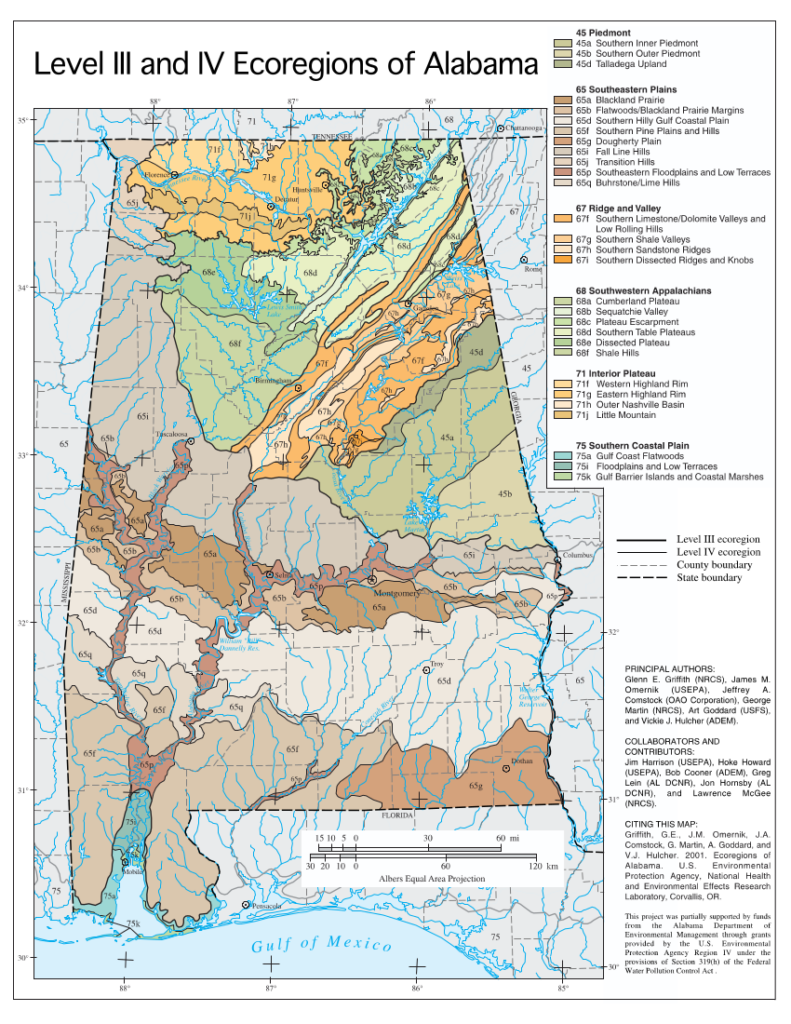
“The Silicious Soils [sandy or otherwise composed of silica, such as chert] of the Mountains or Elevated Lands. These soils cover the highlands or barrens, and the table-lands. They are usually of a light gray color and often are not much more than sand or pure silicious matter. Up to a few years ago they were regarded as almost worthless for all agricultural purposes, but of late years, by kind treatment and the use, in small quantities, on them of suitable composts, they have been found to be fine for cotton, corn, tobacco, small grains, grasses and root and fruit crops. The greatest objection to them is that they do not hold, or retain well, organic matter or fertilizers, and hence in many localities they look as if they had been leached, so completely have all traces of organic matter been washed out of them.”
From Northern Alabama Historical and Biographical Illustrated (1888) p. 11
JACKSON COUNTY
“The general appearance of this county is much more broken, and its scenery greatly diversified. It is made up of high mountain tracts of level lands extending for many miles. These mountains are cut back into by many beautiful coves and valleys of level and fertile lands, some of which are three or four miles wide, shut in by steep mountain slopes, covered with forest growth of valuable timber; indeed, the whole of the valley lands are said by geologists to have been cut out of what was at one time, a level mountain surface, by the flow of the Tennessee River and its numerous tributaries. This mountain surface at that time was all the Cumberland Mountain, but is now cut in two by the river, at the point known as the Boiling Pot, this side of Chattanooga, and has cut out the Tennessee River Valley in which this county is situated: leaving that part of the mountain north of the river known as the Cumberland Mountain, and that part of the mountain south of the river, known as the Raccoon Mountain, or Sand Mountain, as it is called by the natives. Both these mountains extend through north Alabama, and have an average width of about twenty miles; hence the main valley lands lie along the Tennessee River, and are as fine farming lands for all kinds of farming purposes, as can be found in the South
Along the high table lands of the county are numerous small farms which are surrounded with all the evidences of plenty and contentment. The streams are the Tennessee and Paint Rock rivers, and Big and Little Raccoon, Mud, Wido, Big Crow, Jones’ Santa, Big Lanne, and Williams’ creeks, and Hurricane and Larkins’ forks. Besides these, numerous mountain springs abound, the water of which is pure and perpetual. The county is unexcelled in its water supply. The hills and mountain flanks are densely wooded, while some of the alluvial valleys are still uncleared and are covered over with valuable timber. On the uplands are found black [Quercus velutina] and red oaks [Quercus rubra/falcata], pine [Pinus], cedar [Juniperus virginiana] and hickory [Carya]. Along the valleys are found poplar [Liriodendron tulipifera], ash [Fraxinus], maple [Acer], beech [Fagus grandifolia], walnut [Juglans], sweet gum [Liquidambar styraciflua], cherry [Prunus virginiana] and giant white oak [Quercus alba]. Indeed, both upon the table lands and in the valleys, many of the forests remain in their virgin state. They extend along the broad and deep streams of the county, and timber hewn from them may be easily rafted. The inclination of the different water course is such as to favor the erection of manufactories, and for local demands such do exist.”
From Northern Alabama Historical and Biographical Illustrated (1888) p. 92-93
“TABLE-LANDS OF THE WARRIOR AND COOSA BASINS.
PHYSIOGRAPHICAL FEATURES AND CLIMATE.
This area comprises about 4,500 square miles, including all of Cullman, Winston, Walker, and Blount counties, nearly all of Marshall and Dekalb, and small portions of Etowah and Cherokee counties, with the detached spurs of the Cumberland Mountains in the northeastern part of the Tennessee Valley in Jackson County. About three quarters of this area contains the coal measures, with their drainage level above the Subcarboniferous limestone lands.
The extreme southern spurs of the westerly Alleghanian ranges, including the Cumberland Mountains and all of the strata of the lower coal measures and underlying Subcarboniferous rocks, constitute this floral subdivision. It comprises the extensive table-lands drained by the Warrior River and of the coal field drained by the Coosa River, covering fully three-quarters of the area of the mountain region, and also the valleys with their water level not below 700 or 800 feet above the sea.
The lower Carboniferous sandstones and conglomerates [Pottsville formation] form the surface rock of these table-lands. Their surface is furrowed by the narrow beds and deep gorges through which the numerous tributaries of the main channels of drainage have worn their way. The soil resulting from the disintegration of the strata is a light, more or less sandy, loam, and where shallow, full of thin rocky fragments.
The mean annual temperature on these highlands at their average elevation of from 800 to 1,500 feet is about 55° F., with a mean of 45° for the winter and 75° for the summer months; average minimum 12° in January, and maximum 87° in August. The mean annual precipitation amounts to 55 inches; mean for the winter months 18 inches, for the summer months 14 inches. The larger streams forming the main channels of drainage have cut their bed through the Subcarboniferous limestone. The calcareous strata constitute the floor of the wide valleys of erosion by which the diverging ranges are separated and also of their foothills.
VEGETATION OF THE PLATEAUS, MOUNTAIN SLOPES AND HIGHER VALLEYS
Xerophile forests – An uninterrupted forest of a varied growth of deciduous-leaved trees and evergreen cone bearers originally covered this subdivision. On the broad expanse of the table-lands above 900 or l000 feet the tan-bark or mountain oak [Quercus montana] largely prevails, associated with post oak [Quercus stellata] and Spanish oak [Quercus falcata], or more rarely with black-jack [Quercus marilandica] and black oak [Quercus velutina], occasionally with scarlet oak [Quercus coccinea], a rare tree in this State; also with mockernut [Carya tomentosa], pignut hickory [Carya glabra], and fine chestnut [Castanea dentata] trees (the latter rapidly disappearing, having been eagerly sought for on account of their durable timber for fencings or wantonly destroyed for the nuts), and with white oak (Quercus alba) and highland gum (Nyssa sylvatica). Among the tree growth of smaller size the sourwood (Oxydendrum arboreum) is most frequent, here attaining its largest development, not infrequently becoming 40 feet in height and over a foot in diameter; together with dogwood [Cornus florida], persimmon [Diospyros virginiana], sassafras [Sassafras albidum], and the Southern palebark maple (Acer leucoderme), and in localities with a deeper soil, the Nortliern sugar maple (Acer saccharum barbatum), tulip tree [Liriodendron tulipifera], box elder (Acer negundo) and angelica tree (Aralia spinosa). On Sand Mountain, in Cullman County, where these forests have been more closely investigated, the woodlantls support from 25 to 35 timber trees of various species per acre, affording from 5,000 to 6,000 feet B. M. of merchantable lumber of all grades, the largest amounts being derived from the Spanish oak [Quercus falcata] and the less valuable black oak (Quercus velutina). The lumber finds a ready maiket in the mining districts.
Wherever the mountain oak [Quercus montana] prevails pines are rarely seen. On the ridges of a lower altitude, with a thinner soil, the short-leaf pine (Pinus echinata) forms from 20 to 30 per cent of the timber growth, and. together with the loblolly pine (Pinus taeda), supplies pine lumber, which always finds a ready market. Dense groves of the latter cover the shallow depressions deficient in drainage, which are particularly frequent on the Warrior table-land. On these swales, from a fraction of an acre to several acres in extent, the loblolly pine [Pinus taeda] arrives at its perfection, scarcely surpassed anywhere in its dimensions and in the quality of its timber. The trees average about 24 inches in diameter, with a height of from 110 to 120 feet, the trunks free of knots for a length of from 45 to 70 feet and with but a small proportion of sapwood.
The scrub pine (Pinus virginiana) is found on the most broken and poorest places at an elevation mostly above 1,200 feet, and is not frequent. Under the cover of the mostly rather open forest a variety of shrubs contribute to form a dense undergrowth. Blueberries (Vaccinium vacillans, V. .stamineum) are met with everywhere in the mountain region, and a bushy low form of the common azalea or honeysuckle (Azalea nudiflora) [possibly here referring to Rhododendron alabamense – Alabama azalea], conspicuous by the abundance of its mostly snowwhite flowers, borne in close clusters, almost hides the ground. The fringed stuartia (Stuartia pentagyna), mountain holly (Ilex monticola [I. montana]), and its variety (I. monticola mollis), with soft hairy leaves, extend northerly on the lower of the western Alleghenian ranges to southeastern Kentucky, western Virginia, and Pennsylvania, and reach their southern limit on Sand Mountain. Ilex longipes [Georgia or Chapman holly] extends from North Carolina and Tennessee to the Louisianian area, and the rare Ilex dubia [I. amelanchier] [Sarvis holly] is found on the richer slopes, with Darbya [Nestronia] umbellulata [Nestronia or Indian olive], which of late has also been discovered on the edge of the metamorphic hills in Lee County. The last occurs also in a few localities in North Carolina and middle Georgia. Seven bark [Oakleaf hydrange] (Hydrangea quercifolia), one of the most ornamental shrubs, adorns the open woods and rocky hillsides throughout the region, being also common on the lower hills and extending to the Coast Pine belt. The following shade the rocky borders of the water courses:
Vaccinium tenellum (small-leaved huckleberry [Southen dwarf blueberry]), Stuartia virginiana(?) [Stewartia ovata?] (Virginia stuartia), Kalmia latifolia (evergreen kalmia [mountain laurel]), Aronia arbutifolia (chokeberry), Pyrus [Malus] angustifolia (Southern crabapple), Azalea arborescens (sweet-scented azalea).
The chokeberry [Aronia arbutifolia], which is here of arborescent habit, presents a beautiful sight when loaded with its bright scarlet fruit, which remains from early autunm through the winter. The following add to the number of mesophile shrubs, which prefer a damper and deeper soil:
Chionanthus virginica (fringe tree), Crataegus crus-galli (cockspur [haw]thorn), Pyrus [Malus] angustifolia (Southern crab apple), Crataegus mollis (downy haw[thorn]), Crataegus coccinea (scarlet haw[thorn]), Crataegus uniflora (winter haw), Crataegus spathulata (sugar [littlehip] haw) .
Of woody creepers and climbers —
Smilax rotundifolia (horse brier [common greenbriar]), Clematis virginiana (common virgin’s bower), are confined to the mountain region, extending to the Alleghenian area; while —
Bignonia capreolata (cross vine), Berchemia volubilis [scandens] (supple-jack), Tecoma [Campsis] radicans (trumpet vine), Vitis aestivalis (summer grape), are widely distributed in the Carolinian and Louisianian divisions.
Mesophile forests. — Where the sandstones give way to clayey shales more subject to erosion, the channels of the water courses become wider and the valleys are flanked by ridges of a gentler slope and are covered with deeper and richer soil. In these secluded valleys of the table-land, particularly where they begin to slope almost imperecptibly toward their southern and southwestern borders, the arboreal growth is of groat luxuriance and variety. Besides many of the trees of the uplands, the following are found:
Quercus michauxii (cow oak [swamp chestnut oak]). Magnolia umbellata [tripetala] (umbrella [magnolia] tree), (Fagus americana (beech) . Magnolia acuminata (common cucumber tree), Ulmus americana ([American] elm), Juglans cinerea (butternut) (rare). Magnolia macrophylla (large-leaf magnolia), Tilia americana (basswood), Tilia heterophylla [T. americana var heterophylla] (mountain basswood) .
These deciduous-leaved magnolias in these sheltered valleys arrive at their best development, the last having been observed with a trunk fully 20 inches in diameter. In such a valley on the northern border of Winston County, near a branch of the east fork of the Sipsey River, the yellow-fiowered magnolia [cucumber magnolia] (Magnolia acuminata cordata), first described as a distinct species by Michaux the elder, was discovered by the writer in 1882. Since the original discovery of this rare and beautiful tree by this great investigator of the trees of eastern North America, on the banks of the upper waters of the Savannah River, the range of its distribution had remained obscure. It can now be said, however, to extend from upper South Carolina and the upper mountain region of Georgia to northwestern Alabama. Here this tree has been observed as large as a full-grown common cucumber tree, of which species Professor Sargent regards it as a variety. When unfolding under full exposure to the sun, the flowers are from a dingy canary to a golden yellow color, but are of a greenish tint when opening under the shade of the dense foliage. In the shape and size of the mature leaves the yellow-fiowered variety can scarcely be distinguished from the typical form; it is only in the foliage of the young vigorous shoots that the heart-shaped form of the leaves is observed.
Entering near the same valley the cliff -bound channel of the Sipsey fork, one finds to his surprise the rocky defile shaded by groves of stately hemlock (Tsuga canadensis). This inhabitant of the coniferous forests of northern regions extends southward along the highest summits of the Appalachian ranges to (Georgia and northwestern Alabama, where it follows this mountain torrent for a distance of about 10 miles, nearly to the falls of Clear Creek, in Winston County, there reaching its southern limit. In this valley the hemlock is accompanied by the sweet or cherry birch, Betula lenta, at home in the same northern life zone.
Xerophile and mesophile herbaceous plant associations. — Belonging to the former, many ferns peculiar to the mountain region take root in the chinks of the bare rocks. Such are:
Cheilanthes [Myriopteris] tomentosa [wooly lipfern], Asplenium montanum [mountain spleenwort], Cheilanthes [Myriopteris] lanosa [hairy lipfern], Asplenium ruta-muraria [American wall rue], Cheilanthes [Myriopteris] alabamensis [Alabama lipfern], Asplenium pinnatifidum [lobed spleenwort], Pellaea atropurpurea [purple cliff-brake],
In similar situations are found the following flowering plants:
Silene rotundifolia [sandstone fire pink], Arenaria stricta [Sabulina michauxii] [rock sandwort], Silene caroliniana [rock catchfly], Lacinaria graminifolia [Liatris pilosa, grass-leaf blazingstar], Saxifraga virginica [Micranthes virginiensis] [early saxifrage], Senecio obovatus [Packera obovata] [roundleaf groundsel].
Other species of ferns on the border line of xerophile and mesophile associations prefer the more sheltered rocky ledges, as:
Asplenium parvulum [resiliens] [blackstem spleenwort], Dicksonia punctilobula [Sitobolium punctilobulum] [hay scented fern], Woodsia obtusa [blunt-lobed cliff fern], Camptosorus rhizophyllus [Asplenium rhizophyllum] [walking fern], Polypodia vulgare [Polypodium sp.] [rockcap fern], Cystopteris fragilis [fragile fern].
Carex picta (C. bootiana) [painted sedge] covers in dense tufts the rocky shelves on the banks of the head waters of the eastern Sipsey fork, in Winston County, where this pretty and rare plant was collected by the late Judge T. M. Peters.
Associated with Carex picta are C. nigro-marginata [black-edged sedge], C. virescens [ribbed sedge], and C. digitalis [slender woodland sedge], Tipularia unifolia [discolor] [cranefly orchid] (of a widely disrupted distribution from the Gulf coast to Lake Huron in the Allegheuian area), and the northern Peramium (Goodyera) repens [lesser rattlesnake orchid]. Therofon (Boykinia) aconitifolium [aconitifolia] [brook saxifrage] inhabits the bare rocks forming the brink of streams, and Diamorpha pusilla [Sedum pusillum] [Puck’s orpine] is found in similar localities — both extending hither from the lower mountains of South Carolina and Georgia. Heuchera americana [American alumroot] grows in more open, and H. rugelii [H. parviflora var parviflora] [Cumberland grotto alumroot], Viola multicaulis [possibly Viola walteri, Walter’s violet], and Hepatica hepatica [H. acutiloba or H. americana] [Hepatica] in deeply shaded situations; and where the rocky walls are constantly kept moist by the dripping water, Thalictrum clavatum [mountain meadow rue], Viola rostrata [long spurred violet], V. blanda [sweet white violet] and V. striata [pale violet] are found.
In the open woods of a light dry soil where pines are mingled with the hardwood trees, and in the openings of old fields and pastures, where the progeny of the pine is apt to take possession of the ground, there are present numerous xerophile species, which are characteristic of the mountain region in general. Of these, the following glumaceous plants (grasses and sedges — Poaceae and Cyperaceae) are scantily diffused throughout woods and fields having a thin thirsty soil:
Erianthus alopecuroides [silver plume grass], Eragrostis pectinacea (Carolina lovegrass), Andropogon sroparius [Schizochyrium scoparium] [common little bluestem], Poa chapmaniana [Chapman’s bluegrass], Andropogon furcatus [gerardi] [big bluestem], Carex laxiflora [broad loose-flowered sedge], Chrysopogon avenaceus [Sorghastrum nutans] [yellow Indiangrass], Carex laxiflora varians [broad loose-flowered sedge], Sieglingia seslerioides [Tridens flavus] [tall redtop], Carex cephalophora, Melica mutica [two-flowered melic], Carex leavenworthii [Leavenworth’s sedge].
Among the largely predominating Compositae (Asteraceae) tall rosinweeds and coarse sunflowers are conspicuous, particularly the former, which present a number of types rarely or not at all observed in the State outside of this subdivision; for example, Silphium mohrii [Mohr’s rosinweed] and S. gatesii [S. asteriscus var asteriscus], both known from Cullman County; S. trifoliatum [S. asteriscus] [starry rosinweed], ranging from the plains of the Ohio Valley to the Central Prairies region; S. laevigatum [S. asteriscus var laevigatum], Helianthus schweinitzii [Schweinitz’s sunflower] and H. glaucus [glaucophyllus?] [white-leaf sunflower?] from the lower mountains of South Carolina and Georgia, and S. compositum [var compositum] [Carolina rosinweed], abundant throughout the region. The following are frequent in dry thin soils all over the Mountain region, some extending all over the State:
Helianthus atrorubens [Appalachian sunflower], Lactuca hirsuta [red wood lettuce], Helianthus hirsutus [hairy sunflower], Lactuca sagittaefolia(?), Helianthus microcephalus [small-headed sunflower], Nabalus fraseri [barbatus] [barbed rattlesnake root], Helianthus divaricatus [woodland sunflower], Lechea racemulosa [Appalachian pinweed], Heliopsis helianthoides [Eastern sunflower-everlasting], Lechea leggettii [pulchella] [Leggett’s pinweed], Parthenium integrifolium [common wild quinine], Koellia pycnanthemoides, Sericocarpus asteroides [toothed white-topped aster], Blephilia ciliata [downy woodmint], Aster divaricatis [Eurybia divaricata] [common white heart-leaved aster], Monarda fistulosa [Appalachian bergamot], Eupatorium sessilifolium [sessile-leaf eupatorium], Monarda bradburiana [Bradbury beebalm], Solidago caesia [axillary goldenrod], Dasystoma virginiana [Aureolaria virginica] [Virginia oak-leech], Solidago erecta [slender goldenrod], Gerardia [Agalinis] tenuifolia [slender leaf agalinis], Chrysopsis mariana [Maryland goldenaster], Physalis virginiana [Virginia ground cherry], Brauneria purpurea [Echinacea purpurea] [purple coneflower], Physalis pubescens [downy ground cherry], Rudbeckia hirta [black-eyed Susan], Physalis pruinosa [grisea/pubescens], Rudbeckia spathulata, Sabbatia boykinii(?) [rosepink sp.], Coreopsis grandiflora [large flowered coreopsis], Thaspium aureum trifoliatum [Thaspium trifoliatum var aureum], Coreopsis pubescens [hairy coreopsis], Oxalis recurva [Oxalis sp.], Coreopsis auriculata [lobed coreopsis], Tragia urticaefolia [nettleleaf noseburn], Carduus virginicus [Cirsium virginianum] [Virginia thistle], Meibomia [Desmodium] (many species), Andropogon virginicus, Lespedeza (many species) .
Vicia caroliniana [wood vetch] and buffalo clover, Trifolium reflexum, are frequcnt on these table-lands, and Lathyrus venosus [smooth forest pea] in Alabama is contined to them.
Strictly mesophile herhaceous plant association. — Ferns abound in the shade of the forests.
Characteristic species are:
Adiantum pedatum [maidenhair fern], Botrychium obliquum [dissectum] [cut-leaf grape fern], Asplenium plalyneuron [ebony spleenwort], Dryopteris [Amauropelta] noveboracensis [New York fern], Phegopteris hexagonoptera [broad beech fern], Dryopteris marginata [marginal woodfern], Botrychium virginianum [common grape fern], Dryopterls acrostichoides [Christmas fern]
Asplenium angustifolium(?), which is most frequent in the Ohio valley, occurs very rarely. Of grasses and sedges Muhlenbergia diffusa [schreberi] [nimblewill] forms dense plots, and the following prefer the shade of woods:
Brachyelytrum erectum [common shorthusk], Poa autumnalis [bluegrass], Festuca nutans [subverticillata?] [nodding fescue], Carex laxiflora [broad loose-flowered sedge], Festuca shortii [paradoxa], Carex laxiflora varians, Poa sylvestris [forest bluegrass], Carex laxiflora patulifolia.
The following are frequent in the openings of woods and on their borders:
Vagnera racemosa [Maianthemum racemosum] [false Solomon’s seal], Tiarella cordifolia [Piedmont foamflower], Uvularia puberula [Carolina bellwort], Hypericum virgatum [coppery St. John’s wort], Uvularia sessillfolia [merrybells], Scutellaria incana, Iris cristata [dwarf crested iris], Phlox divaricata [eastern blue phlox], Syndesmon [Thalictrum] thalictroides [rue anemone], Mertensia virginica [Virginia bluebells], Anemone quinquefolia [wood anemone], Vincetoxicum hirsutum(?) [possibly Matelea], Anemone virginiana [thimbleweed], Gentiana villosa [striped gentian], Ranunculus recurvatus [hooked buttercup], Galium circaezans [licorice bedstraw], Cimicifuga racemosa [black cohosh], Houstonia caerulea [Quaker ladies], Trautvetteria carolinensis [false bugbane], Deringa canadensis [Cryptotaenia canadensis] [wild chervil], Viola hastata [halberd-leaf violet]. Podophyllum pelatatum [mayapple], Viola multicaulis [possibly Viola walteri, Walter’s violet], Sanguinaria canadensis [bloodroot], Viola pubescens [hairy yellow forest violet].
On the higher shady banks of water courses are found:
Porteranthus (Gillenia) stipulaceus [stipulata] [Midwestern Indian physic], Stachys cordata [heart-leaved hedge nettle], Porteranthus trifoliatus [Gillenia trifoliata] [mountain Indian physic], Zanthorhiza apiifolia [Xanthorhiza simplicissima] [yellowroot].
In the more or less dense forest, covering hill and dale, are to be found:
Orchis [Galearis] spectabilis [showy orchid], Aralia racemosa [spikenard], Cypripedium parviflorum [small yellow lady’s slipper], Sanicula marilandica (rare) [black snakeroot], Arisaema quinatum [southern Jack in the pulpit], Phryma leptostachya [American lopseed], Circaea lutetiana [canadensis] [Canada enchanter’s nightshade], Frasera carolinensis [American columbo], Hydrastis canadensis (scarce) [goldenseal], Cynoglossum virginicum [Anersonglossum virginianum] [southern wild comfrey], Bicuculla cucullaria [Dicentra cucullaria] [Dutchman’s breeches], Obolaria virginica [pennywort], Dentaria [Cardamine] diphylla [toothwort], Solidago flexicaulis [zigzag goldenrod], Cubelium concolor [eastern green violet], Solidago vaseyi [Vasey’s goldenrod], Panax quinquefolius [American ginseng].
The Solidago vaseyi [Vasey’s goldenrod] has been collected near Holmes Gap (1,500 feet), and is known from a few localities on the highest ranges of the Carolinas and Georgia,
On the restricted flat semiswampy places, not infrequently met with on the Warrior table-land, open or slightly under cover, the following are most frequently seen:
Cyperus pseudo-vegetus (green flatsedge), Phlox maculata [northern meadow phlox], Carex lupulina [hop sedge], Lysimachia quadrifolia [whorled loosestrife], Carex lurida [sallow sedge], Gentiana elliottii [catesbyi] [coastal plain gentian], Habenaria [Platanthera] ciliaris [yellow fringed orchid], Bidens involucrata [polylepis] [Midwestern tickseed sunflower], Xyris flexuosa [caroliniana] [pineland yellow-eyed grass], Coreopsis grandiflora [large-flowered coreopsis], Rhexia virginica [Virginia meadow beauty], Doellingeria infirma [Appalachian flat-topped white aster], Ludwigia alternifolia [alternate-leaved seedbox].
Mesophile plant associations of rock houses. — On the perpendicular walls at the head of the deep narrow gorges are found shelves of hard, resisting sandstone with the softer strata beneath them worn away by the action of the percolating surface water. The wide and deep excavations thus formed are called by the people of the country “rock houses.” In these gloomy recesses, never visited by the direct rays of the sun, their roots and walls constantly moistened by the water oozing from every crevice, some of the rarest and most delicate ferns find a shelter from wind and sudden changes of temperature. Trichomanes [Didymoglossum] petersii [dwarf filmy fern], the tiniest of this order in the United States, and confined to Northern Alabama, is at home in these rock houses, and thence it way first brought to light Judge T. M. Peters, who discovered it on the banks of the head waters of Sipsey River. The filiform horizontal rhizomes are interwoven into dense patches, their fronds of dark green scarcely an inch high, somewhat resembling the thallus of a large liverwort. This fern was subsequently found in a similar locality on the western edge of the table-land by Prof. E. A. Smith, and later by the writer on its eastern border at the falls of Black Creek, in Etowah County. Trichomanes radicans [Vandenboschia boschiana] [Appalachian filmy fern] is also a frequent inhabitant of these rock houses, being found on wet, deeply shaded, rocky walls northward to the Cumberland Mountains of Kentucky. The long creeping rootstock of this beautiful fern, adhering firmly to the rock, decorates the roof and walls of these recesses. Asplenium trichomanes [maidenhair spleenwort], with its fronds of brightest green, and the thallus of a large liverwort (Dumortiera sp.) are the frequent companions of the above. Of plants of higher orders only a few have been observed in these cavities. Thin grass (Agrostis perennans) [Autumn bentgrass] with its weak, decumbent stems, occurs here, where its foliage is scarcely ever affected by frost and never touched by the direct sunlight, and Heuchera rugelii [Heuchera parviflora var. parviflora] [Cumberland grotto alumroot] is also quite frequently found on the damp ledges which form the threshold of the caves, but rarely penetrates beyond them.
Hydrophilic plant associations (paludial plants). — On the table-land beyond the channels of the large streams and their very numerous branches no areas of great extent of a water-soaked or submerged soil are foimd, and the narrow channels through which the water rushes toward the lowlands afford but little chance for the spread of a hydrophile vegetation. The wet grassy swales are inhabited by the following:
Andropogon virginicus [Anatherium virginicum] [broomsedge], Carex granularis [limestone meadow sedge], Homalocenchrus (Leersia) virginicus [virginica] [Virginia cutgrass], Eleocharis tenuis [slender spikerush], Panicularia nervata [Glyceria striata] [Panicularia nervata], Eleocharis acicularis [needle spikerush], Panicum rostratum [Coleataenia anceps] [beaked panic grass], Eleocharis ovata, Panicum comutatum [Dichanthelium commutatum] [variable witchgrass], Scirpus polyphyllus, Panicum polyanthes [Dichanthelium polyanthes] [small-fruited witch grass], Dichromena [Rhynchospora] colorata [narrowleaf whitetop sedge], Panicum [Dichanthelium] sphaerocarpon [round-fruited witchgrass], Kobresia pumila(?), Carex lurida (sallow sedge), Juncus marginatus [grass-leaved rush], Carex lupulina [hop sedge], Juncus (common species), Carex intumescens [bladder sedge], Cicuta maculata [water hemlock], Carex squarrosa (rare) [squarrose sedge], Coreopsis [Anacis] tripteris [tall coreopsis], Carex torta [streambed sedge], Eupatorium maculatum [spotted Joe-Pye weed].
In the brooks where during its lowest stage the water becomes stagnant, a large Fontinalis, F. lescurii [novae-anglii], is found. Hymenocallis occidentalis [woodland spiderlily] occurs in deep clefts of rocks barely rising above the water. Sagittaria latifolia [common arrowhead] and S. longirostris australis [long-lobed arrowhead] are found on the miry banks of Ryans Creek, Cullman County, with Peltandra virginica [green arrow arum]. Orontium aquaticum [golden club] is common in the streams of the wider valleys not above 1,000 feet. On the loose stones in the swiftly running brooks and shallow streams Podostemon abrotanoides [ceratophyllum] [threadfoot] a type of the southern Alleghenies is not rare on the Warrior table-land, and P. ceratophyllum of northern distribution is known in the State, but only from the vicinity of Auburn.
Vegetation of Lookout Mountain. — Near the northern frontier of the State the most easterly of the spurs of the Appalachian ranges belonging to this subdivision rises abruptly at Valley Head to an elevation fully 800 feet above Little Wills Valley, with its floor at this point 1,150 feet above tide water.
The summit of Lookout Mountain spreads out to a wide table-land of the same character as the plateau of the Warrior coal field, and terminates suddenly in the precipitous escarpment abutting upon the Tennessee River known as the most prominent landmark in the Tennessee basin. Near Mentone, Little River, a pretty stream which follows the southern extension of this table-land, leaps over a ledge into its narrow channel, some 125 feet below. By reason of a rainfall more copious than in other sections of the mountain region (64.4 inches), and toward its northern extremity of a generally deeper and fresher soil, this mountain was recently covered with a fine hard-wood forest, chiefly of oaks, and was noted for the abundance of white oak timber (Quercus alba) and tan-bark oak [likely Quercus montana, Chestnut oak]; but this timber wealth is now almost exhausted. On its flanks the black locust (Robinia pseudoacacia) is found, one of the few localities in Alabama where it can be considered to be indigenous. The short-leaf pine [Pinus echinata] is rarely met with on these heights. The scrub pine is more frequent, reaching its best development on rocky benches and declivities with a scanty covering of soil.
On the brow of this mountain, and particularly along the low, damp banks of Little River, there occurs a strong mingling of types that are at home in the Alleghenian area of the adjoining States and of North Carolina with plants of the lower ranges within the Carolinian area, giving rise to a varied flora, the like of which has not been observed in any other part of the mountain region of Alabama. When the low elevation of this extremely limited spot is considered (not quite 2,000 feet above the sea), the suffusion of types from different life zones admits of no explanation on the ground of climate or local influences controlling plant distribution, but points clearly to a disjunction of floral conditions due to geological changes. Among the woody plants peculiar to the Alleghenian area, Rhododendron catawbiense [Catawba rhododendron] is the most prominent. In the beginning of summer, when covered with the profuse clusters of its purple or lilac llowers, this shrub, from 6 to 10 feet in height. massed in dense thickets along the banks of Little River forms one of the most attractive sights. ‘I’he home of this shrub is ascribed to the highest crests of the southern chains of the mountains from western Virginia to Roan Mountain, on the border of North Carolina and Tennessee, at an altitude of 6000 feet. It has. however. been found by Mr. Small, at a much lower elevation on Table Mountain. At its extreme southern limit in Alabama it is associated with the, Azalea arborescens [sweet azalea] and Kalmia latifolia [mountain laurel]. Of other shrubs Viburnum cassinoides [northern wild raisin], extending to the Canadian zone, is abundant on the banks of this stream. Viburnum dentatum [arrowood viburnum], Rubus enslenii [Enslen’s blackberry] and Celastrus scandens [Ameircan bittersweet] of the same range of distribution, are frequent among the shrubs of the more exposed rocky heights.
With these Alleghenian shrubs occur a host of other species, which are at home on the southern extremity of the lower ranges within the Carolinian area, and are more or less frequent throuuhout our mountain region. For example:
Butneria (Calycanthus) fertilis [Calycanthus floridus] [sweetshrub]. Hydrangea arborescens cordata [smooth Hydrangea], Ilex monticola [Ilex montana] [mountain holly]. Philadelphus hirsutus [Cumberland mock-orange], Vaccinium melanocarpum [V. stamineum] [deerberry], Diervilla rivularis [hairy southern bush honeysuckle], Vaccinium pallidum [hillside deerberry].
The Vaccinium pallidum [hillside deerberry] is reported as scarce on some of the highest summits of North Carolina (Buckley). Crataegus biltmoreana [C. intricata var biltmoreana] [Biltmore hawthorn], C. austromontana [valleyhead hawthorn], and C. sargenti[i] [Sargent’s hawthorn] are new discoveries made on the declivities of the mountain by Mr. Beadle of the Biltmore Herbarium in 1899, which have also become known from western North Carolina, eastern Tennessee, and northern Georgia. The prostrate stems of the northern Rubus hispidus [swamp dewberry] cover open, miry places.
The large lichen, Umbilicaria pustulata papulosa which covers the naked cliffs, forms an association strongly expressive of the Alleghenian character of the flora of this locality. In the soil, rich in humus, shaded by the rocks, and on the shaded ledges lining the banks of Little River, mesophile ferns are also abundant. Asplenium bradleyi [Bradley’s spleenwort] of very local distribution in the Cumberland Mountains of Tennessee and Kentucky, occurs here, together with the more frequent —
Asplenium parvulum [A. resiliens] [blackstem spleenwort], Asplenium montanum [mountain spleenwort], Asplenium trichomanes [maidenhair spleenwort], Asplenium pinnatifidum [lobed spleenwort], Asplenium felix-foemena [Athyrium asplenoides] [southern lady fern], Dryopteris marginalis [marginal woodfern], Dicksonia punctilobula [Sitobolium punctilobulum] [hay-scented fern].
The last three are xerophile species, occurring on somewhat exposed rocks. Other herbaceous southern Appalachian types here found are:
Galax aphylla [likely Galax urceolata, but possibly Nemophylla aphylla] [Galax], Viola blanda [sweet white violet], Thalictrum clavatum [mountain meadowrue], Viola rostrata [long-spurred violet], Viola multicaulis [possibly Viola walteri, Walter’s violet], Eatonia pensylvanica [Sphenophilis pensylvanica] [swamp oats].
Of these the first is the most prominent, frequenting springy, rocky banks and dripping ledges, and the others are all more or less frequent in similar localities throughout the mountain region. Sarracenia catesbaei [Sarracenia oreophila, Green Pitcher plant] and Isoetes engelmanni valida are paludial plants so far only known in the State from the banks of Little River near De Soto Falls. There occurs also Danthonia glabra [D. sericea] [silky oat-grass], a most rare plant, lately described, from upper Georgia (Nash), with Danthonia compressa [mountain oat-grass], and Deschampsia [Avenella] flexuosum [common hairgrass] so far not yet reported from any other locality in the State, while Carex virescens [ribbed sedge], Tiarella cordifolia [Piedmont foamflower], Ascleplas quadrifolia [fourleaf milkweed], and Asarum macranthum [Hexastylis shuttleworthii] [large-flower heartleaf] frequent the rocky dells and more or less open copses. The tiny Arenaria brevifolia [A. leptoclados] [slender sandwort], known from a few localities in upper Georgia and the Cumberland Mountains of Tennessee, roots in crevices of rocks among the dark-green cushions of mosses (Grimmia, Hedwigia), with the three-leaf stonecrop (Sedum ternatum) [mountain stonecrop] and the round-leaf talinum (Talinum teretifolium) [Phemeranthus teretifolium] [Appalachian rock-pink] a fleshy perennial with rose-purple flowers adorning exposed rocks in the mountains northward to Pennsylvania. On the exposed rocks close to the edge and above the falls of Little River dense tufts of filiform leaves produced by a many-branched rootstock deeply sunk in the crevices attract the attention. Specimens of this plant in flower obtained in September proved to be Chondrophora virgata (Bigelovia Nutt) [Bigelowia nudata] [ray-less goldenrod]. The identity of our plant with Nuttal’s specimens is, however, not free from doubt. In the type collected by Nuttall in lower New Jersey and preserved in the Herbarium of the Academy of Sciences at Philadelphia the radical leaves, which furnish the decisive character, are wanting; furthermore, the similarity to Euthamia graminifolia [northern smooth goldentop] ascribed by Nuttall to his type is not recognized in our plant. The locality quoted by Nuttall is also doubtful, his plant having never been found afterwards, although the ground has been closely investigated by later botanists.
Under the umbrageous cover of the high forest on the upper flanks of the mountain, in the deep soil, rich in humus, tall umbelliferous herbs are conspicuous, among which are Ligusticum canadense [American lovage], frequent throughout the mountains northward to Pennsylvania, Thaspium pinnatifidum [cut-leaf meadow parsnip], and Thaspium barbinode [hairy-joint meadow parsnip], which extends north to the Ohio Valley. Together with these occur Oxalis grandis [great yellow wood sorrel], Polygonatum commutatum [P. biflorum var. commutatum] [large Solomon’s seal], widely distributed through the Alleghenian area, Trillium stylosum [T. catesbyi] [Catesby’s trillium] of the southern Appalachian ranges, and Cypidpedium acaule [pink lady’s slipper], found in more open boggy places.
Cultural plant associations. — Scarcely 20 per cent of the area of the table-lands is reduced to a state of cultivation; the rest consists of more or less devastated woodlands and of high forests, which, however, near the settlements and highways of commerce are largely stripped of merchantable timber and are suffering from the inroads of fire and cattle.
Scarcely more than a quarter of a century ago, before these tablelands were made easily acccssible to the immigrant by the great trunk lines leading from the centers of population in the North to the Gulf coast, they were but sparsely inhabitated. The earlier settlers who had squatted upon them depended for their support more on the chase than upon the cultivation of a soil which was looked upon as too poor to afford an adequate return. This, however, has all been changed by the influx of a population which was attracted by the mild and salubrious climate, and which, coming with the determination to establish its home here, has succecded in conquering the unpromising soil and developed its possibilities. With the rapid increase in population these lands have come much into demand, and under rational management almost every crop raised in the Northern States can be successfully grown on these tahle-lands by the side of cotton.
The meadow grasses of the North, with red clover and similar forage plants, do well here. Much attention is given to the production of breadstuffs, chiefly corn, to which the greater part of the arable land is devoted. Small grains, as wheat and rye, supply a part of the home demand. Irish and sweet potatoes are profitable summer crops, and nearly all of the root crops and vegetables grown in the temperate zone are produced here in abundance and perfection. Of small fruits, the strawberry has heen found highly profitable, usually being harvested hefore the end of April. This fruit finds a ready sale in the distant northern markets. Orchards of fruit trees on a large scale do not yet exist, although apples, pears, and peaches are successfully grown. The cultivation of the grape was given great attention by the earlier of the German immigrants until the appearance of a fungous disease proved a great drawback. But with the successful employment of remedies to subdue this disease, viticulture, particularly of grapes for table use, has received a new impetus.”
From the Plant Life of Alabama by Charles Mohr (1901) pp 69-80
Paint Rock Valley
“These Coves nestle in this valley between the river and the mountains, like the parts of a jig-saw puzzle. As the land in the valley and on the sides of the mountains was so rich, it was covered with a very dense forest of large trees of many kinds. If this timber were here now, it would be worth a fortune of more than a million dollars.
When the first’ settlers came, they made their homes up in the Coves and on the sides of the Mountains. Down near the river, there were so much big timber, vines, canes, ponds, lagoons and lakes, the climate was unhealthful and the land was difficult to clear for cultivation. The land in the coves and on the hillsides was more easily cleared and very rich and loose. It is said that in the spring of the year a man could bend over a dogwood sapling large enough for a good hand spike—a stick used to roll logs—and pull it up by the roots, because the ground was so rich and loose. The foregoing conditions account for most of the old graveyards being located up on the sides of the mountains.
As the first settlers had small fields or patches of corn in cultivation, some years the squirrels, coons and bears would eat up nearly all of it. It was the habit of the bear to go into the field at night and gather 40 or 50 ears of corn, pile it up and sit down to eat all he wanted. The women did not need to raise turkeys for there were great flocks of wild turkeys in the woods near. When they wanted a turkey for dinner, the man would go out and shoot one, or if the ammunition was scarce, he would build a pen to catch them alive. The writer has seen a few — pens. These pens were built of ten-foot rails, about — six or eight rails high, covered with rails so that when the turkeys got in the pen they could not get out. About six or eight feet from one side of the pen, a ditch 18 inches or two feet deep was dug under the bottom rail of the pen and to the center, and covered the ditch two or three feet inside the pen, then scattered shelled corn in the ditch. The turkeys would go in. When they got in and raised up their heads, they never stooped down again to go back out, but put their time in going round the pen trying to get out at a crack.
As a rule there were so much beech [Fagus grandifolia] mast, acorns, hickory [Carya] nuts and chestnuts [Castanea] that their hogs got fat enough for meat in the woods with but little or no feed at all.
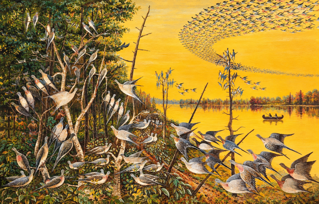
Birds were so numerous that boys with traps could keep a supply for the table without great effort. Some winters such flocks of wild carrier pigeons [Ectopistes migratorius – Passenger pigeons] came and as their habit was to select certain trees to roost in, so many would get on a limb that they would break it off. These pigeons are now extinct, like the buffalo. For many years, millions of these pigeons were killed in the north and shipped to market. Agriculture was the main industry of the people of the valley. It was hard to clear the land and dispose of the great amount of timber. Before it could be cultivated, they cut and rolled logs for many days before planting the crop. They lived in log houses with either a dirt floor or a puncheon floor—that was slabs split out of logs and hewn smooth with a broadax. Malecome Thompson, a great-uncle of John K. Thompson, once owned the place where John Beason lives, at Princeton. To build his dwelling, he cut a large poplar tree [Liriodendron tulipifera], sawed off two logs, split them into long thin slabs, hewed them in proper shape and put up a two-room house of good size.
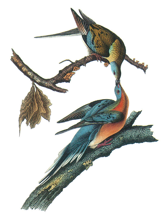
To make a wheat bin, one would go down in the bottoms, cut a large hollow sycamore [Platanus occidentalis], cut off about six feet, nail plank on one end and use it to put grain in. These Sycamores were so large that once W. W. Thompson’s father led his horse with his saddle on, through a big hollow cut. All the cedars [Juniperus virginiana] were big, old trees, which grew on the sides of the mountains. If one now had all the cedar that was burned to kindle fires and to make molasses, he would be rich.”
From History of Jackson County, Alabama (1935) by John Robert Kennamer pp. 137-139
“Though we have no written description of these early pioneer scenes, we have some faint records preserved only in memory and brought down to us by tradition. The earliest white trappers and hunters to visit this territory would often build a hut for shelter and after a short time return laden with his furs and skins to the markets on the eastern coast. His only neighbor was the Cherokee Indian [sic] with whom he exchanged knives, guns and other articles for skins and furs.
The valleys of the Tennessee, Paint Rock and the low level lands lying along Crow, Mud and Sauta Creeks were covered with dense cane-brakes [Arundinaria gigantea], brushwood and briers matted together with vines; and towering above all this were large oak [Quercus], poplar [Liriodendron tulipifera], gum [Liquidambar styraciflua] and other trees, with a lake or lagoon here and there.
The ridges and coves which were bordered by the Cumberland, Sand and Gunter’s Mountain were fertile and had a luxuriant growth of cane and forest. The mountain tops were better suited for the early settler to make his home, or to live while hunting, with no undergrowth except tall grass, with trees far enough apart that one could drive a team and wagon for miles without a road. Deer were plentiful and turkeys as numerous as chickens are at the present time. One has described these mountains as follows: “The mountain air sighed through the treetops as pure and sweet as the breath of a maiden; squirrels gambled in the forest trees; turkeys gobbled and strutted on the mountains; eagles screamed from ~ their lofty perch on towering cliffs; and doves cooed their story of love on every hill and in every dale.”
From History of Jackson County, Alabama (1935) by John Robert Kennamer pp. 6-7
The small farmer settled back on the mountains and in the hill section of the county [circa 1817-1818]. He had come in search of economic freedom and more liberty of life in the forest. He loved his rifle and the pursuit of the game in the woods. He built his house of logs, cleared his corn patches and raised his hogs and cattle on the range. The ring of the axe in the forest was a familiar sound among the pioneers, and to clear the land was a great task. The usual mode was to ‘belt‘ or deaden all the timber save the smaller saplings, and commence cultivating before the roots and small stumps were out of the way. This ‘New’ ground was planted in corn.”
From History of Jackson County, Alabama (1935) by John Robert Kennamer p. 12
“However, the great bulk of the county was uncultivated and lay wild in native forest. It ‘was a county of springs. No purer water ever gushed from under hill or mountain in any land, and rippled cheerily on toward the larger streams all the year around.”
From History of Jackson County, Alabama (1935) by John Robert Kennamer p. 13
Further reading
Diary of My Travels in America (1797) by Louis Philippe, King of France 1830-1848
This work contains early descriptions of the Allegheny and Cumberland Plateaus as well as the Ridge and Valley and Interior Low Plateau ecoregions, but the translation is protected under copyright. The author of this page is unaware of any public domain archival copies of the work. Nevertheless, it is worth acquiring.